

Sales of posters, prints and miscellaneous....
Wednesday 3 April 2024 at 11:00
9 rue de Provence, 75009 Paris
310 lots
-
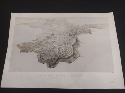
149 - UKRAINE - GOUPIL & CIE- [ Crimea as the crow flies... ] 1855. Aerial map of the Crimean peninsula, towns, roads, place names, terrain, shoreline details. Published by Goupil & Cie Editeurs, publisher's dry stamp. Lithograph on wove paper, in color. Dimensions: 650 x 930 mm. Condition B. Traces of wear, wetness, foxing.
Estimate €200 - €300 -
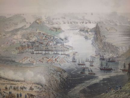
150 - UKRAINE-RUSSIE - CLERGET, H. - Bombardment de Sébastopol - Lithograph by Hubert Clerget and by V Adam, printed by Lemercier in Paris, Paris_WILD rue de la Banque 15 près de la Bourse - In 1854 - Lithograph in colors on laid paper - Sheet size : H : 520 mm X W : 700 mm / Subject : H : 420 mm X W : 600 mm. Condition A: A few restored tears and foxing around the edges.
Estimate €200 - €300 -
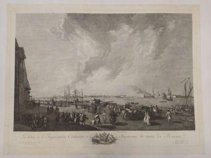
151 - RUSSIA - LE BAS, J.P - Vue de St Petersbourg, dédiée à L'impératrice Catherine II, souvenirs de toutes les Russiea - peint d'après nature par le Prince peintre du Roi, gravé par J P Le Bas, à Paris chez l'auteur graveur du cabinet du Roi et conseiller en son académie, rue de la Harpe - En 1778 XVIII - Engraving on laid paper - Sheet size : H : 610 mm X L : 800 mm / Subject : H : 480 mm X L : 730 mm. Condition A: soiling to edges.
Result €300Estimate €300 - €400 -
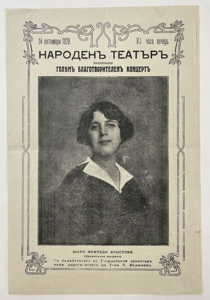
152 - RUSSIA-THEATRE - [ Russian theater programs ] XXth. Set of program documents for Russian theater and opera, in Cyrillic alphabet. - Size: 205 x 240 mm. Condition A
Estimate €100 - €150 -
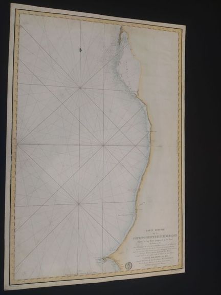
153 - AFRICA - DEPOT GENERAL DE LA MARINE - Carte réduite de la côte Occidentale d'Afrique, depuis le Cap Blanc jusqu'au Cap de Naze Reconnue en 1817, dans la campagne de la Corvette la Bayadère, commandée par M Roussin, capitaine de Vaisseau, chevalier de St Louis et de la légion d'honneur, with the Aviso le Levier under his command, commanded by M Legoarant, enseigne de vaisseau, surveyed by M Givry and drawn up according to his observations and those of the Officers of the two Batiments. Publi
Estimate €100 - €200 -
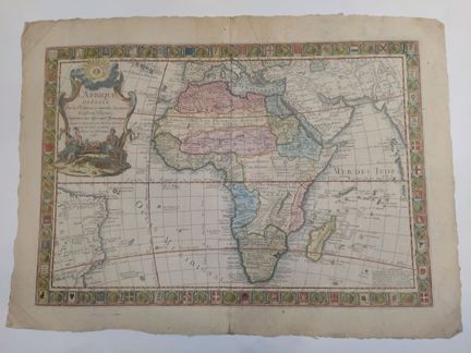
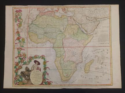
154 - AFRICA - DESNOS, L.C - L'Afrique dressée sur les relations et nouvelles découvertes de différents voyageurs, conformes aux observations astronomiques - Corrigée et augmentée par Desnos ingénieur pour les globes et sphères rue Saint Jacques au Globe, Paris - 1766 - Engraving enhanced with watercolor on laid paper - Sheet size: H: 568 mm X W: 790 mm / Subject: H: 476 mm X W: 695 mm. Condition A/B : Central fold, soiling, dusting, a few scattered stains and corner folds.
Estimate €400 - €600 -
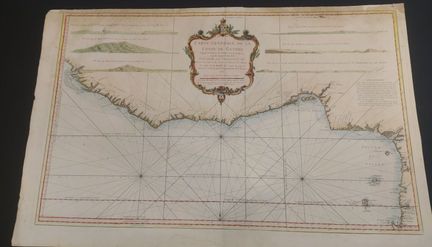
155 - AFRICA-GUINEA - BELLIN, N. - Carte générale de la coste de Guinée : depuis la rivière de Sierra Leona jusqu'au cap de Lopes Gonsalvo / dressée au dépost des Cartes et Plans de la Marine ; par ordre de M. Rouillé, Ch.r comte de Jouy et secrétaire d'Etat ayant le Département de la Marine - Editée à Paris chez Mr. Bellin ingénieur ordinaire de la Marine - 1750 - Engraving enhanced with watercolor on laid paper - Sheet size : H : 605 mm X W : 967 mm / Subject : H : 546 mm X W : 890 mm. C
Estimate €300 - €600 -
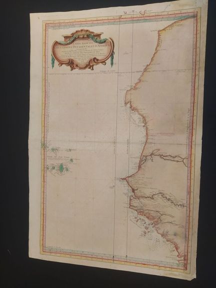
156 - AFRICA-WESTERN COASTS - BELLIN, N. - Carte reduite des costes occidentales d'Afrique : seconde feuille depuis le Cap Bojador jusqu'a la Riviere de Sierra Léona pour le service des vaisseaux du Roy / dressée au dépost des Cartes et Plans et journaux de la Marine ; par ordre de M. Rouillé, Ch.r comte de Jouy et secrétaire d'Etat ayant le Département de la Marine - Editée à Paris chez Mr. Bellin ingénieur ordinaire de la Marine - 1753 - Engraving enhanced with watercolor on laid paper - Sh
Estimate €400 - €600 -
157 - AFRICA - CREPY, J. - Carte Générale de l'Afrique contenant les Principaux Etats qui y sont contenue dressée sur les Nouvelles Observations d'Inslin - - Crepy, Jean (1660-ca. 1730) - 1735 - Engraving enhanced with watercolor on laid paper - Sheet size : H : 542 mm X L : 748 mm / Subject : H : 520 mm X L : 640 mm. Condition A : Folds, soiling, dusting.
Estimate €400 - €600 -
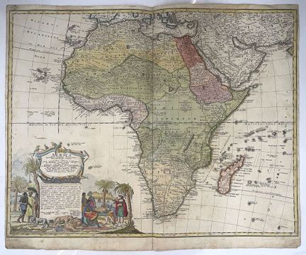
158 - AFRICA - HOMANN, J.B - [ Africa secundum legitimas projectionis Stereographicae regulas... ] c. 1750. Large decorative map of Africa adorned with a beautiful cartouche illustrating Europeans and African people, as well as exotic flora and fauna. Extends to Madagascar and the archipelagos of the Seychelles, Comoros and Mascarene Islands. Copper engraving on laid paper by Homann, enlarged by Johann Matthias Haas after Guillaume De l'Isle and D'Anville. - Dimensions: 470 x 580 mm. B condition. Some
Estimate €400 - €600 -
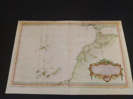
159 - AFRICA - DEPOT GENERAL DES CARTES - Carte réduite des costes occidentales d'Afrique, première feuille contenant les costes de Barvarie depuis le détroit de Gibraltar jusqu'au Cap Bojador et les isles Canaries - dressée au Dépot des cartes, plans et journeaux de la Marine pour le service des vaisseaux du Roy par odre de M Rouille ministre et secrétaire d'état ayant ke département de la Marine, à Paris chez Mr Bellin, ingénieur de la marine, rue Doyenné - En 1753 - Color engraving on la
Estimate €400 - €600 -
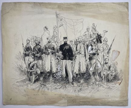
160 - AFRICA-MILITARIAT-CAVALRY- CARREY, P. - [ North African Infantry ] 19th century. Original drawing in black ink enhanced with paint, illustrating a colonial infantry corps of North Africa, by P. Carrey. Signature on lower right. Dimensions: 435 x 535 mm. C condition. As is. Traces of handling, tears, stains and creases.
Estimate €200 - €300 -
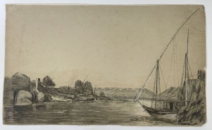
161 - EGYPT - ANONYMOUS - [ Landscape of Egypt ] 1868. Original pastel drawing heightened with watercolor, on cream laid paper, illustrating an Egyptian landscape. Dated January 24, 1868 on verso. Dimensions: 275 x 455 mm. Condition B. Traces of handling, short edge tears, slight rippling of paper. Light foxing. Mounted on soft card.
Estimate €150 - €200 -
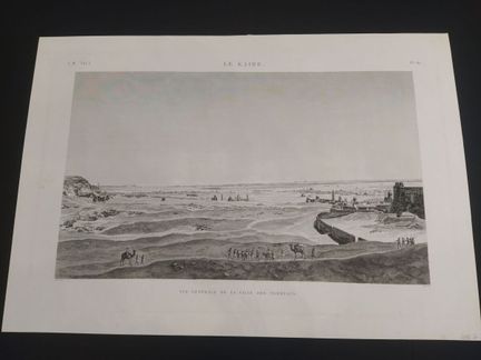
162 - EGYPT - DUTERTRE - Le Kaire - Vue générale de la ville des Tombeaux (E. M VOL I PL 61) - View by Dutertre, edited by Jomard (1777-1862) published in Paris - In 1809 - Copper engraving, laid paper - Sheet size : H : 590 mm X L : 580 mm / Subject : H : 680 mm X L : 410 mm. Condition A : Good condition, a few brown spots.
Estimate €200 - €300 -
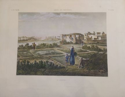
163 - EGYPT - ARTS ET METIERS - Le Jardinier (E.M Vol II, PI.XXIX) - by Conte - In the 19th century - Representations, observations and research made in Egypt during the French army expedition. Series of engravings, consisting of 26 volumes of text and 11 large folio volumes of copper-engraved plates - Copper engraving, in color on laid paper - Sheet size: H: 550 mm X W: 720 mm / Subject: H: 350 mm X W: 480 mm. Condition A: short restored tear, foxing, brown stains on paper edges.
Estimate €200 - €300 -
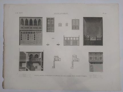
164 - EGYPT - Alexandria, plans, sections, elevations and details of a Turkish house. E.M Vol II PL 93 - By H J Redouté and De Buigne - 19th century - Engraving on laid paper - Sheet size : H : 530 mm X W : 710 mm / Subject : H : 430 mm X W : 597 mm. Condition A : Some traces of handling
Estimate €200 - €300 -
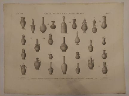
165 - EGYPT - Vases, furniture, and instruments, E.M Vol II PI FF - by H J Redouté and De Buigne - 19th century - Engraving on laid paper - Sheet size : H : 530 mm X W : 710 mm / Subject : H : 430 mm X W : 597 mm. Condition A : Some traces of handling
Estimate €200 - €300 -
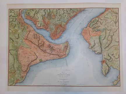
166 - TURKEY-CONSTANTINOPLE - Plan de la ville de Constantinople et de ses faubourgs tant en Europe qu'en Asie - Levé géométriquement par Fr. Kauffer, ingénieur, attaché à Mr. Le Comte de Choiseul-Gouffier, Ambassadeur de France, près la Porte Othomanne. - Originally surveyed in 1776, first edition 1786 - 19th century - Plate 68, Part II. - Printed by Kaeppelin et Cie, 15 Quai Voltaire. - Lithograph enhanced with watercolor on wove paper - Sheet size : H : 525 mm X W : 693 mm / Subject : H : 46
Estimate €200 - €300 -
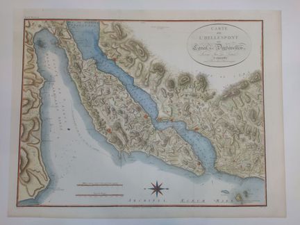
167 - TURKEY - DARDANELLES - Carte de l'Hellespont ou Canal des Dardanelles, levé sur les lieux et assujettie aux Observations Astonomiques - Tome II, plate 52 - by François d'Houdan (1748-1828)geometrically by Fr. Kauffer, engineer, attached to Mr. Le Comte de Choiseul-Gouffier, Ambassador of France, near the Porte Othomanne. - Originally surveyed in 1776, first edition 1786 - Beaublé engraving - Improved and enlarged in 1821 by J. D. Barbier du Bocage - 19th century - Engraving enhanced with wate
Estimate €200 - €300 -
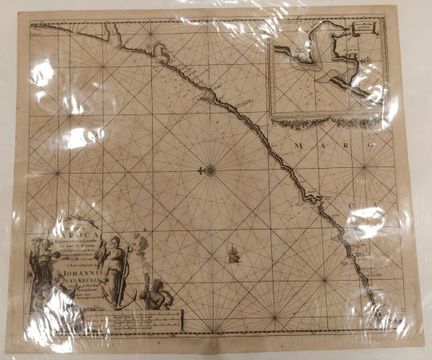
168 - MAROC - VAN KEULEN, J. - [ Paskaart van de kust van Maroca beginnende van Larache tot aan C. Cantin... ] 1682. Nautical chart of the Moroccan coast from Larache to Cantin. Cartographic insert in upper right-hand corner. Beautiful decorative cartouche, compass rose and ship. By Johannes Van Keulen. Engraving on laid paper. Dimensions: 540 x 620 mm. Condition B. Freckles, browned paper. Central fold marked.
Estimate €400 - €600 -
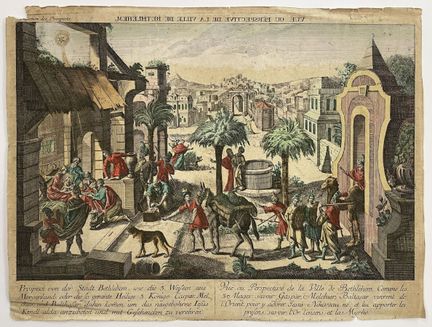
169 - PALESTINE-JERUSALEM-OPTICAL VIEW - "Vuë ou perspective de la Ville de Bethlehem...". - 18th century - Optical view of Bethlehem. Prospects Collection. Se vend a Augsbourg au Negoce comun de l'Academie Imperiale d'Empire des Arts libereaux avec Privilege de sa Majesté Imperiale. Color engraving on laid paper - Dimensions : H : 330 mm X L : 440 mm. Condition B-. As is, wetness, stains, traces of wear and tears. Rousseurs.
Estimate €100 - €200 -
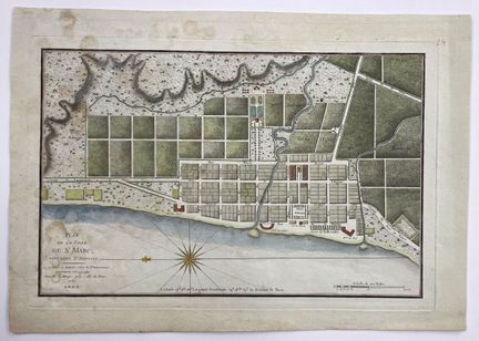
170 - SAINT DOMINGUE - PHELIPEAU - [ Plan de la ville de St Marc ] 1785. Color engraving representing the plan of the city of St Marc. Published by Phelipeau in Paris. On laid paper. - Dimensions: 270 x 405 mm. Condition B. Mottling and foxing.
Estimate €150 - €200 -
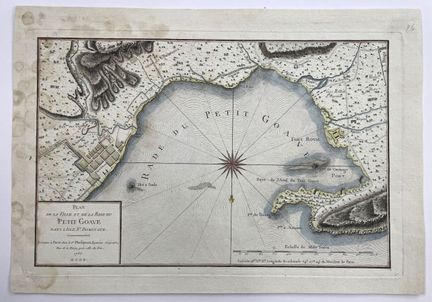
171 - SAINT DOMINGUE - PHELIPEAU - [ Plan de la ville et de la Rade du Petit Goave ] 1786. Color engraving representing the plan of the town and the Rade du Petit Goave. Published by Phelipeau in Paris. On laid paper. - Dimensions: 260 x 405 mm. B condition. Mottling and foxing.
Result €150Estimate €150 - €200 -
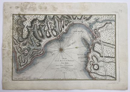
172 - SAINT DOMINGUE - PHELIPEAU - [ Plan de la ville et de la Baye et du Bourg de Jacmel ] 1786. Color engraving representing the plan of the city and Baye and Bourg of Jacmel in the Island of St Domingue. Published by Phelipeau in Paris. On laid paper. - Dimensions: 260 x 405 mm. B condition. Mottling and foxing.
Estimate €150 - €200 -
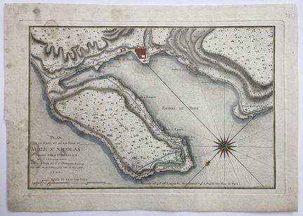
173 - SAINT DOMINGUE - PHELIPEAU - [ Plan de la Baye et de la Ville du Môle St Nicolas ] 1786. Color engraving representing the plan of the Baye and the City of Môle St Nicolas in the Island of St Domingue. Published by Phelipeau in Paris. On laid paper. - Dimensions: 260 x 405 mm. B condition. Mottling and foxing. A tear in the left margin.
Estimate €150 - €200 -
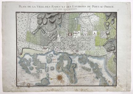
174 - SAINT DOMINGUE - PHELIPEAU - [ Plan de la ville, des rades et des environs du Port-au-Prince ] 1785. Color engraving representing the plan of the city, roadsteads and surroundings of Port-au-Prince in the island of St Domingue. Published by Phelipeau in Paris. On laid paper. - Dimensions: 265 x 405 mm. B condition. Mottling and foxing.
Result €150Estimate €150 - €200 -
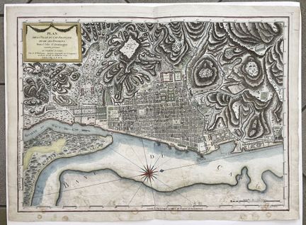
175 - SAINT DOMINGUE - PHELIPEAU - [ Plan de la ville du Cap François et de ses environs ] 1789. Color engraving representing the plan of the town of Cap François and its surroundings on the island of St Domingue. Published by Phelipeau in Paris. On laid paper. - Dimensions: 265 x 405 mm. B condition. Mottling and foxing.
Estimate €150 - €200 -
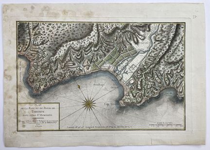
175-1 - SAINT DOMINGUE - PHELIPEAU - [ Plan de la Baye et du Bourg de Tiburon... ] 1789. Color engraving representing the plan of the Bay and Town of Tiburon in the Island of St Domingue. Published by Phelipeau in Paris. On laid paper. - Dimensions: 265 x 405 mm. B condition. Mottling and foxing. Short tears in margins.
Estimate €150 - €200 -
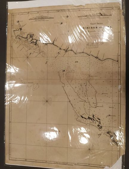
176 - CUBA CARIBBEAN ISLAND - Coast chart of Trinidad de Cuba, from River Guaurabo to Gayo Grande (copy from the spanish chart) - by Jacquernier Bremen, printed in Cuba - Circa 1820-1825, - Lithograph on wove paper - Sheet size : H : 840 mm X W : 620 mm / Subject : H : 790 mm X W : 590 mm. Condition B : Some tears, soiling, brown spots and missing lower right part.
Estimate €100 - €200 -
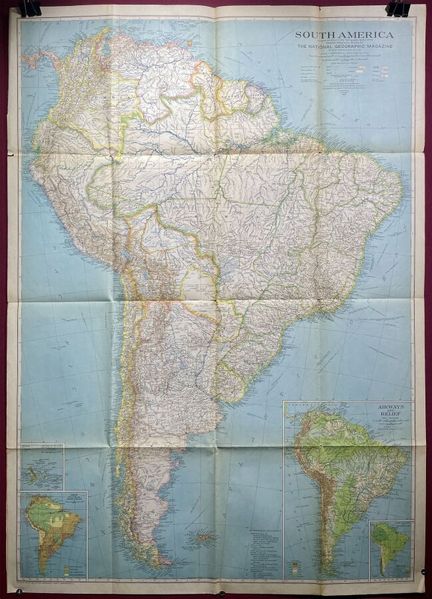
177 - AMERIQUE DU SUD - NATIONAL GEOGRAPHIC SOCIETY - [ South America... ], Washington, 1937. Map of South America showing major mountains, capes, rivers, lakes, islands...Cartographic insert of the Galapogos Islands. Color lithograph. Dimensions: 950 x 675 mm. Condition A. Original folds.
Estimate €80 - €120 -
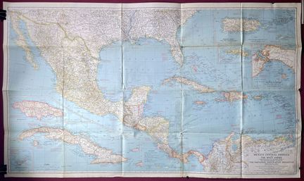
178 - AMERIQUE CENTRALE - NATIONAL GEOGRAPHIC SOCIETY - [ Mexico, Central America and the West Indies... ], Washington, 1939. Map of Central America and the Caribbean Archipelago. Cartographic inserts of Jamaica, Cuba, Bermuda, Puerto Rico and Virgin Islands, Saint Thomas and Panama. Color lithograph. Dimensions: 950 x 675 mm. Condition A. Short tears to original folds.
Estimate €80 - €120 -
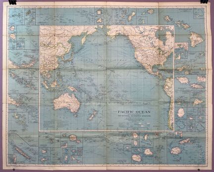
179 - PACIFIC - NATIONAL GEOGRAPHIC SOCIETY - [ Pacific Ocean ], Washington, 1936. Map centered on the Pacific Ocean showing sea, air and land routes, time zones, glaciers, mountains... Cartographic inserts all around the central subject. Color lithograph. Dimensions: 795 x 985 mm. A condition. Short tears to original folds.
Estimate €80 - €120 -
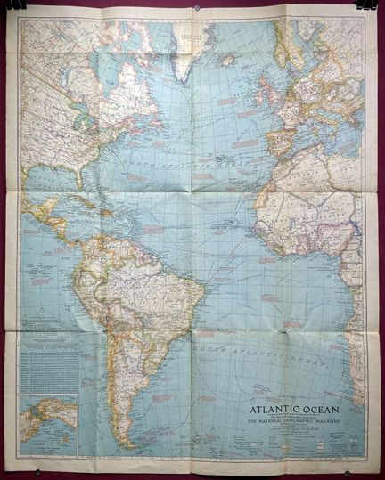
180 - ATLANTIC - NATIONAL GEOGRAPHIC SOCIETY - [ Atlantic Ocean ], Washington, 1939. Map centered on the Atlantic Ocean showing sea, air and land routes, time zones, glaciers, mountains... Cartographic insert of the Isthmus of Panama. Color lithograph. Dimensions: 790 x 635 mm. Condition A. Short tears to original folds.
Estimate €80 - €120 -
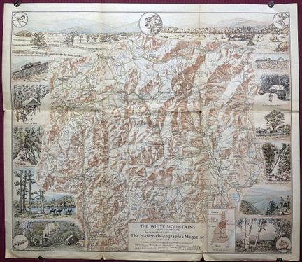
181 - ETATS-UNIS - NATIONAL GEOGRAPHIC SOCIETY - [ The White Mountains of New Hampshire ], Washington, 1937. Map showing the White Mountains of the state of New Hampshire, renowned for its picturesque villages and vast wilderness. Surrounding the map are illustrations of various tourist attractions. Cartographic insert of the area concerned. Dimensions: 435 x 505 mm. A condition. Short tears to original folds.
Estimate €80 - €120 -
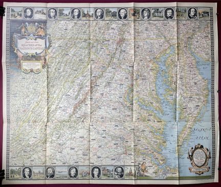
182 - ETATS-UNIS - NATIONAL GEOGRAPHIC SOCIETY - [ Historic and scenic reaches of the nation's capital ], Washington, 1938. Map centered on the states of Virginia, Maryland and Delaware, with the capital city of Washington at its center. Surrounding the map are several vignettes of famous Americans and historic sites in the areas shown on the map. Dimensions: 665 x 795 mm. A condition. Short tears to original folds.
Estimate €100 - €200 -
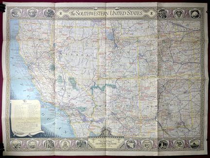
183 - ETATS-UNIS - NATIONAL GEOGRAPHIC SOCIETY - [ The Southwestern United States ], Washington, 1940. Map of the Southwestern United States showing sea, air and land routes, national parks, reserves and monuments, battlefields and Indian reservations. Provides information on exploration routes with dates. Dimensions: 655 x 880 mm. A condition. Short tears to original folds.
Estimate €80 - €120 -
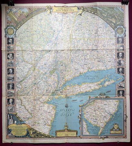
184 - ETATS-UNIS - NATIONAL GEOGRAPHIC SOCIETY - [ The reaches of New-York City ], Washington, 1939. Decorative map of New York State, Manhattan, Long Island and the surrounding areas of New Jersey, Massachusetts and Connecticut. Surrounding illustrations of famous people and places. Cartographic insert of the southern part of New Jersey, the upper left corner shows the New York skyline and the right a scene along the Hudson River. Dimensions: 740 x 675 mm. A condition. Short tears to original folds.
Estimate €100 - €200 -
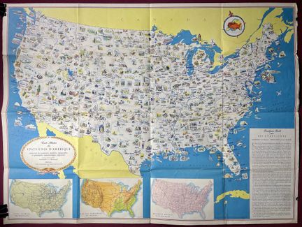
185 - ETATS-UNIS - GENERAL DRAFTING CO - [ Illustrated map of the United States of America... ], c. 1950. Decorative map of the United States, showing resources, products, topography and major regional features. Dimensions: 605 x 815 mm. Condition A-. Original folds, creases and short tears. Beautiful colors.
Estimate €100 - €200 -
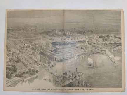
186 - AMERICA-CHICAGO - MEYER, H. - Vue Générale de l'exposition international de Chicago - Drawing by Henri Meyer, engraving by Méaulle, signature on both corners of the subject - In 1893 - Lithograph on laid paper - Sheet size : H : 520 mm X W : 760 mm / Subject : H : 480 mm X W : 710 mm. Condition A : Marked central fold, tears on the edges of the sheet, and some foxing.
Estimate €150 - €200 -
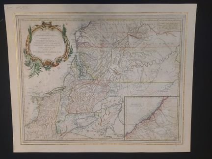
187 - AMERICA - DE VAUGONDY, R. - [ Part of North America... ] 1755. Carte de la partie septentrionale de l'Amérique, qui comprend le cours de l'Ohio, la Nouvelle Angleterre, la Nlle York, le New Jersey, la Pensylvanie, le Maryland, la Virginie, la Caroline. By Robert De Vaugondy. Engraving on laid paper, in color. Dimensions: 510 x 640 mm. B condition. Generalized foxing, browned paper. Laminated on soft card.
Estimate €300 - €400 -
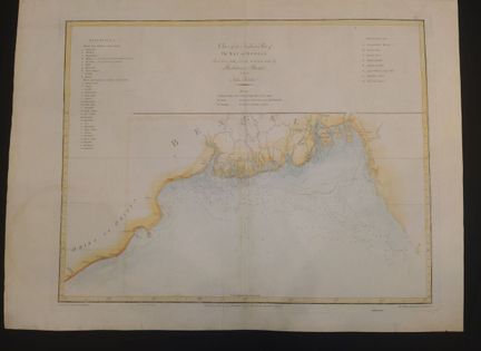
188 - INDIA - Chart of the Northerne Part of the Bay of Bengal, laid down chiefly from the surveys made by Bartholomen Plaisted and John Ritchie - published by Alexander Dalrymple (1737-1808) and engraved by B. Henry, handwriting engraved by W. Whitchurch, after de Mannevillette (1707-1780) - In 1810 - Color engraving on laid paper - Sheet size: H: 520 mm X W: 730 mm / Subject: H: 460 mm X W: 600 mm. Condition A : Marked central fold, paper slightly damaged at edges, some soiling.
Estimate €100 - €200 -
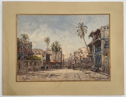
189 - (INDIA-XIX) HILDEBRANDT, E. - [ Bombay ], c. 1870. Chromolithograph by R. Steinbock, based on a watercolor by Eduard Hildebrandt, showing a main street in Bombay. Published by R. Wagner, Berlin, Paris and London, Goupil & Cie, Editeurs. Dimensions: 240 x 335 mm. A- condition. Some foxing. laminated on softback, with Marie-Louise.
Estimate €150 - €200 -
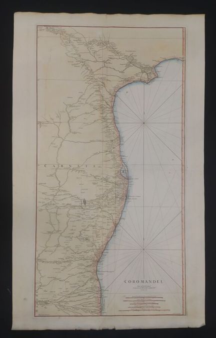
190 - INDIA - D'ANVILLE, J.B. - [ Coromandel ] 1753. Large format map of the Coromandel coast located in the Bay of Bengal. Map in two sheets. Published by Jean Baptiste D'anville and engraved by Guillaume Delahaye. Engraving on laid paper, color, strong paper. Dimensions: 1040 x 630 mm. Condition A-. Minor foxing, small holes restored. Some light dampening.
Estimate €200 - €300 -
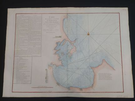
191 - CEYLON - DE LA HAYE,G. - Carte de la Baye et du Port de Trinquemalay dans L'Isle de Ceylan... ] 1775. Carte de la Baye et du Port de Trinquemalay dans L'Isle de Ceylan. Remarks, instructions and cross-references on the left-hand side. By Guillaume Dela Haye for after de Mannevillette's 'Le Neptune Oriental'. Engraving on laid paper, color. Size: 555 x 775 mm. Condition A. Central fold marked.
Estimate €150 - €200 -
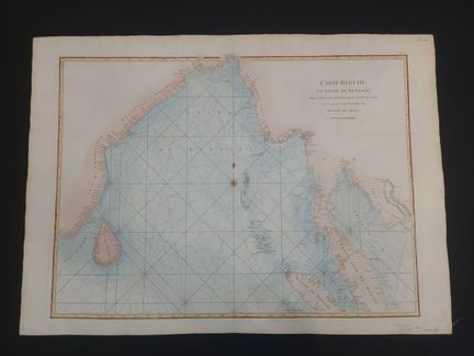
192 - GULF OF BENGAL - DE LA HAYE,G. - [ Carte réduite du Golfr du Bengale... ] 1775. Carte réduite du Golfr du Bengale depuis l'Ile de Ceylan jusqu'au Golfe de Siam, avec la partie septentrionale du Détroit de Malac. By Guillaume Dela Haye for after de Mannevillette's 'Le Neptune Oriental'. Engraving on laid paper, color. Dimensions: 555 x 775 mm. Condition A.
Estimate €150 - €200 -
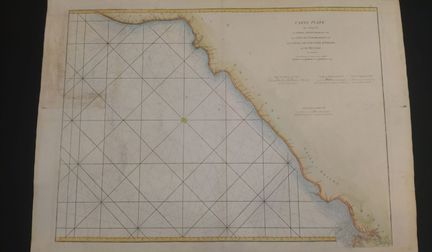
193 - INDE-COTE DE COROMANDEL - DEPOT GENERAL DE LA MARINE - Carte Plate qui comprend la partie septentrionale de la côte de Coromandel et les côtes de Golconde, d'Oricha et de Bengale - D'après de Mannevillette, Jean-Baptiste-Nicolas-Denis, publiée au Depot General de la Marine, Paris - En 1810 - Color engraving on laid paper - Sheet size: H: 550 mm X W: 770 mm / Subject: H: 490 mm X W: 670 mm. Condition B : Marked central fold, some restorations on verso, soiling, dust on sheet edges.
Estimate €100 - €200 -
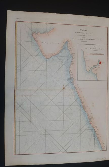
194 - INDIA - Carte de la côte de Guzérat, du golfe de Cambaye et des côtes de Concan et de Canara - after De Mannevillette Jean Baptiste P. D (1707-1780), published in Paris - Dated 18th century - Engraving on laid paper - Sheet size : H : 780 mm X L : 560 mm / Subject : H : 670 mm X L : 490 mm. Condition A : Slightly marked center fold, soiling.
Estimate €100 - €200 -
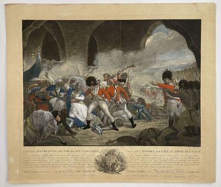
195 - (INDIA-BATTLES) - SINGLETON, H - [ The last Effort and Fall of Tippoo Sultan ] c. 1800. Color engraving illustrating Sultan Tipu in a bad position during the Battle of Seringapatam in 1799. Engraved by Paul Jacob Laminet after a painting by Henry Singleton. Published by Anthony Cardon and Luigi Schiavonetti. - Dimensions: 430 x 485 mm. Condition A-. Paper slightly yellowed,
Result €360Estimate €200 - €300 -
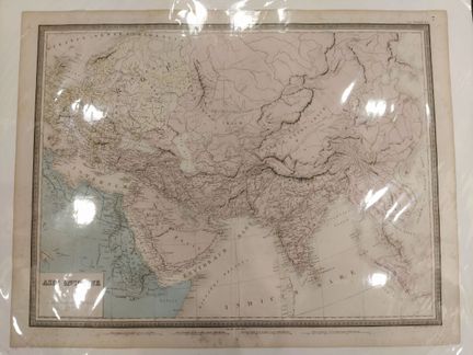
196 - ASIA - ANDRIVEAU, J - Asie ancienne - faisant partie d'Atlas Universel, planche n°7, édité par J Andriveau-Goujon 21 rue du bac à Paris, imprimé par Louis Antoine - En 1861 - Color engraving on laid paper - Sheet size : H : 530 mm X L : 700 mm / Subject : H : 470 mm X L : 640 mm. Condition A : Rousseurs on the edges of the sheet.
Estimate €100 - €200 -
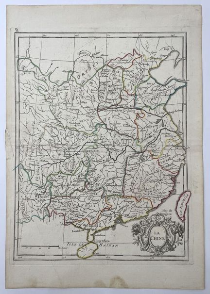
196-1 - CHINA - LE ROUGE, G. - "La Chine" - 18th century - Map of China by Georges-Louis Le Rouge, circa 1750, colored engraving on laid paper - Size: 345 mm X 240 mm. Condition A-. Tear and minor wetness in margins. Fold in lower left corner. Original central fold.
Result €110Estimate €100 - €200
About the sale
ATTENTION: PICK-UP OF LOTS AT OUR PREMISES FROM TUESDAY APRIL 9
Terms of sale
Show the terms of sale
Auctions Fees
· Buyer fee : 30% taxes included
·
Conditions de règlement / / Payment
· Cash up to €1000 for French nationals
· Credit card EXCEPT AMEX
· Bank transfer
Picking up or scheduling a shipping
Pick-up at our office: everything except furniture, make an appointment
· Monday to Friday from 9:30 am to 12:30 pm and from 2 pm to 5:30 pm
· Possibility of mandating a relative: notify us by email or make a power of attorney, the person then presents themselves with an ID
Shipping within the European Union: jewelry, paintings, books, silverware, ceramics, glassware, etc.
• Shipping via DHL, quote on request
• Transport by professionals, list available on request
Shipping outside the European Union:
• Transport by professionals, list available on request