

Sales of posters, prints and miscellaneous....
Wednesday 3 April 2024 at 11:00
9 rue de Provence, 75009 Paris
310 lots
-
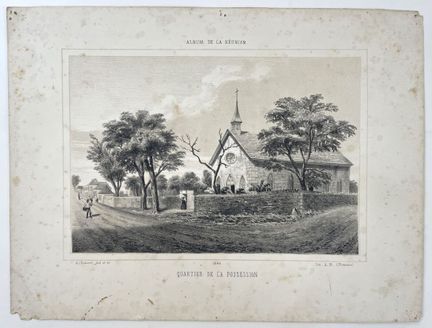
99 - (LA REUNION-974) ROUSSIN, A. - [ Quartier de la Possession ], 1864. Original lithograph by Antoine ROUSSIN (1819-1894), on wove paper. From the "Album de La Réunion". Printed by Antoine Roussin (Imp A.R). Size: 245 x 315 mm. Condition A-. Some foxing, handling marks and thumbtack holes. Slight dampening.
Estimate €100 - €200 -
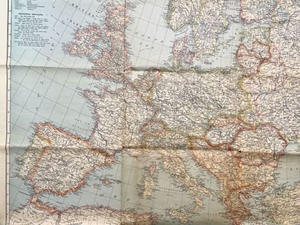
100 - EUROPE - NATIONAL GEOGRAPHIC SOCIETY - [ Europe and near east ], Washington, 1940. Map of Europe and the Near East. Features major bays, lakes, rivers, glaciers, islands, mountains... Cartographic insert of the Middle East. Color lithograph. Dimensions: 855 x 985 mm. A- condition. Short tears to original folds.
Estimate €100 - €200 -
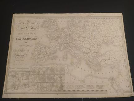
101 - EUROPE - HACQ, J.M - Carte générale des victoires et conquêtes des Français de 1792 à 1815 - author of the text, Panckoucke and Charles-Louis-Fleury (1780-1844), engraved by Hacq, Jacques Marie (1795-1873) and published by C.L.F. Panckoucke in Paris - In 1815/1821 - Engraving on laid paper - Sheet size : H : 650 mm X L : 920 mm / Subject : H : 600 mm X L : 900 mm. Condition A : Missing right corner, traces of handling
Estimate €200 - €300 -
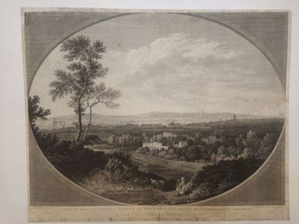
102 - ENGLAND-WESTMINSTER - ROBERTSON, G. - A South view of the cities of London and Westminster, taken from Denmark Hall near Camberwell. From the original picture in the Possession of Mr. Smart - Engraving by George Robertson (1748 - 1788) - Engraving by Daniel Lerpinière (1745-1835) - Published by John Boydell on May 1, 1779 - Burin engraving on laid paper - Sheet size: H: 480mm X W: 595mm / Subject: H: 430 mm X W: 580 mm. Condition B: Some restored tears, soiling and dusting.
Estimate €400 - €600 -
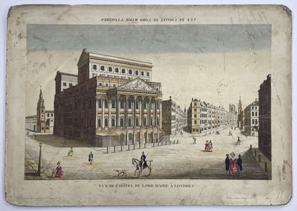
103 - ROYAUME UNI-VUE D'OPTIQUE - BASSET - "Vue de l'Abbaye de Westminster à Londres / Vue de l'Hôtel du Lord Maire à Londres" - XVIIIe - Set of two optical views concerning London. Published by Basset in Paris. Color engraving - Dimensions : H : 320 mm X L : 465 mm. Condition B. As is, wetness, stains, wear and tears. Mounted on rigid support.
Estimate €150 - €200 -
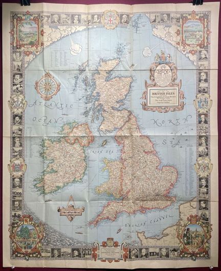
104 - UNITED KINGDOM - NATIONAL GEOGRAPHIC SOCIETY - [ British Isles... ], Washington, 1937. Decorative map of the British Isles and Ireland. Decorated with numerous illustrations of famous people and places. Dimensions: 920 x 755 mm. A condition. Short tears to original folds.
Result €100Estimate €100 - €200 -
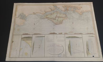
105 - BRITISH ISLANDS - DEPOT GENERAL DE LA MARINE - [ Map of the Isle of Wight ...] 1803. Large format map of the Isle of Wight and the adjacent Hampshire coast, containing a special description of the roadsteads of St. Helena. Map in two sheets. Published by the Dépôt général de la marine. Engraving on laid paper, color, strong paper. Dimensions: 670 x 955 mm. Condition B. Traces, tears, wetness. Missing lower right corner.
Estimate €200 - €300 -
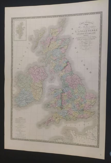
106 - UNITED KINGDOM - ANDRIVEAU, J. - Carte générale des Iles Britaniques contenant l'Angleterre l'écosse et l'Irlande, indiquant les principales Routes, les Canaux de Navigation, les chemins de Fer éxécutées et en cours d'éxécution dans la grande Bretagne. - By J. Andriveau - by E. Andriveau-Goujon geographer and publisher - 1866 - H. 100 x W.692mm / Subject: H.585 x W.608mm. - Condition A: very good overall condition, central fold with very slight tear in margin.
Estimate €200 - €300 -
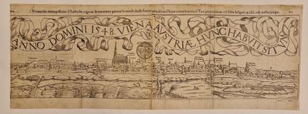
107 - AUSTRIA-VIENNA - MUNSTER, S. - Vienne, cité metropolitaine d'Austriche, cogneue et renommée par tout le monde, seule forteresse invicible en Orient contre le très cruel Turc, poutraicte au vif selon la figure, qu'elle a de nostre temps. - From the "Cosmographia Universalis" by Sebastian Münster 1489 to (Nieder-Ingelheim, 1489 - Basel, 1552) - Wood engraving on laid paper - 1569 - Sheet size: H: 284 mm X W: 767 mm. Condition A: Restored folds, traces of use, soiling, slight tears in restored
Estimate €300 - €600 -
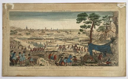
108 - AUSTRIA-OPTICAL VIEW - "Siege of Bergopzom by the troops of France...". - 18th - Optical view of the Siege of Bergopzom by the French troops commanded by Mr. Le Maréchal de Lowandal. Color engraving on laid paper, c. 1750 - Dimensions : H : 240 mm X W : 435 mm. Condition B-. As is, wetness, stains, traces of wear and tears. Some foxing. Mounted on softback.
Estimate €80 - €100 -
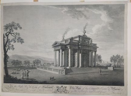
109 - IRELAND-DUBLIN - ROOKER, E. - To the Earl of Charlemont this view of his Lordship's Casine at Marino near Dublin is most humbly inscribed by His Lordship's most devoted servant - Thomas Ivory (1709-1779) - Engraving by Edward Rooker (c. 1712 - 22 November 1774), on laid paper - Sheet size: H: 470mm X W: 645mm / Subject: H: 407mm X W: 618mm. Condition B: Soiling, marginal tears and restored tear on left side, folds, stains.
Result €300Estimate €300 - €600 -
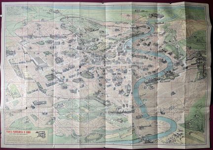
110 - ITALY-ROME - MAURO GIGLI - [ Pianta panoramica di Roma... ], c. 1960. Monumental folding map of the city of Rome. On verso the list of monuments with a road map. Dimensions: 700 x 1000 mm. Condition A. Original folds, short tears. Some handling marks in margins.
Estimate €100 - €200 -
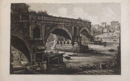
111 - ITALY-ROME - ROSSINI, L. - Veduta del Ponte Rotto. Caption: A. Arco dell'antico Ponte Senatorio alla Ripa del Trastervere. B. Archi moderni. C. Avanzi della Pila antica sulla Riva opposta. D. Casa di Pilato. - E. Tempio di Vesta. F. Cloaca Massima - Luigi Rossini (1790 - 1857) - Published in Rome in 1822 - Monochrome engraving - Sheet size: H: 470mm X W: 745 mm / Subject: H: 352mm X W: 447mm. Condition A: Paper creased, some wetness.
Estimate €300 - €600 -
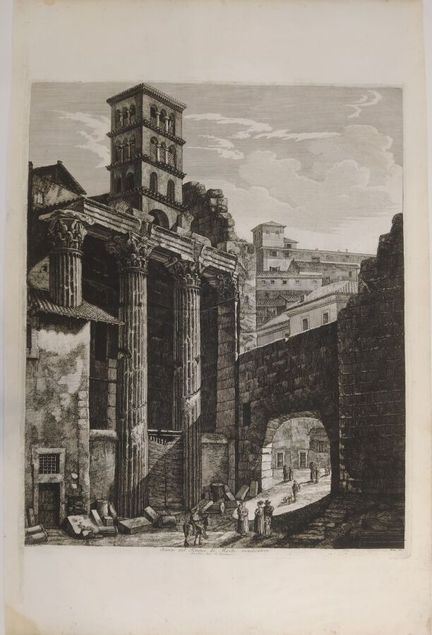
112 - ITALY-ROME - ROSSINI, L. - Avanzi del Tempio di Marte vendicatore. Dal Volga Arco de Pantani. - Luigi Rossini (1790 - 1857) - Published in Rome in 1820 - Monochrome engraving - Sheet size: H: 745 mm X W: 484 mm / Subject: H: 530 mm X W: 430 mm. Condition A : Some foxing, some wetness.
Estimate €200 - €400 -
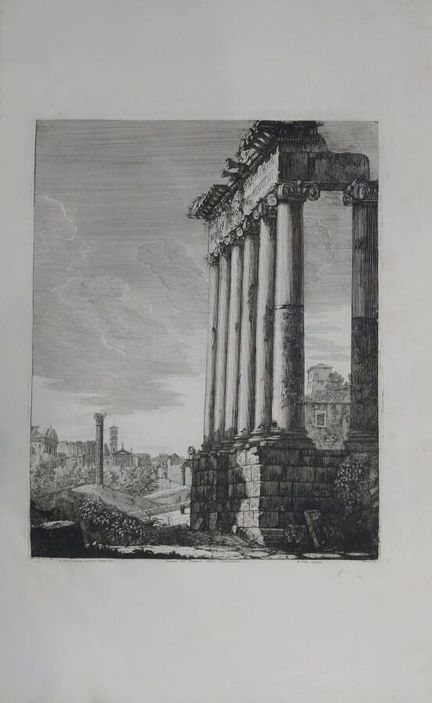
113 - ITALY-ROME - ROSSINI, A. - Avanzi del Tempio della Concordia. Caption: A. Clivo Capitolino scoperto l'anno 1817, B. Clivo moderno - Luigi Rossini (1790 - 1857) - Published in Rome in 1819 - Monochrome engraving - Sheet size : H : 745 mm X W : 470 mm / Subject : H : 447 mm X W : 352mm. Condition A: Paper creased, short marginal tear, foxing, some wetness.
Estimate €150 - €300 -
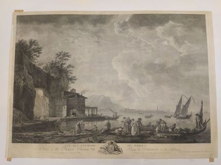
114 - ITALY-NAPLES - VERNET, J. - Vue des environs de Naples. Dédiée à sa Majesté Christian VII, Roy de Danemarck et de Norwege - Tiré du Cabinet de Mr. le Marquis de Villette - D'après Joseph Vernet (1714-1789) - Gravé par Pierre Jacques Duret (1729-17..?) - Publié à Paris, chez Duret Graveur. Intaglio engraving, monochrome - Sheet size : H : 554 mm X W : 774 mm / Subject : H : 484 mm X W : 725 mm. Condition A : Wrinkled paper, short tears and marginal restorations, some marks and dusting.
Estimate €600 - €800 -
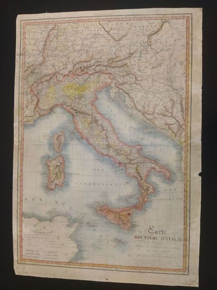
115 - ITALY - EUSTACHE, H. - Carte routière d'Italie - dressé d'après les dernières observations - Carte par Hérisson Eustache (1759-1832 édité par Jean à Paris, gravé par JB Tardieu - En 1829 - Gravure en couleurs sur papier vergé - Dimensions feuille : H : 790 mm X L : 550 mm / Sujet : H : 740 mm X L : 551 mm. Condition C : Marked central fold, paper damaged at the edges, a few tears and lacks at the edges of the paper, soiling.
Estimate €100 - €200 -
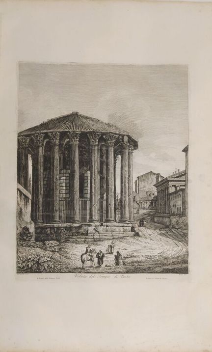
116 - ITALY ROME - Veduta del tempio di Vesta (View of the Temple of Vesta) - Plate 52 from Antichita Romane, by Luigi Rossini (1790-1857), published in Rome - Published in 1820 - Etching on laid paper - Sheet size: H: 750 mm X W: 460 mm / Subject: H: 440 mm X W: 350 mm. Condition A : Tears on the edges of the sheet, with some paper losses and some foxing at the bottom of the sheet.
Estimate €200 - €400 -
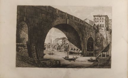
117 - ITALY ROME - Veduta di Ponte Cestio dal volgo Pont ferrato - by Luigi Rossini (1790-1857), published in Rome - Published in 1822 - Etching on laid paper - Sheet size : H : 470 mm X W : 750 mm / Subject : H : 350 mm X W : 540 mm. Condition A : Soiling on the edges of the paper, with a few brown spots and freckles.
Estimate €200 - €400 -
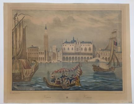
118 - ITALY - Venice - Paris chez Mazsani quai aux fleurs 7, lithographie de Grosselin rue Perdue n°1 - In the 19th century - Lithography in colors - Sheet size : H : 550 mm X W : 800 mm / Subject : H : 470 mm X W : 700 mm. Condition A : A few marked folds in the subject and a few restored tears at the edges of the sheet.
Estimate €300 - €600 -
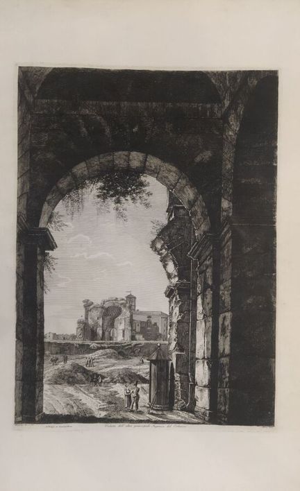
119 - ITALY - ROSSINI, L. - Veduta dell' altro principale Ingresso, del Colosseo - by Luigi Rossini (1790 - 1857) and published in Rome- In 1822 - Monochrome engraving - Sheet size : H : 740 mm X W : 530 mm / Subject : H : 530 mm X W : 380 mm. Condition A : Good condition, blackened edges.
Estimate €200 - €400 -
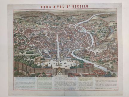
120 - ITALY - ROME - Roma a vol d'ucello - With caption at bottom naming all important places - Published in Milan by Vallardi (Milan, May 31, 1784 - January 5, 1861) - Lithograph enhanced with watercolor - 19th century - Sheet size: H: 556 mm X W: 694 mm / Subject: H: 490 mm X W: 633 mm. Condition A/B : Restored folds, traces of use, soiling, dusting, slight tears in restored margins.
Estimate €300 - €600 -
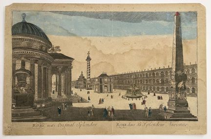
121 - ITALY-OPTICAL VIEW - "Rome and its ancient splendor / The Pamphile Palace and Piazza Navona, Rome" - 18th century - Set of two optical views of Rome. Color engraving - Dimensions: H: 295 mm X W: 450 mm. Condition B. As is, browned paper, wetness, traces of wear and tears. Mounted on a flexible support.
Estimate €150 - €200 -
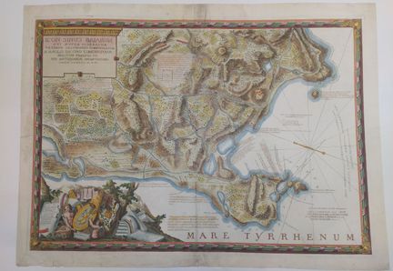
122 - ITALY - GULF OF BAIA (NAPLES) - LUBENS - Icon sinus Baiarum uti nuper videbatur veterum testimoniis comprobatum N. Anglo Iacobo Edmonstoun, militum praefecto rei antiquariae amantissimo - Description of temples and archaeological remains - By Lubens, cartographer - circa 1750 - Engraving on laid paper enhanced with watercolor - Sheet size: H: 540 mm X W: 740 mm / Subject: H: 682 mm X W: 477 mm. Condition A/B : Restored folds, traces of use, soiling, dusting - slight tears in restored margins.
Estimate €300 - €600 -
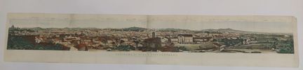
123 - ITALY - ROME - Panorama Di Roma e suoi Contorni, preso da S. Pietro in Montorio - With legend at top naming all important places - ca 1870 - Lithograph enhanced with watercolor - Sheet size: H: 158 mm X W: 905 mm / Subject: H: 98 mm X W: 884 mm. Condition A/B : Central fold, soiling, dusting.
Estimate €200 - €300 -
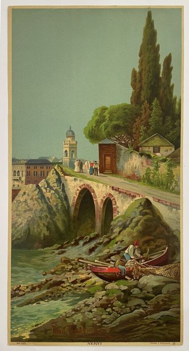
124 - ITALY - KAUFMANN, K. - [ Nervi ] XXth. Print of a view of Nervi in Genoa, by Karl Kaufmann. Dimensions: 610 x 310 mm. Condition A.
Estimate €100 - €200 -
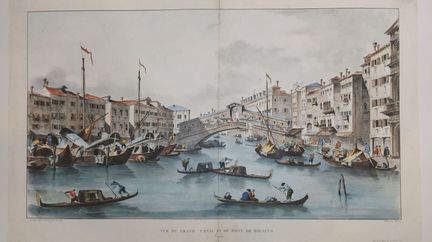
125 - ITALY-VENICE - GUARDI - View of the Grand Canal and Rio Alto Bridge (in Venice) - Drawn from life by Guardi, lithograph by Brunet, printed by Villaine, 11 rue de Sèvres. - In 1840 19th century - Color lithograph on laid paper - Sheet size : H : 410 mm X W : 680 mm / Subject : H : 350 mm X W : 620 mm. Condition A : Marked central fold restored on verso, traces of handling.
Estimate €300 - €600 -
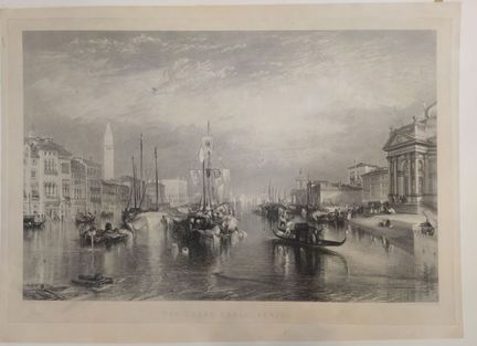
126 - ITALY-VENICE - MILLER, W. - The Grand Canal in Venice - painted after Joseph Mallord William Turner (1775 - 1851) and engraved by William Miller (1796 - 1882) - In the 19th century - Steel engraving, then on laid paper - Sheet size: H: 470 mm X W: 650 mm / Subject: H: 380 mm X W: 580 mm. Condition A : Restoration in the subject, paper slightly blackened on the edges of the sheet.
Estimate €300 - €600 -
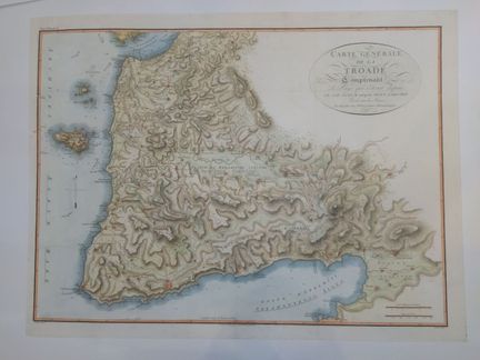
127 - GREECE TROADE - BARBIER DU BOCAGE, J.D - Carte générale de la Troade, comprenant le pays qui s'étent depuis le cap Sigeum jusqu'au Mont Gargaron (Tome III planche n°18), levée sur les lieux et assujettie aux Observations Astronomiques - by Jean-Denis Barbié du Bocage (1760 -1825) - In 1819 - Copper margin, colored engraving, printed on wove paper - Sheet size : H : 490 mm X L : 650 mm / Subject : H : 440 mm X L : 600 mm. Condition A : Good overall condition, some soiling to the edges of th
Estimate €200 - €300 -
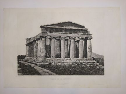
128 - SICILE - BERTHIER, P. - Temple de la Concorde (Agrigente) - Heliogravure from life of a photograph by Paul Berthier, published by Drivet et Cie, 43 rue Tournefort Paris, printed by Alfred Chardon, 3 rue Racine, Paris - In 1869 - Heliogravure on laid paper - Sheet size : H : 330 mm X L : 480 mm / Subject : H : 260 mm X L : 350 mm. Condition A : Dirt.
Estimate €300 - €600 -
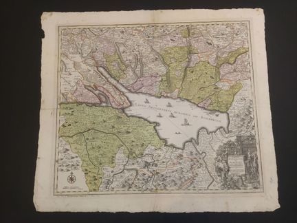
129 - GERMANY-SWITZERLAND - SEUTTER, M. - [ Lacus Bodamicus vel Acronius ...] c. 1750. Very detailed and accurate map of Lake Constance, with illustrated cartouche and compass rose. By Matthäus Seutter. Engraving on laid paper, color.dimensions: 565 x 650 mm. Condition B. Traces of wear, wetness, original folds.
Estimate €200 - €300 -
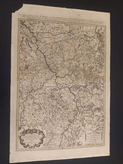
130 - ALLEMAGNE - Le Cercle eslectoral du Rhein subdivisé les Estats qui le composent - dressé sur les mémoirs les plus nouveaux par le Sir Sanson, géographe ordinaire du Roy à Paris, chez H Jaillot - En 1692 - Color engraving on laid paper - Sheet size: H: 950 mm X L: 630 mm / Subject: H: 790 mm X L: 550 mm. Condition B: Marked central fold, some restorations made, slight tears and lacks on the edges of the paper, and soiling.
Estimate €300 - €600 -
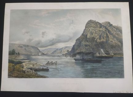
131 - GERMANY-RHINE - SABATIER, L. - Le rochers de Lurley - from the "Bords du Rhin" collection - Lithograph drawn from life and lithographed by L Sabatier, including the stamp "Goupil et Cie Editeurs", in Paris, printed by Jacomme et Cie de Lancry, 16, Paris - Lithograph in colors on laid paper - Sheet size : H : 490 mm X W : 700 mm / Subject : H : 380 mm X W : 620 mm. Condition A : Some restorations on the subject and soiling.
Estimate €100 - €200 -
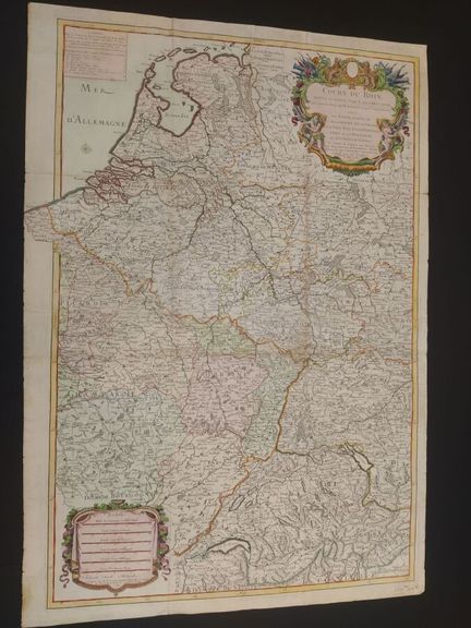
132 - ALLEMAGNE-RHIN - DESNOS, L.C. - Cours du Rhin depuis sa source jusqu'à son embouchure avec tous les pays qu'il travers et qui l'avoisinent savoir, la Suisse, partie de l'Allemagne, de la France, les Pays-Bas et les provinces-Unies ou la Hollande, où le eft le théatre de la guerre. - published in Paris, chez Desnos rue St Jacques au globe n°254 - In 1792 - Engraving on laid paper - Sheet size : H : 910 mm X L : 620 mm / Subject : H : 870 mm X L : 580 mm. Condition B: Marked folds, traces of h
Estimate €200 - €400 -
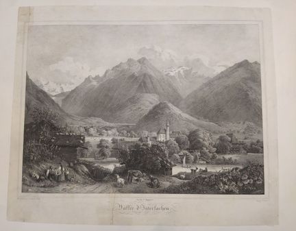
133 - SWITZERLAND - JOLY, A. - Vallée d'Interlachen - Dessin d'après nature et lithographie par A Joly, imprimé par Engelmann - En 1860 - Lithographie sur papier vergé -Dimensions feuille : H : 530 mm X L : 630 mm / Sujet : H : 870 mm X L : 400 mm. Condition B : Tears restored, paper blackened and damaged at edges.
Estimate €300 - €600 -
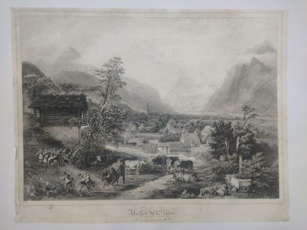
134 - SWITZERLAND-MOLLIS - CHAPUY, N. - Clarie Valley. Vue prise au dessus de Mollis - View by Nicolas Chapuy (Paris, 1790 - 1858) - Engraved by A. Joly - Monochrome lithograph - Sheet size: H: 463 mm X W: 600 mm / Subject: H: 400 mm X W: 560 mm. Condition A : Wrinkled paper, marginal tears (some restored), some marks and dust.
Estimate €300 - €600 -
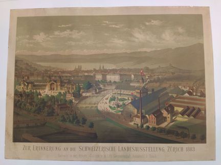
135 - SUISSE-ZURICH - Zur Erinnerung an die Schweizerische Landesausstellung, Zurich 1883 - Gedruckt in der Arbeits - Gallerie v. d. Lith Genossenschaft, Aussersihl, b. Zurich. - Ernst Conrad - 1883 - Chromolithography - Sheet size : H : 550 mm X W : 740 mm / Subject : H : 460 mm X W : 680 mm. Condition A: Paper mottled, small marginal tears, a few scattered stains and marks.
Estimate €300 - €600 -
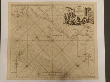
136 - PORTUGAL - VAN KEULEN, J. - [ Paskaart van de kust van Portugal, Barbaria, en Genehoa... ] 1698. Nautical chart of the coast of Portugal, including part of Morocco, the Canary Islands, Cape Verde and the Azores. Beautiful decorative cartouche, wind roses. By Johannes Van Keulen. Engraving on laid paper. Dimensions: 540 x 620 mm. Condition B. Freckles, browned paper. Central fold marked.
Estimate €400 - €600 -
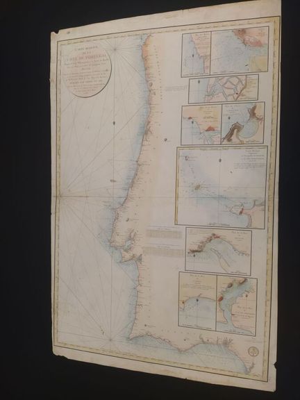
137 - PORTUGAL - COLLIN, E. - Carte réduite de la côte de Portugal depuis le cap Sillerio jusqu'à la Barre de Huelba (avec les plans particuliers des principaux ports, dressé d'après les opérations Trigonométriques de M Cierca) - écrit par Besençon, gravé par E Collin, publiée par ordre du Roi au Dépot de la Marine à Paris - En 1816 - Etching on laid paper - Sheet size: H: 950 mm X L: 620 mm / Subject: H: 880 mm X L: 600 mm. Condition B: Marked central fold, a few tears and missing edges,
Estimate €200 - €400 -
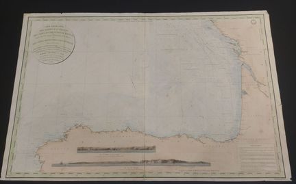
138 - SPAIN - DEPOT DES CARTES DE LA MARINE - Particular maps of the attérages probes of the western coasts of France, from the Ile d'Yeu to the mouth of the Bidassoa and the northern coasts of Spain. - By Monsieur le Saulnier de Vauhello, lieutenant de Vaisseeau Chevalier de la Légion d'Honneur, commander of the Bricks la Badine and l'alsacienne, assisted by M M. Wissocq, Cazeaux and Darondeau, Ingénieurs Hydrographes de la Marine and A Jehenne, lieutenant de Vaisseau, published by oder of the Kin
Estimate €100 - €200 -
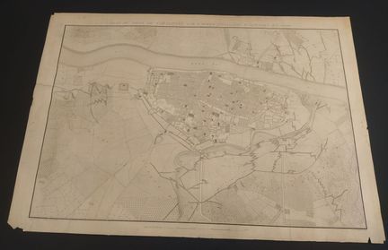
139 - SPAIN-SARAGOSSE - TARDIEU, A. - Plan du siège de Saragosse par l'Armée française d'arragon en 1809 - Engraved at the Dépot Général des fortifications by Ambroise Tardieu (1788 - 1841), French cartographer and engraver and written by Richhomme and Adam - In 1809 - Engraving on laid paper - Sheet size: H: 690 mm X W: 980 mm / Subject: H: 600 mm X W: 880 mm. Condition B: Misses on the corners of the sheet and soiling, dusting, restorations.
Estimate €200 - €300 -
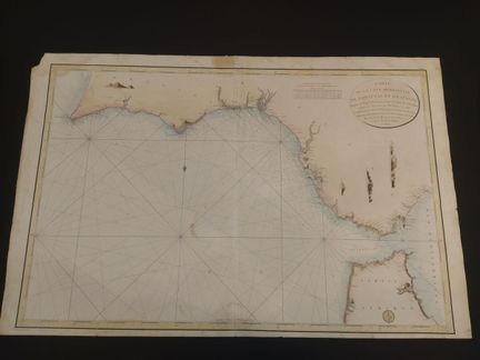
140 - SPAIN-PORTUGAL - Carte de la côte Méridionale de Portugal et d'Espagne depuis le Cap St Vincent jusqu'à la Baie de Gibraltard d'après les plans levé par M.Tofino en 1786 et rectifiés pour les côtes de Portugal, n°199 - D'après les triangles de M Cierra, publiée par odre de SE. LE Vice -Amirak decrès Ministre de la Marine et des Colonies au dépot Général de la Marine - En 1804 - Color engraving on laid paper - Sheet size : H : 620 mm X W : 950 mm / Subject : H : 580 mm X W : 870 mm.
Estimate €150 - €200 -
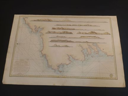
141 - SPAIN - DEPOT GENERAL DE LA MARINE - Coasts of Spain part of Galicia from Cape Ortegal to Cape Silleiro according to Plans surveyed in 1797 - by Don Vincente Tofino officer of the Navy for the service of French vessels, at the depot of maps, plans and journals of the Navy, engraved by Bouclet and written by Hérault - In 1973 - Color engraving on laid paper - Sheet size: H: 620 mm X W: 960 mm / Subject: H: 550 mm X W: 850 mm. Condition A : Marked central fold, some restorations made, slight tear
Estimate €200 - €300 -
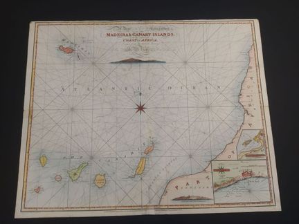
142 - ATLANTIC-MADEIRA-CANARY ISLANDS - [ Madeira & Canary Islands... ] 1814. Nautical chart of the Atlantic Ocean, Madeira and the Canary Islands, with the coast of Africa adjacent. Cartographic insert of a plan of the Bay of Funchal. Published in London by J.W. Norie. Engraving on wove paper, color.dimensions: 645 x 805 mm. Condition B. Traces of wear, wetness. Lack restored and repainted.
Estimate €300 - €600 -
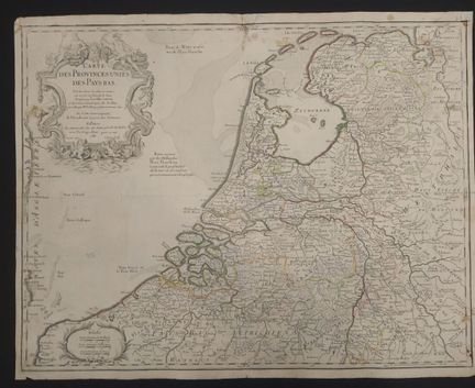
143 - PAYS BAS - DELISLE, G. - Carte des provences unis des Pays-Bas. Tirés des cartes des plus correctes qui ont été faites sur les lieux, rectifiées par Les Obfervations et opérations Géométrique de Snellius et par celles que Mr Caffini a faite en dernier lieu. - Par G.De l'Isle géographe de l'Académie des sciences, à Paris chez Dezauche Rue des Noyers près celle des Anglois avec privilége d'Aut, gravé par Liebaux le fils. - In 1788 - Engraving on laid paper - Sheet size : H : 500 mm X
Estimate €100 - €200 -
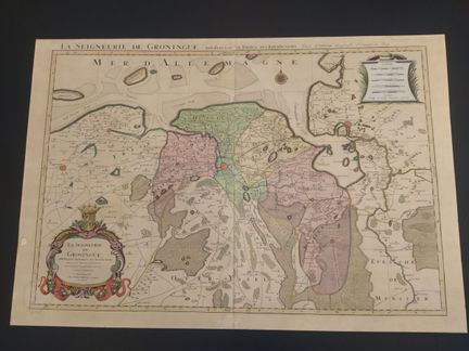
144 - NETHERLANDS - MORTIER, P. - La Seigneurie de Groningue subdivisée en toutes ses Juridictions - dressée sur les mémoires les plus nouveaux, Sir Sanson, géographe ordinaire du Roy, publié à Amsterdam chez Pierre Mortier et compagnie avec Privit - En 1700 - Color engraving on laid paper, reinforced - Sheet size: H: 600 mm X W: 870 mm / Subject: H: 540 mm X W: 800 mm. Condition A : Marked central fold, brown stains, paper missing at left, soiling.
Estimate €300 - €600 -
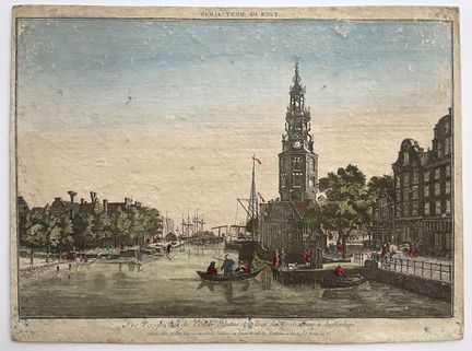
145 - PAYS BAS-VUE D'OPTIQUE - "Tour de Mont-Alban / Vue du Neuf Vitleg près de Boschbrug à la Haye" - 18th century - Set of two optical views of the Netherlands. Color engraving on laid paper - Dimensions : H : 295 mm X L : 410 mm. Condition B-. As is, wetness, stains, traces of wear. Rousseurs. Mounted on rigid backing.
Estimate €150 - €200 -
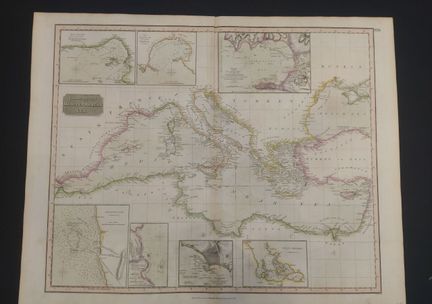
146 - MEDITERRANEAN - THOMSON, J. - Chart of the Mediterranean Sea. - drawn and engraved by John Thomson's New General Atlas - In 1817 - Hand-colored engraving on laid paper - Sheet size : H : 540 mm X W : 680 mm / Subject : H : 490 mm X W : 630 mm. Condition A : Marked central fold, with restoration on verso, paper slightly yellowed.
Estimate €150 - €200 -
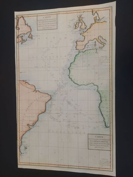
147 - ATLANTIC - TARDIEU, A. - [ Carte des déclinaisons de l'aiguille aimantée .... ] c. 1780. Large-format map of the Atlantic, giving information on its depths and showing the coasts of Europe, Africa and South America, and the magnetic inclination and declination. Map in two assembled sheets. By Ambroise Tardieu. Engraving on laid paper, color. Dimensions: 870 x 525 mm. Condition A. Short tear at wide left. Original folds.
Estimate €200 - €300 -
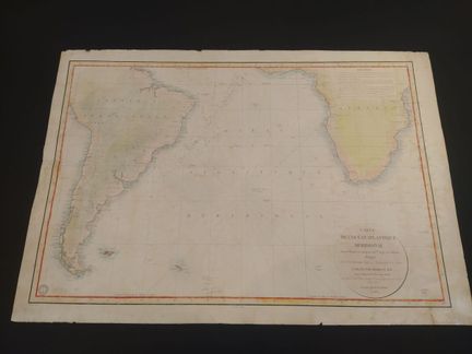
148 - ATLANTIC - DEPOT GENERAL DE LA MARINE - [ Map of the Southern Atlantic Ocean...] 1834. Large format map of the southern Atlantic Ocean, South America and the southwestern part of Africa. Published by the Dépôt général de la marine. Engraving on laid paper, color, strong paper. Dimensions: 650 x 955 mm. Condition B. Traces, tears, wetness.
Estimate €200 - €300
About the sale
ATTENTION: PICK-UP OF LOTS AT OUR PREMISES FROM TUESDAY APRIL 9
Terms of sale
Show the terms of sale
Auctions Fees
· Buyer fee : 30% taxes included
·
Conditions de règlement / / Payment
· Cash up to €1000 for French nationals
· Credit card EXCEPT AMEX
· Bank transfer
Picking up or scheduling a shipping
Pick-up at our office: everything except furniture, make an appointment
· Monday to Friday from 9:30 am to 12:30 pm and from 2 pm to 5:30 pm
· Possibility of mandating a relative: notify us by email or make a power of attorney, the person then presents themselves with an ID
Shipping within the European Union: jewelry, paintings, books, silverware, ceramics, glassware, etc.
• Shipping via DHL, quote on request
• Transport by professionals, list available on request
Shipping outside the European Union:
• Transport by professionals, list available on request