

Works on paper: from ancient to modern, 300 years of history
Tuesday 23 June 2026 at 13:00
9 rue de Provence, 75009 Paris
308 lots
-
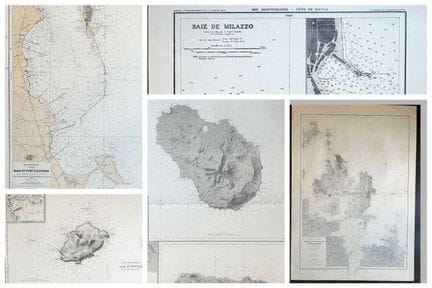
51 - SICILY & SARDINIA - ITALY - 19 SEA MAPS, some printed in color : SICILY & SARDINIA - 9 SEA MAPS including one in color: 1-"CAP BOI à la Pointe dei CAPPUCCINI", 1975 (53 x 75 cm). 2-"Bay of MILAZZO", 1970 (53 x 37 cm). 3-"Gulf of CONGIANUS", 1972 (75 x 52.5 cm). 4-"SAN PIETRO CHANNEL", 1982 (75 x 106 cm). 5-"Islands south of SICILY (Pantelleria Island...). 1982 (75 x 106 cm). 6-"Southeast coast of CAPE SCALAMBRI", 1973 (74.5 x 105 cm). 7-"USTICA ISLAND and PALERMO BAY". 1972 (74.
Estimate €100 - €200 -
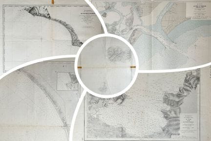
52 - ITALY - SICILY - 22 SEA MAPS, some printed in color: ITALY - 14 SEA MAPS, some printed in color: 1-"Plan de l'Île de PANARIA (Île de LIPARI)", 1965 (74.5 x 53 cm). 2-"PONZA and ZANNONE Islands", 1974 (74.5 x 53 cm). 3-"West Coast of Italy from MONTALTO to CAPE LINARO", 1962 (105 x 74 cm, tears at middle folds in margins). 4-"West Coast of Italy from CAPE LINARO to FIUMICINO", 1962 (74 x 105 cm). 5-West coast of Italy from FIUMICINO to PORTO D'ANZIO", 1964 (75 x 106 cm, consolidated tears
Estimate €100 - €200 -
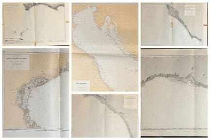
53 - ITALY- 44 SEA MAPS, four of which are printed in color: ITALY- 27 SEA MAPS including four printed in color: 1-"West coast of Italy from TROJA ISLAND to TALAMONE", 1959 (74.5 x 106 cm). 2-"Western part of the ELBE ISLAND and PIANOSA ISLAND", 1961 (74.5 x 105 cm). 3-"West coast of Italy from LA MAGRA to L'ARNO", 1968 (75 x 106 cm). 4-"Access to VENICE, PORT DU LIDO", 1971 (74.5 x 105 cm). 5-"ILE D'ELBE, Rade de PORTO-FERRAJO", 1961 (53 x 74.5 cm). 6-"Carte particulière des Côtes d'Italie
Estimate €150 - €200 -
54 - ITALY - ROME - RARE AND EXCEPTIONAL GRAVED PANORAMA FROM THE XVIIth CENTURY - View of "ROMA" (View taken beyond the gate of the Castel SAINT-ANGE). 1642. Etching engraved by Israël SILVESTRE (Nancy 1621 - Paris 1691), after Louis de Lincler (active in the 17th century). Printed on four leaves. Proof of the 1st state on 2, with artists' names and cross-references, before Mariette's name, on watermarked laid paper (bunch of grapes & letters). Ref: Faucheux, n°28. Margins. Israël Silvestre e
Result €1,200Estimate €1,200 - €1,500 -
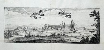
55 - ITALY - View of LORETTE - SILVESTRE - [Loreto]. c.1642. Original etching engraved by Israël SILVESTRE (1621-1691). Proof without the letter, on watermarked laid paper. Good margins. 28.7 x 44.5 cm. A/B condition (some old restorations in the margins, good condition).
Result €200Estimate €200 - €300 -
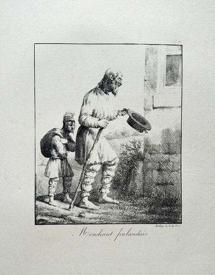
56 - FINLAND - "Finnish beggar". 19th century. Lithograph by Hippolyte BELLANGE (1800-1866). Proof on watermarked laid paper (letters), printed by C. de LASTEYRIE. Full margins. 47 x 30.5 cm. Condition A (good condition).
Estimate €60 - €80 -
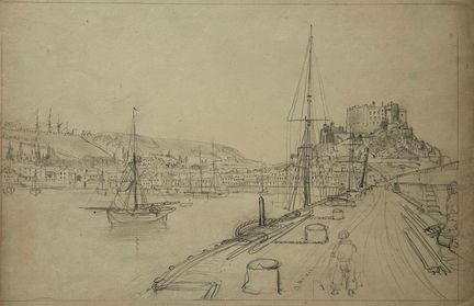
57 - JERSEY (UK) - [JERSEY - Port and Castle of Mont Orgueil, or Gorey Castle]. 19th century. Original sketch (probably by Félix Benoist) in graphite on wove paper. Provenance: Fonds of the Charpentier workshop run by Pierre-Henri (1788-1854) and his son Henri-Désiré (1806-1883), printers and publishers based in Paris, then in Nantes (from 1854). 22.5 x 34 cm. Condition A (good state of preservation).
Result €300Estimate €300 - €400 -
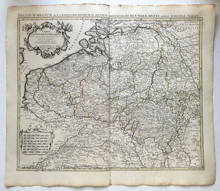
58 - BELGIUM & NETHERLANDS - G. DE L'ISLE - "CARTE des PAYS-BAS catholiques [...], par Guillaume de l'Isle de l'Académie Royale des sciences". A Amterdam, chez J. Covens et C. Mortier. 1742. Engraved map, on watermarked laid paper. Limits formerly colored. Title cartouche upper left. Margins. Folded in two (original). 57 x 67 cm. Condition A (stain at bottom middle fold, good condition).
Estimate €200 - €300 -
59 - CARTE DE France divisée en ses Provinces où l'on a joint les Routes de Paris aux principales Villes du Royaume [...] par Mr l'Abbé Clouet de l'Académie Royale des Sciences de Rouen. 1770. Engraved map with colored boundaries. laid paper. A Paris, chez le Sr Mondhare rue St Jacques à l'Hôtel Saumur. All margins. 58.5 x 83 cm. Condition A (two stains and rare marks of handling in the margins, otherwise good condition).
Estimate €90 - €120 -
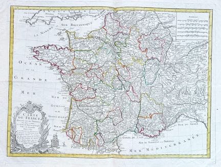
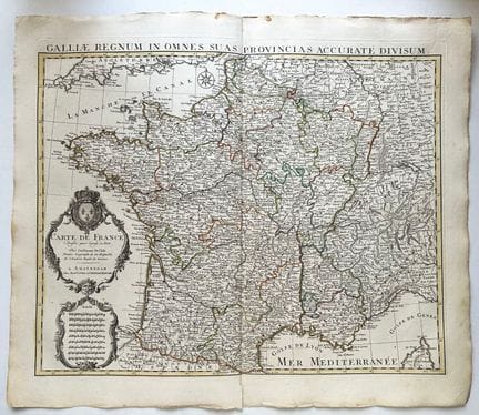
60 - CARTE DE FRANCE - G. DE L'ISLE - "CARTE de France, dressée pour l'usage du Roy, par Guillaume de L'Isle, premier géographe de Sa Majesté, de l'Académie Royale des sciences". A Amterdam, chez J. Covens et C. Mortier. 1742. Engraved map, on watermarked laid paper. Limits and major cities formerly colored. Margins. Folded in two (original). 57 x 67 cm. Condition A (one tear in lower margin, well preserved).
Estimate €250 - €300 -
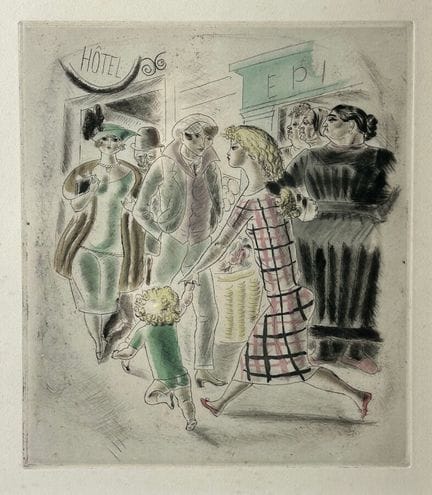
61 - CHAS LABORDE (1886 - 1941) - "Ménilmontant". 1926. Etching in color. Proof on wove paper, from the "Rues et visages de Paris" series. Margins. Framed piece. 27.5 x 24 cm for the subject. 45 x 41 cm for the frame. Condition A (not examined outside its frame, good condition when viewed).
Estimate €80 - €100 -
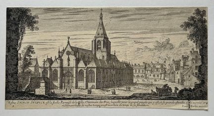
62 - PARIS - "L'Eglise SAINT SULPICE est la seule Paroisse de la Ville St Germain des Prez...". 17th century. Original etching engraved by Jean MAROT (1619 - 1679). Proof on laid paper, with the excudit of J. van Merlen (1616-1682). 13.3 x 26 cm. Condition A/B (cut on the subject, good condition).
Estimate €80 - €100 -
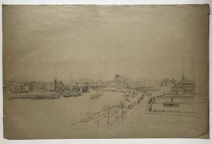
63 - PARIS (75) - [View of Paris and the Seine]. 19th century. Original Sketch (probably by Félix Benoist (1818-1896)) in graphite on gray-green wove paper. On verso a drawing of a Park. Provenance: Fonds of the Charpentier workshop run by Pierre-Henri (1788-1854) and his son Henri-Désiré (1806-1883), printers and publishers based in Paris, then Nantes (from 1854). 32.5 x 49.5 cm. Condition A/B (small pinhole at corners, short tear at top right, otherwise good condition).
Estimate €300 - €400 -
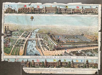
64 - PARIS - "Vue de l'EXPOSITION UNIVERSELLE DE PARIS 1878 - PANORAMA DES PALAIS DE L'EXPOSITION". 1878. Color lithograph, on glazed wove paper. Printed by J.E. Goossens, Brussels. Published by J. DOSSERAY, Paris. Approx. 60 x 83 cm. Condition D (missing lower left, foxing, stains and tears, as is).
Estimate €100 - €200 -
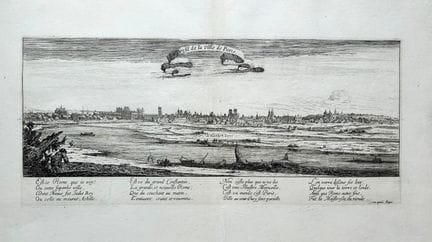
65 - PARIS (75) - "Profile of the city of PARIS". c.1650. Original etching engraved by Israël SILVESTRE (1621-1691). Proof with the letter, Silvestre's name erased, on watermarked laid paper. Good margins. 28.8 x 45 cm. Condition A/B (some old restorations, good condition).
Result €200Estimate €200 - €300 -
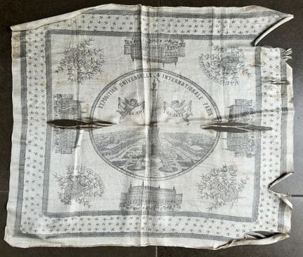
66 - PARIS (75) - EIFFEL TOWER - 1889 PARIS EXPO FOULARD - "Exposition Universelle & Internationale Paris". 1889. Printed on fabric. Published by Jules JALUZOT & Cie, Grands Magasins du Printemps. 52 x 60 cm approx. C/D condition (damaged, tears).
Estimate €150 - €200 -
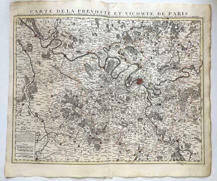
67 - PARIS et ses Environs - G. DE L'ISLE - "CARTE de la Prévosté et Vicomté de PARIS, dressée sur un grand nombre de mémoires particuliers assujettis aux observations de Mrs de l'Académie des sciences, par G. de L'Isle, premier géographe du Roy". A Amterdam, chez J. Covens et C. Mortier. 1742. Engraved map, on watermarked laid paper. Limits and major cities formerly colored. Margins. Folded in two (original). 57 x 67 cm. Condition A (well preserved).
Estimate €200 - €300 -
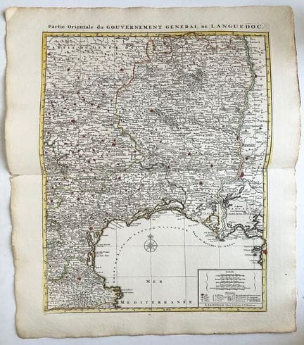
68 - LANGUEDOC - MAP of the "Partie orientale du Gouvernement général de LANGUEDOC". Amterdam: J. Covens and C. Mortier. 1742. Engraved map, on watermarked laid paper. Limits and major cities formerly colored. Margins. Folded in half. 67 x 57 cm. Condition A (one tear in right margin, good condition).
Estimate €200 - €300 -
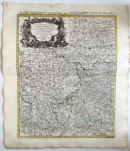
69 - LANGUEDOC- Sr SANSON - MAP of "Gouvernement général de LANGUEDOC, Partie occidentale - par le Sr SANSON". A Amterdam, chez J. Covens et C. Mortier. 1742. Engraved map, on watermarked laid paper. Limits and major cities formerly colored. Title cartouche top left. Margins. Folded in half. 67 x 57 cm. Condition A (well preserved).
Estimate €200 - €300 -
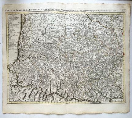
70 - BEARN - PAYS-BASQUE - G. DE L'ISLE - "CARTE du BEARN de la BIGORRE de l'ARMAGNAC et des Pays voisins, par G. de L'Isle, premier géographe du Roy de l'Académie Royale des Sciences à Paris". A Amterdam, chez J. Covens et C. Mortier. 1742. Engraved map, on watermarked laid paper. Limits and major cities formerly colored. Margins. Folded in half. 57 x 67 cm. Condition A (well preserved).
Estimate €300 - €400 -
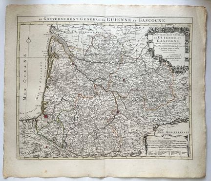
71 - PAYS-BASQUE - GASCOGNE - GUIENNE - BORDELAIS - G. DE L'ISLE - CARTE du "Gouvernement de GUIENNE et GASCOGNE, dressé sur les Observations de Mr de l'Académie Royale des Sciences...". A Amterdam, chez J. Covens et C. Mortier. 1742. Engraved map, on watermarked laid paper. Limits formerly colored. Title cartouche at upper right. Margins. Folded in half. 57 x 67 cm. Condition A (well preserved).
Result €300Estimate €300 - €400 -
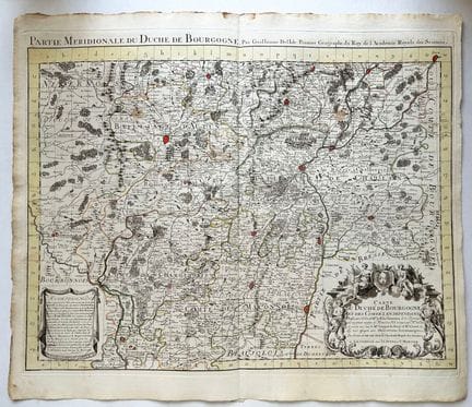
72 - BOURGOGNE - G. DE L'ISLE - CARTE de la "Partie Méridionale du Duché de BOURGOGNE, par Guillaume de l'Isle, premier géographe du Roy de l'Académie Royale des Sciences". A Amterdam, chez J. Covens et C. Mortier. 1742. Engraved map, on watermarked laid paper. Limits formerly colored. Title cartouche lower right. Margins. Folded in half. 57 x 67 cm. Condition A (well preserved).
Estimate €200 - €300 -
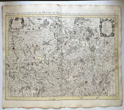
73 - BOURGOGNE (NOYER - DIJON) - G. DE L'ISLE - CARTE de la "Partie Septentrionale du Duché de BOURGOGNE, par Guillaume de l'Isle, premier géographe du Roy de l'Académie Royale des Sciences". A Amterdam, chez J. Covens et C. Mortier. 1742. Engraved map, on watermarked laid paper. Limits formerly colored. Margins. Folded in half. 57 x 67 cm. Condition A (small traces of wetness at the edge of the lower margin, otherwise in good condition).
Estimate €200 - €300 -
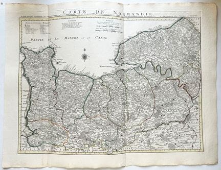
74 - NORMANDIE - G. DE L'ISLE - "CARTE de NORMANDIE, où sont marqués exactement les Pays ou Contrées enfermées dans cette Privince aussi bien que les Villes Bourgs Paroisses et autres lieux, par Guillaume de l'Isle de l'Académie Royale des Sciences". A Amterdam, chez J. Covens et C. Mortier. 1742. Engraved map, on watermarked laid paper. Limits formerly colored. Margins. Folded in three (original). 57 x 76 cm. Condition A (well preserved).
Estimate €400 - €500 -
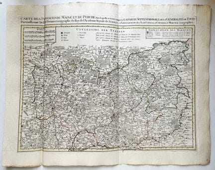
75 - MAINE & PERCHE - CHER (18) - SARTHE (72) - INDRE-ET-LOIR (37) - G. DE L'ISLE - "CARTE des Provinces du MAINE et du PERCHE dans laquelle se trouve comprise la partie septentrionale de la Généralité de TOURS, par Guillaume de l'Isle, le premier géographe du Roy de l'Académie Royale des sciences". A Amterdam, chez J. Covens et C. Mortier. 1742. Engraved map, on watermarked laid paper. Limits formerly colored. Margins. Folded in three (original). 57 x 75 cm. Condition A (well preserved).
Estimate €350 - €400 -
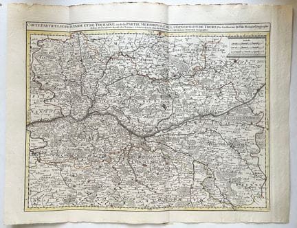
76 - ANJOU & TOURAINE - MAINE-ET-LOIRE (49) - INDRE-ET-LOIRE (37) - G. DE L'ISLE - "CARTE particulière d'ANJOU et de TOURAINE ou de la Parie Méridionale de la Généralité de TOURS, par Guillaume de l'Isle, le premier géographe du Roy de l'Académie Royale des sciences". A Amterdam, chez J. Covens et C. Mortier. 1742. Engraved map, on watermarked laid paper. Limits formerly colored. Margins. Folded in three (original). 57 x 74.5 cm. Condition A (well preserved).
Estimate €400 - €500 -
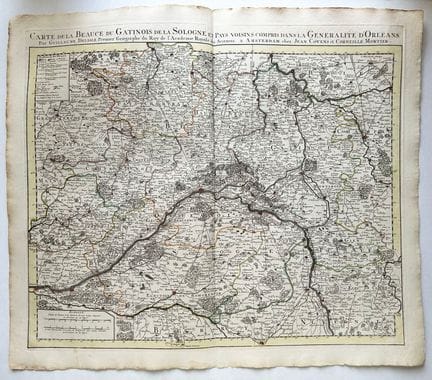
77 - BEAUCE - SOLOGNE - GATINAIS - G. DE L'ISLE - "CARTE de la BEAUCE, du GATINOIS, de la SOLOGNE et Pays voisins compris dans la Généralité d'ORLEANS, par Guillaume de l'Isle, le premier géographe du Roy de l'Académie Royale des sciences". A Amterdam, chez J. Covens et C. Mortier. 1742. Engraved map, on watermarked laid paper. Limits formerly colored. Margins. Folded in half (original). 57 x 67 cm. Condition A (good condition).
Estimate €250 - €300 -
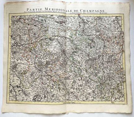
78 - CHAMPAGNE - AUBE (10) - YONNE (89) - HAUTE-MARNE (52) - G. DE L'ISLE - CARTE de la "Partie Méridionale de la CHAMPAGNE, par Guillaume de l'Isle de l'Académie Royale des sciences". A Amterdam, chez J. Covens et C. Mortier. 1742. Engraved map, on watermarked laid paper. Limits formerly colored. Margins. Folded in half (original). 57 x 67 cm. Condition A (good condition).
Estimate €200 - €300 -
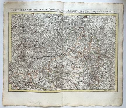
79 - CHAMPAGNE - MARNE (51) - AISNE (02) - G. DE L'ISLE - "CARTE de la CHAMPAGNE et des Pays voisins où l'on voit la Généralité de CHALONS partie de celle de SOISSONS etc, par Guillaume de l'Isle de l'Académie Royale des sciences". A Amterdam, chez J. Covens et C. Mortier. 1742. Engraved map, on watermarked laid paper. Limits formerly colored. Margins. Folded in half (original). 57 x 67 cm. Condition A (few small stains and a short tear in lower margin, good condition).
Estimate €200 - €300 -
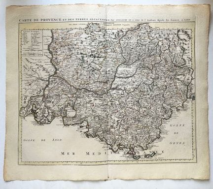
80 - PROVENCE - VAR (83) - BOUCHES-DU-RHÔNE (13) - VAUCLUSE (84) - G. DE L'ISLE - "CARTE de PROVENCE et des terres adjacentes, par Guillaume de l'Isle de l'Académie Royale des sciences à Paris". A Amterdam, chez J. Covens et C. Mortier. 1742. Engraved map, on watermarked laid paper. Limits formerly colored. Margins. Folded in half (original). 57 x 67 cm. Condition A (slight trace of wetness at bottom of middle fold, good condition).
Estimate €300 - €400 -
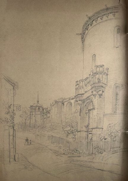
81 - CHÂTEAU EN FRANCE - Original drawing (probably by Félix Benoist) in graphite on wove grey paper. Provenance: Fonds of the Charpentier workshop run by Pierre-Henri (1788-1854) and his son Henri-Désiré (1806-1883), printers and publishers based in Paris, then Nantes (from 1854). 50.5 x 37 cm. Condition B (a short tear on the right edge of the sheet and at the top right, rare small handling creases on the edges and a slight trace of insolation at the bottom left).
Estimate €200 - €300 -
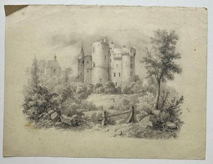
82 - CHÂTEAU DE BRETAGNE - Original drawing (probably by Félix Benoist) in graphite on wove paper. Provenance: Fonds of the Charpentier workshop run by Pierre-Henri (1788-1854) and his son Henri-Désiré (1806-1883), printers and publishers based in Paris, then Nantes (from 1854). 20 x 26.5 cm. Condition A (good state of preservation).
Estimate €150 - €200 -
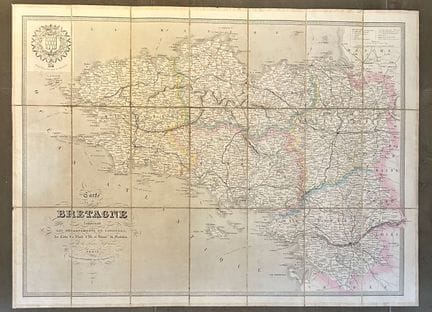
83 - BRITTANY - ROAD MAP OF BRITTANY - "Carte de la Bretagne comprenant les départements du FINISTERE, des Côtes du Nord, d'ILLE-ET-VILAINE, du MORBIHAN, et de la Loire Inférieure". c.1850. Engraved map with colored boundaries. With the arms of the province of Brittany at top left. Logerot Editeur, Paris. Folded and canvas-backed map, in its original titled cover. 56.5 x 77 cm. Condition B (cloth weakened, few stains on verso, otherwise good condition).
Estimate €100 - €200 -
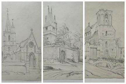
84 - NORMANDIE - Reunion of 3 drawings. 19th century. Original lead pencil DRAWINGS (probably by Félix Benoist) on wove paper. Provenance: Fonds of the Charpentier workshop run by Pierre-Henri (1788-1854) and his son Henri-Désiré (1806-1883), printers and publishers based in Paris, then in Nantes (from 1854). Approx. 19 x 12.5 cm each. Condition A (well preserved). Set of 3 pieces.
Estimate €200 - €300 -
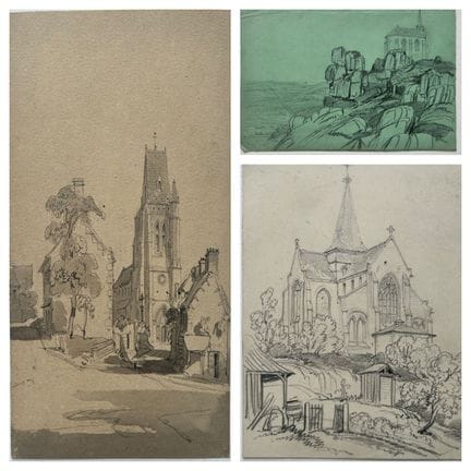
85 - Félix BENOIST (1818-1896) - Meeting of 3 graphite drawings on paper. 19th century. Provenance: Fonds of the Charpentier workshop run by Pierre-Henri (1788-1854) and his son Henri-Désiré (1806-1883), printers and publishers based in Paris, then Nantes (from 1854). 16.5 x 12 cm, 14 x 11 cm & 14.5 x 21.5 cm. Condition A (well preserved). Set of 3 pieces.
Estimate €150 - €200 -
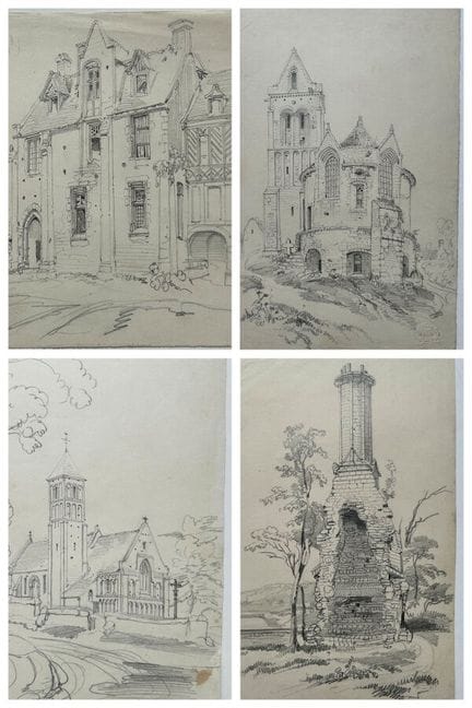
86 - Félix BENOIST (1818-1896) - Meeting of 4 graphite drawings on paper. 19th century. Provenance: Fonds of the Charpentier workshop run by Pierre-Henri (1788-1854) and his son Henri-Désiré (1806-1883), printers and publishers based in Paris, then in Nantes (from 1854). 21 x 13.5 cm approx. each. Condition A (well preserved). Set of 4 pieces.
Estimate €250 - €300 -
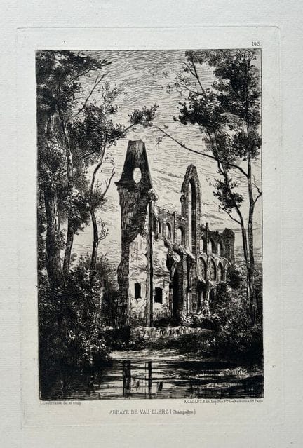
87 - AISNE (02) - Bouconville-Vauclair - "ABBAYE de VAU-CLERC (VAUCLAIR)". c.1870. Original etching by Léopold DESBROSSES (1821-1908). Proof with the letter, on Arches laid paper. Printed and published by A. Cadart, Paris. Good margins. 49 x 32 cm. Condition A (well preserved).
Estimate €60 - €80 -
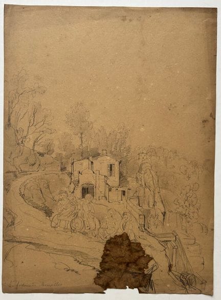
88 - ALPES-MARITIMES (06) - "La Fontaine de MOURAILLES" (near NICE). 19th century. Original Sketch (probably by Félix Benoist) in graphite on wove paper. Situated "La fontaine de Mourailles" in gray pencil lower left. Provenance: Fonds of the Charpentier workshop run by Pierre-Henri (1788-1854) and his son Henri-Désiré (1806-1883), printers and publishers based in Paris, then in Nantes (from 1854). 32 x 23.5 cm. Condition C (tear and brown ink stain at foot, few small scattered stains).
Estimate €80 - €100 -
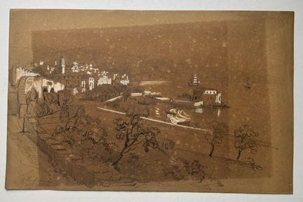
89 - ALPES-MARITIMES (06) - "VILLEFRANCHE-SUR-MER" (near NICE). 19th century. Original sketch (probably by Félix Benoist) in graphite, heightened with white gouache, on brown wove paper. Situated "Villefranche / près de Nice" in gray pencil lower left. Provenance: Fonds of the Charpentier workshop run by Pierre-Henri (1788-1854) and his son Henri-Désiré (1806-1883), printers and publishers based in Paris, then Nantes (from 1854). 20.3 x 32 cm. Condition B/C (traces of exposure).
Estimate €100 - €200 -
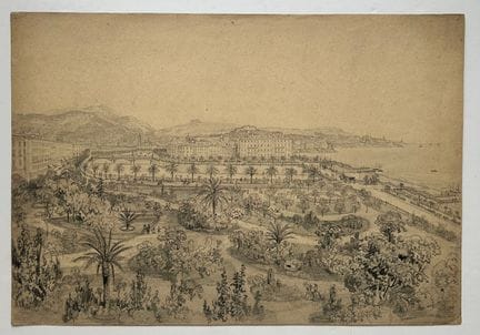
90 - ALPES-MARITIMES (06) - "NICE, View from the Public Garden". 19th century. Original Sketch by Félix Benoist (1818-1896) in graphite on wove paper. PREPARATORY DRAWING for the lithograph entitled "Nice", for the album "NICE ET SAVOIE" published in 1864 by Charpentier. Provenance: Fonds of the Charpentier workshop run by Pierre-Henri (1788-1854) and his son Henri-Désiré (1806-1883), printers and publishers based in Paris, then in Nantes (from 1854). View from the Hôtel des Anglais, with the Jar
Estimate €300 - €400 -
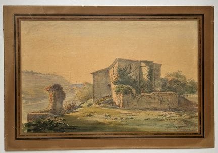
91 - ALPES-MARITIMES (06) - CIMIEZ (NICE) - "Ancienne Préfecture des Alpes-Maritimes", 1880. Watercolor by Antoine TRACHEL (1828-1903) on paper, located and signed lower right. 24 x 38 cm for the subject. 30.5 x 45 cm with passe-partout mount. Condition A (good state of preservation).
Estimate €200 - €300 -
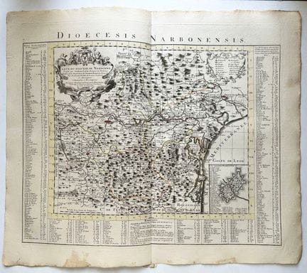
92 - AUDE (11) - NARBONNE - G. DE L'ISLE - "CARTE du Diocèse de NARBONNE, dressée par Guillaume Lafont, Bourgois de Narbonne, rectifiée sur les observations de l'Académie Royale des Sciences par Guillaume de L'Isle (1675-1726). A Amterdam, chez J. Covens et C. Mortier. 1742. Engraved map, on watermarked laid paper. Limits formerly colored. Title cartouche top left. With alphabetical table of places in the Diocese of Narbonne. Margins. Folded in two. 57 x 67 cm. Condition A (few small stains and a
Estimate €200 - €300 -
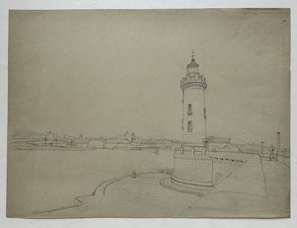
93 - BOUCHES-DU-RHÔNE (13) - [MARSEILLE - The Sainte-Marie Lighthouse and entrance to the Vieux Port]. 19th century. Original Sketch (probably by Félix Benoist) in graphite on wove paper. Provenance: Fonds of the Charpentier workshop run by Pierre-Henri (1788-1854) and his son Henri-Désiré (1806-1883), printers and publishers based in Paris, then Nantes (from 1854). 23.5 x 32 cm. Condition A (tiny pinhole in corners, good condition).
Estimate €250 - €300 -
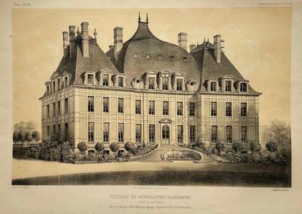
94 - CHER (18) - "CHÂTEAU de MONTALIVET-LAGRANGE (Canton de SANCERRE), Built around 1610 by the Maréchal de Montigny-Lagrange" (SAINT-BOUIZE). 19th century. Lithographed by Victor PETIT (1817-1871). Proof on wove paper, printed by Monrocq. Published by Ch. Boivin, Paris. Margins. 31.2 x 49.2 cm. Condition A (rare small marginal stains, otherwise good condition).
Result €160Estimate €80 - €100 -
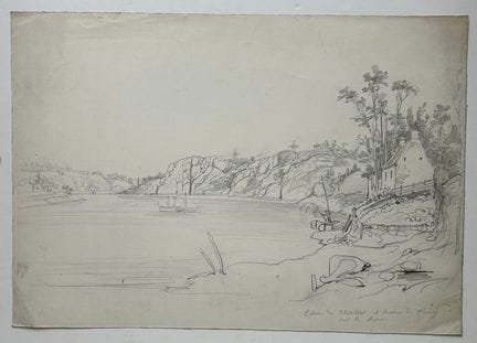
95 - CÔTES D'ARMOR (22) - "Ecluse du Chatellier et Rochers de Fumay, sur la Rance (à Saint-Samson-sur-Rance, près de Dinan)". 19th century. Original Sketch (probably by Félix Benoist) in graphite on wove paper. Situated "Ecluse du Chatellier et Rochers de Fumay, sur la Rance" lower right in gray pencil. Provenance: Fonds of the Charpentier workshop run by Pierre-Henri (1788-1854) and his son Henri-Désiré (1806-1883), printers and publishers based in Paris, then Nantes (from 1854). 24.2 x 34.5 c
Estimate €250 - €300 -
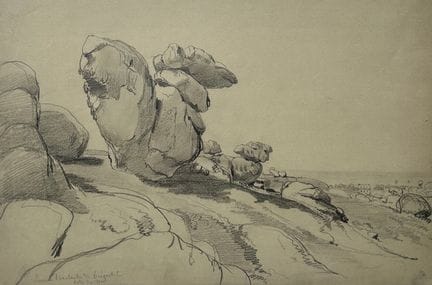
96 - CÔTES D'ARMOR (22) - LANNION - "Pierre branlante de TREGASTEL, Côtes du nord". 19th century. Original Sketch (probably by Félix Benoist) in graphite on grey wove paper. Situated "Pierre branlante de TREGASTEL, Côtes du nord" lower left in gray pencil. Provenance: Fonds of the Charpentier workshop run by Pierre-Henri (1788-1854) and his son Henri-Désiré (1806-1883), printers and publishers based in Paris, then in Nantes (from 1854). 23 x 32 cm. Condition A (good state of preservation).
Result €200Estimate €200 - €300 -
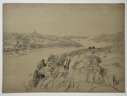
97 - CÔTES D'ARMOR (22) - LANNION - "Mouth of the river of LANNION (with Breton family)". 19th century. Original Sketch (probably by Félix Benoist) in graphite on grey wove paper. Located "Embouchure de la rivière de LANNION" lower left in gray pencil. Provenance: Fonds of the Charpentier workshop run by Pierre-Henri (1788-1854) and his son Henri-Désiré (1806-1883), printers and publishers based in Paris, then in Nantes (from 1854). 23.5 x 32.5 cm. Condition A (good state of preservation).
Result €250Estimate €250 - €300 -
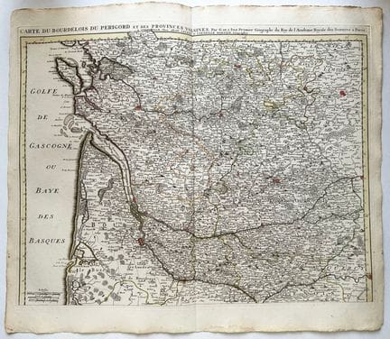
98 - PERIGORD - SAINTONGE (17) - ILE D'OLERON - DORDOGNE (24) - "CARTE du BOURDELOIS du PERIGORD et des Environs voisines par G. de L'Isle, premier géographe du Roy de l'Académie Royale des Sciences à Paris". A Amterdam, chez J. Covens et C. Mortier. c.1742. Engraved map, on watermarked laid paper. Limits formerly colored. Margins. Folded in half. 57 x 67 cm. Condition A (rare small traces of wetness at the edge of the margins, otherwise in good condition).
Estimate €300 - €400 -
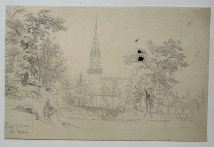
99 - FINISTERE (29) - "CAST, près CHATEAULIN". 19th century. Original Sketch (probably by Félix Benoist) in graphite on wove paper. Situated "Cast (Finistère) Près Chateaulin" lower left in gray pencil. Provenance: Fonds of the Charpentier workshop run by Pierre-Henri (1788-1854) and his son Henri-Désiré (1806-1883), printers and publishers based in Paris, then Nantes (from 1854). 18 x 27 cm. B/C condition (ink stain and rare minor foxing).
Estimate €180 - €200 -
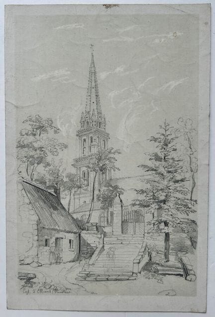
100 - FINISTERE (29) - "Church of ELLIANT". 19th century. Original Sketch (probably by Félix Benoist) in graphite, heightened with white gouache, on wove paper. Located "Egl. d'Elliant (Finistère)" lower left in gray pencil. Provenance: Fonds of the Charpentier workshop run by Pierre-Henri (1788-1854) and his son Henri-Désiré (1806-1883), printers and publishers based in Paris, then Nantes (from 1854). 24.5 x 16.3 cm. Condition A (good state of preservation).
Result €200Estimate €200 - €300

About the sale
No public viewing or telephone orders
Pick-up at our offices, 9 Rue de Provence, 75009 Paris : by appointment only from Monday June 29 - 2:00 pm
- Monday to Friday, 09:30 to 12:30 and 14:00 to 17:30
- Possibility of appointing a relative: notify us by e-mail or give him or her power of attorney, and the person will then present him or herself with proof of identity.
Shipment within the European Union :
- Shipment via DHL, estimate on request
- Professional transport, list available on request
Shipping outside the European Union :
- Professional transport, list available on request
Terms of sale
Show the terms of sale
Frais de vente
· Frais acheteur : 26.2 % TTC en sus de l’adjudication
· Frais Live : 3.6 % TTC en sus de l’adjudication
Conditions de règlement / / Payment
· Espèces jusqu’à 1000€ pour les ressortissants français
· Carte bleue SAUF AMEX
· Virement bancaire