

Engravings, prints, lithographs
Tuesday 2 April 2024 at 14:00
9 rue de Provence, 75009 Paris
301 lots
-
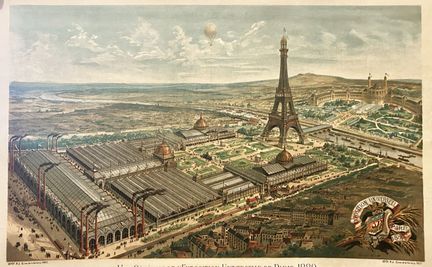
51 - PARIS - "Vue générale de l'Exposition Universelle de Paris en 1889" (Champ-de-Mars). Original lithograph in colors by SERVANDO. Proof on fine wove paper. Published at Dépôt R.J. 15 rue de la Verrerie, Paris. Margins. 46.5 x 71.7 cm. Condition A (some restorations).
Estimate €600 - €800 -
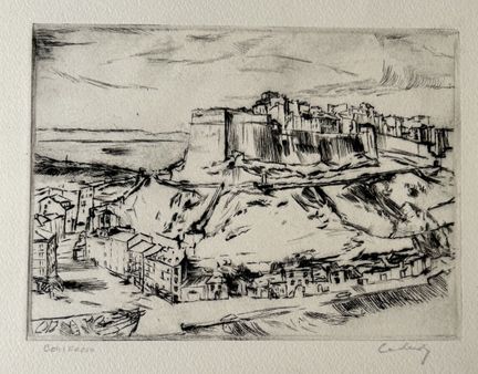
52 - CORSICA - (VIEW of BONIFACIO). c.1920. Drypoint engraving on wove paper. Title and signature (unidentified) in gray pencil. Margins. 18 x 22 cm - Condition A (well preserved).
Estimate €100 - €200 -
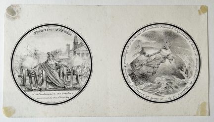
53 - CORSICA - CURIOSITY - "TABATIERE à la Corse: 1° 19 Vendemiaire, 2° TOULON (06), 3°Assassinat du DUC D'ENGHIEN (for the picture on the left) & 1°Death of 4 million French people, 2°Waste of 15 billion, 3°French sick poisoned at JAFA and 4° Strangling of PICHEGRU. 19th century. Lithograph, on wove paper. Margins. 12 x 21 cm - Condition B (traces of old mounting at corners)
Estimate €100 - €200 -
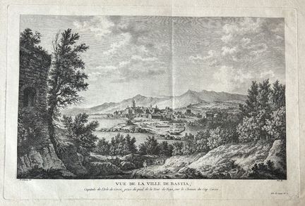
54 - CORSICA - "Vue de la ville de BASTIA, Capitale de l'Isle de Corse, prise du pied de la Tour de Toga, sur le Chemin Cap Corse". c.1784. Engraved with etching and burin by Née, after D'Aubigny. Proof on watermarked laid paper (letters). Good margins. 34.5 x 52 cm. Condition A (a few freckles and stains in the margins, slight trace of median vertical fold).
Estimate €100 - €200 -
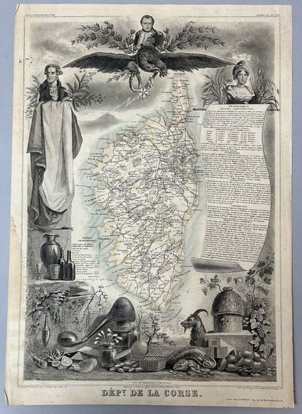
55 - CORSICA - MAP OF CORSICA, drawn by Levasseur, circa 1850. Engraved map with colored boundaries. Wove paper. Published by A.Combette in Paris. Small margins. 44.5 x 31.5 cm. Condition B (small tear top left, stain at edge of left margin).
Estimate €80 - €100 -
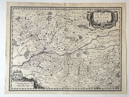
56 - MAP OF THE DUCCHY OF ANJOU - HONDIUS - JANSSONIUS - "The Duchy of Aniou". c.1630. Engraved map published in Amsterdam. laid paper. Title cartouche top right. Margins. 40.5 x 53.5 cm. Condition A/B (trace of original median vertical fold, good condition).
Estimate €150 - €200 -
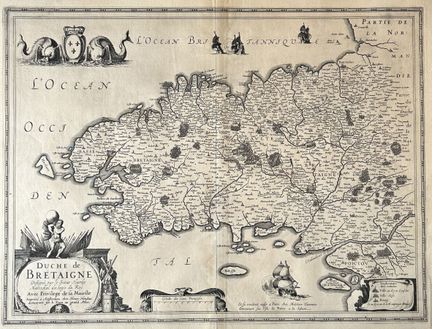
57 - BRITAIN - MAP of the "Duchy of BRETAIGNE, drawn by Sieur Hardy, Mareschal des logis du Roy, with privilege of His Majesty". c.1630. Engraved map on laid paper, with address "à Amsterdam imprimé chez Henry Hondius demeurant sur le Dam au grand Atlas / Et vendent aussi à Paris, chez Melchior Tavernier demeurant sur l'Isle du Palais à la Sphère". Title cartouche lower left. Margins. 40.5 x 53 cm. Condition A (trace of original median vertical fold).
Estimate €150 - €200 -
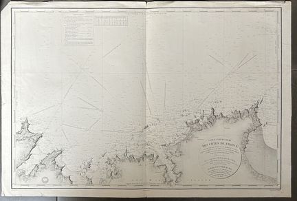
58 - CARTE MARINE DE LA BRETAGNE depuis le CAP FREHEL jusqu'à CANCALE - "Carte particulière des Côtes de France (partie comprise entre le Cap Fréhel et Cancale, Baie de la Frenay, Anse de Saint-Cast, Mouillage des Ehbiens[...], levée en 1829 par les ingénieurs hydrographes de la Marine". At the Marine general depot in 1836. Nautical chart engraved by Michel. laid paper. Margins. 63 x 94 cm. Condition A (good general condition).
Estimate €100 - €200 -
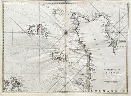
59 - MARINE MAP OF NORMANDY - COTENTIN & ANGLO-NORMAND ISLANDS - "2ème Carte particulière des Costes de Normandie contenant les Costes du Cotentin depuis la Pointe de la Percée jusqu'à GRANVILLE où sont comprise les Isles de JERSEY, Grenezey (GUERNESEY), Cers & AURIGNY avec les Iles de BREHAT", levé et gravée par Ordre du Roy, 1693. Engraved map, on laid paper. Colored boundaries. Good margins. 62 x 99 cm. Condition A (a short tear at the top middle fold, well preserved).
Estimate €300 - €400 -
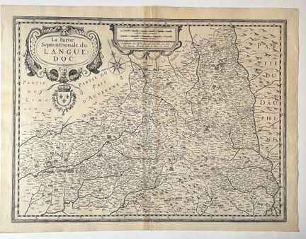
60 - LANGUEDOC MAP - HONDIUS - "La partie Septentrionale du LANGUEDOC". 1623. Engraved map. laid paper. With address "A Amsterdam chez Josse Hondius et se vend à Paris chez Melchior Tavernier demeurant aupres du Palais a. 1623". Title cartouche top left. Margins. 40.5 x 53 cm. Condition A (trace of original median vertical fold and trace of insolation).
Estimate €150 - €200 -
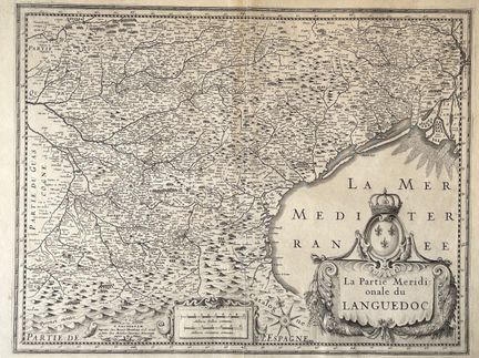
61 - MAP OF THE LANGUEDOC - HONDIUS - "La partie Méridionale du LANGUEDOC". 1623. Engraved map. laid paper. With address "A Amsterdam chez Henry Hondius et se vend à Paris chez Melchior Tavernier demeuranr aupres du Palais". Title cartouche lower right. Margins. 40.5 x 53 cm. Condition A (trace of original median vertical fold and slight trace of sunstain).
Estimate €150 - €200 -
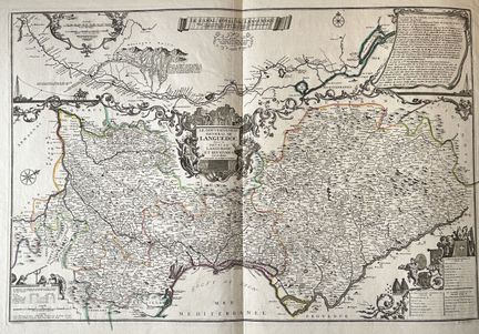
62 - LANGUEDOC - MAP of "Gouvernement général de LANGUEDOC divisé en haut et bas Languedoc et Sévennes par N. DE FER - Le CANAL ROYAL DE Languedoc". 1712. Map engraved by P. Starckman. Limits formerly colored. laid paper. Title cartouche at center. Margins. Folded in half. 54 x 80 cm. Condition A (good condition).
Estimate €200 - €300 -
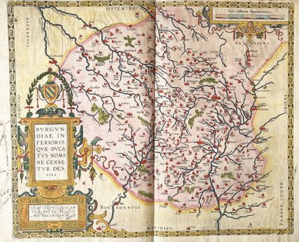
63 - MAP OF BURGUNDY (47) & (21) - Abraham ORTELIUS - "Burgundiae in Ferioris quae ducatus nomine censetur des", 1584. Engraved map. Early coloring. laid paper. Title block lower left. With address "Cum Privilegio JM Periali et Belgico ad decentum". Margins. 39 x 50.5 cm. Condition A (original median vertical fold, some handwritten annotations in brown ink in margins and verso).
Estimate €300 - €400 -
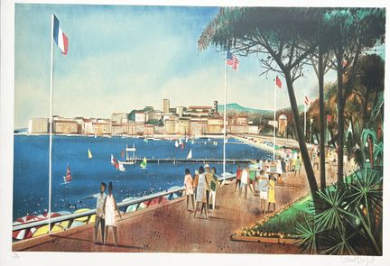
64 - ALPES-MARITIMES (06) - CANNES - Robert VERNET-BONFORT - "La Croisette à CANNES". 1975. Lithograph in colors. Fine proof on wove paper, numbered 126/250 and signed in pencil by the artist. Margins. 54 x 75 cm. Condition A (very slight trace of fold at lower right, barely visible, good condition).
Estimate €80 - €100 -
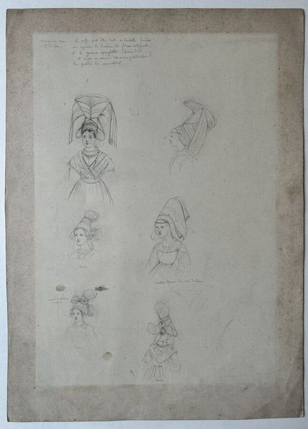
65 - CALVADOS (14) - VIRÉ - [Sketch of Viré costumes]. 19th century. Sketch in pencil on chine paper. Handwritten annotations at upper left in gray pencil: "Environs de Viré, Coiffe de Viré; La coiffe peut être toute en dentelle brodée, on ajoute le diadème de fleurs artificielles et 2 grosses épingles chaine d'or et croix au cou, manière particulière de porter le mouchoir". Provenance: Fonds of the Charpentier workshop run by Pierre-Henri (1788-1854) and his son Henri-Désiré (1806-1883),
Estimate €150 - €200 -
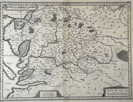
66 - CARTE de la SAINTONGE - Charente-Maritime (17) - HONDIUS - "Carte du Pais de Xaintonge". c.1630. Map of Saintonge, with part of Poitou, including La Rochelle and Oléron. Engraved map published in Amsterdam. laid paper. Margins. 40.5 x 53 cm. Condition A (trace of original median vertical fold, good condition).
Estimate €150 - €200 -
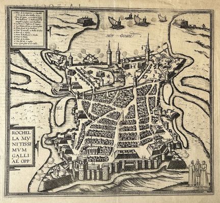
67 - CHARENTE-MARITIME (17) - PLAN de LA ROCHELLE - Georg Braun & Frans Hogenberg - "Rochella Munitissimum Galliae opp." c.1575. Engraved plan. laid paper. French text on verso. Margins. 39 x 45.5 cm. Condition A (original centerfold, good condition).
Estimate €200 - €300 -
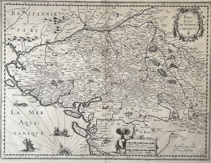
68 - MAP OF POITOU - HONDIUS - "POICTOU Pictaviensis Comitatus". c.1630. Map of Poitou and part of Saintonge, with Ile d'Oléron. Engraved map on laid paper, with address "Amstelodami excudit / Judocus Hondius". Margins. 40.5 x 53 cm. Condition A (trace of original median vertical fold, good condition).
Estimate €150 - €200 -
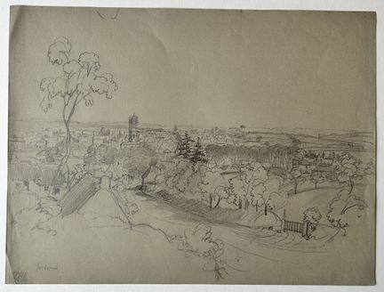
69 - CÔTES D'ARMOR (22) - View of "ROSTRENEN". 19th century. Sketch in graphite on grey wove paper. Situated in gray pencil lower left and stamped (letters "E.B" separated by a caduceus). Provenance: Fonds of the Charpentier workshop run by Pierre-Henri (1788-1854) and his son Henri-Désiré (1806-1883), printers and publishers based in Paris, then Nantes (from 1854). Drawing probably by Félix Benoist (Saumur, 1818 - Nantes, 1896), a draftsman and lithographer who worked closely with the Charpentie
Estimate €300 - €400 -
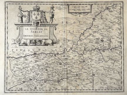
70 - DORDOGNE (24) - HONDIUS - J. TARDO - MAP of the "Diocese of SARLAT, Diocesis Sarlatensis". 1625. Engraved map on laid paper, with address "à Amsterdam imprimé chez Henry Hondius et fe / vendent à Paris, chez Melchior Tavernier auprès du Palais". Title block at upper left. Margins. 40.5 x 53 cm. Condition A (trace of original median vertical fold and rare printing creases, good condition).
Estimate €150 - €200 -
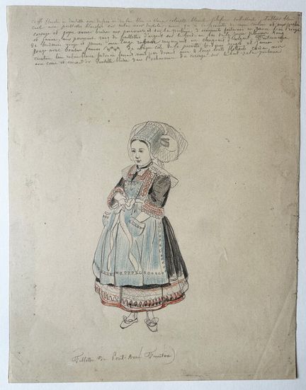
71 - FINISTERE (29) - "Fillette de PONT-AVEN (Finistère)". Sketch in graphite and colored pencil, on glazed wove paper. Titled at bottom in pencil. Handwritten annotations (precise descriptions of costume) in pencil at top "White lace headdress with [...] blue and white ribbon, white collar, [...] blue apron, ass with white sequins on black lace ribbon [...]". Provenance: Fonds of the Charpentier workshop run by Pierre-Henri (1788-1854) and his son Henri-Désiré (1806-1883), printers and publishers
Estimate €250 - €300 -
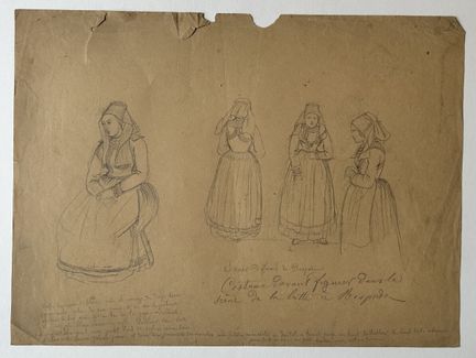
72 - FINISTERE (29) - "Scaër different from ROSPORDEN. Costumes in front of figures in the Rosporden wrestling scene". 19th century. Pencil drawing on brown wove paper. Handwritten annotations (precise costume descriptions) in pencil at bottom. Preparatory costume drawing for the lithograph "Une lutte à Rosporden" published in "Bretagne contemporaine" by Charpentier in 1860. Provenance: Fonds of the Charpentier workshop run by Pierre-Henri (1788-1854) and his son Henri-Désiré (1806-1883), printer
Estimate €150 - €200 -
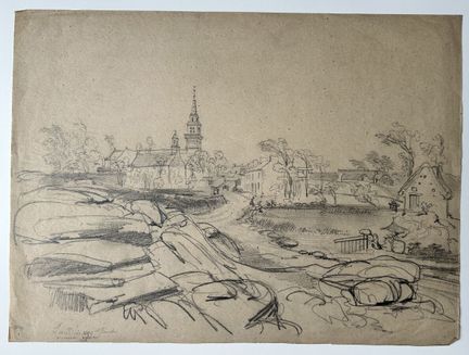
73 - FINISTERE (29) - "LANDUNVEZ, Finistère, old church". 19th century. Sketch in pencil on grey wove paper. Located in gray pencil lower left. Provenance: Fonds of the Charpentier workshop run by Pierre-Henri (1788-1854) and his son Henri-Désiré (1806-1883), printers and publishers based in Paris, then in Nantes (from 1854). 23.3 x 31.5 cm. Condition A (well preserved).
Estimate €150 - €200 -
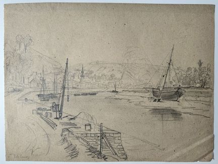
74 - FINISTERE (29) - "PORT LAUNAY". 19th century. Sketch in pencil on grey wove paper. Located in gray pencil lower left. Provenance: Fonds of the Charpentier workshop run by Pierre-Henri (1788-1854) and his son Henri-Désiré (1806-1883), printers and publishers based in Paris, then in Nantes (from 1854). 21 x 28 cm. Condition A (well preserved).
Estimate €150 - €200 -
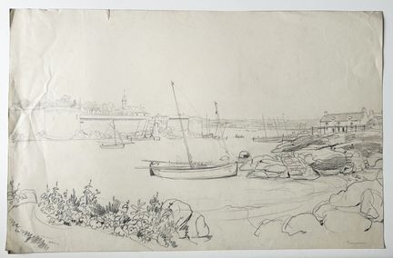
75 - FINISTERE (29) - "CONCARNEAU". 19th century. Sketch in pencil on wove paper. Located in gray pencil lower right. Provenance: Fonds of the Charpentier workshop run by Pierre-Henri (1788-1854) and his son Henri-Désiré (1806-1883), printers and publishers based in Paris, then in Nantes (from 1854). 25.5 x 39.5 cm. Condition A (rare small handling creases on the left edge, otherwise in good condition).
Estimate €200 - €300 -
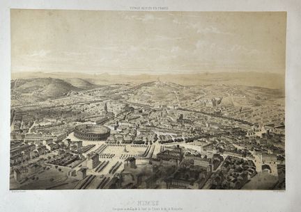
76 - GARD (30) - AERIAL VIEW of "NÎMES, Vue prise au-dessus de la Gare du Chemin de fer de Montpellier". c.1853. Lithograph after GUESDON, on wove paper. Printed by Lemercier, Paris. Published in Paris by A. Hauser, Bd des Italiens, n°11. Plate 33 from "Voyage aérien en France". Margins. 38 x 54 cm - Condition B (some rare light foxing).
Estimate €150 - €200 -
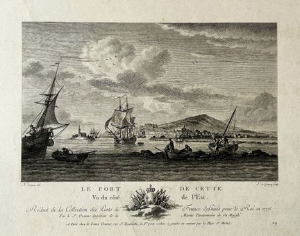
77 - HERAULT (34) - OZANNE - VUE du "PORT de CETTE (SETE), vu du côté de l'Est, réduit de la Collection des PORTS de FRANCES dessinés pour le Roi en 1776, par le Sr OZANNE, Ingénieur de la Marine, Pensionnaire de Sa Majesté". 18th century. Etching and burin engraving by Y. LE GOUAZ, after N. Ozanne. Proof on laid paper. A Paris, chez Le Gouaz, graveur, rue St Hyacinthe la 1ère porte cochère à gauche en entrant par la Place St Michel. Margins. 29 x 43 cm - Condition A (a few stains and short
Estimate €150 - €200 -
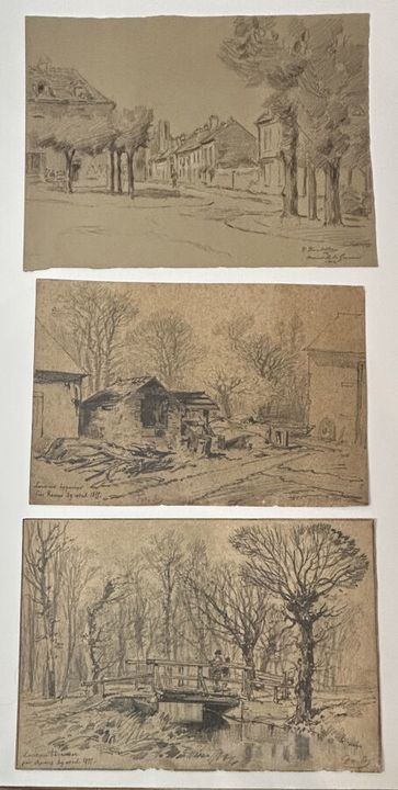
78 - LOT OF 3 ANCIENT 19th CENTURY DRAWINGS. BRETAGNE (ILLE-ET-VILLAINE) - Pencil drawings on paper, all located, dated and signed: 1-"La rivière Haquemar près Rennes, 29 avril 1855", signed with initials. 2-"La rivière Haquemar Près RENNES, 29 avril 1855". 3-"Arnouville les Gonnesses", signed R. Boutilles(?) and dated 1914. 19 x 27 cm approx. each. Condition A/B (good condition).
Estimate €100 - €200 -
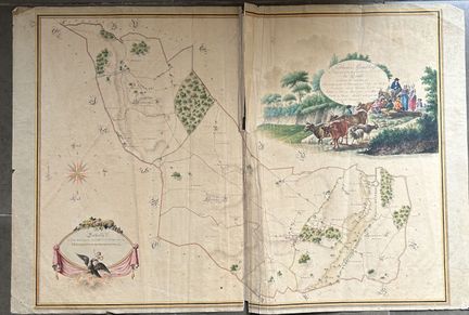
79 - INDRE (36) - CADASTRAL PLAN - "Tableau d'assemblage du Plan cadastral parcellaire de la Commune de Reuil, canton de VALENCAY, Arrondissement de CHÂTEAUROUX Dépt. De l'INDRE terminé sur le terrain le 20 juillet 1810 [...] évaluations terminées le [...] 1812". Engraved plan. Old coloring. laid paper. Title block at upper right. Margins. Folded in half. 64 x 98 cm. Condition B/C (tear at middle fold on upper part, some stains and foxing, folds, small accidents...).
Estimate €800 - €1,000 -
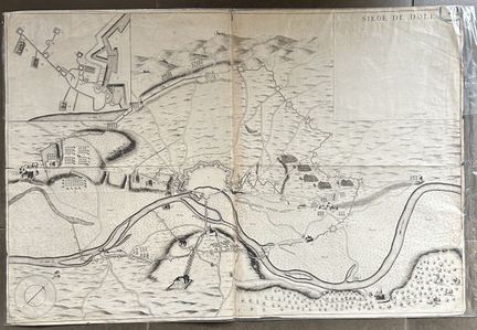
80 - JURA (39) - PLAN of the "SIEGE OF DOLE in 1636". c.1637. Engraved plan printed on 2 leaves. laid paper. Before text in upper right inset. Small margins. Folded in two. 54 x 79 cm. Condition A/B (traces of folds, rare short tears on the edges of the sheet, otherwise good overall condition).
Estimate €200 - €300 -
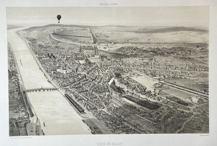
81 - LOIR-ET-CHER (41) - VIEW of "BLOIS EN BALLON, Vue prise au-dessus de l'Evêché". c.1850. Original lithograph by Jules ARNOUT, on wove paper. Printed by Lemercier, Paris. Published in Paris by Bulla Frères & Jouy and in London by E. Gambart Juning & Cie. Plate 13 of "Excursions Aériennes" (Hot-air balloon). Margins. 38 x 54 cm - Condition A (good condition).
Estimate €200 - €250 -
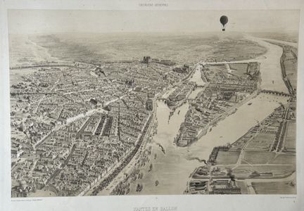
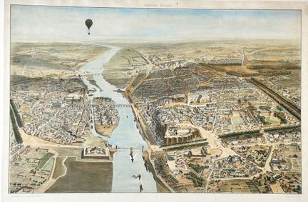
82 - LOIRE-ATLANTIQUE (44) - VIEW of "NANTES en BALLON (Montgolfière), Vue prise au-dessus du quai de la Fosse". c.1850. Original lithograph by Jules ARNOUT, on wove paper. Printed by Lemercier, Paris. Published in Paris by Bulla Frères & Jouy and in London by E. Gambart Juning & Cie. Margins. 38 x 54 cm - Condition A (rare scattered foxing in the margins).
Estimate €200 - €250 -
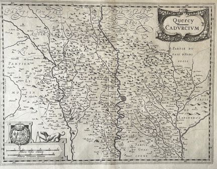
83 - CARTE du QUERCY - LOT (46) - HONDIUS - "QUERCY / Cadurcium". c.1630. Engraved card on laid paper, with address "Amstelodami / Judocus Hondius excudit". Margins. 40.5 x 53 cm. Condition A (trace of original median vertical fold and a printing fold on the left).
Estimate €100 - €200 -
84 - MAINE-ET-LOIRE (49) - View of "ANGERS EN BALLON. View from above the slaughterhouse". 19th century. Lithograph by Jules Arnout. Antique color proof on wove paper. Printed by Lemercier. Margins. 33 x 46 cm. Condition A (good).
Estimate €200 - €300 -
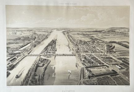
85 - MAINE-ET-LOIRE (49) - VIEW of "SAUMUR". c.1850. Original lithograph by Villemin, on wove paper. Printed by Lemercier, Paris. Published in Paris by A. Hauser, Bd des Italiens, n°11. Margins. 38 x 54 cm - Condition A (good condition).
Estimate €200 - €300 -
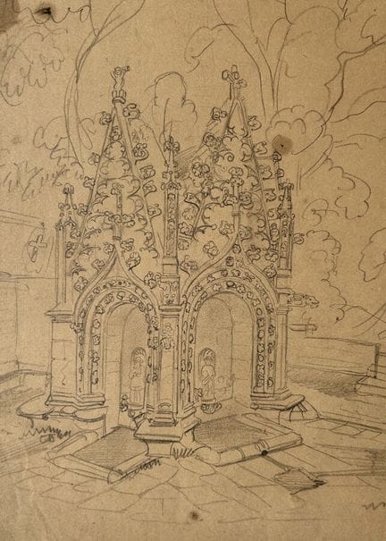
86 - MORBIHAN (56) - PLUMELIAU - [The three fountains of ST NICODEME". 19th century. Sketch in pencil on cream wove paper. Located "St Nidodème" in gray pencil lower right. Provenance: Fonds of the Charpentier workshop run by Pierre-Henri (1788-1854) and his son Henri-Désiré (1806-1883), printers and publishers based in Paris, then in Nantes (from 1854). Drawing probably by Félix Benoist (Saumur, 1818 - Nantes, 1896), a draftsman and lithographer who worked closely with the Charpentiers. 29.3 x 2
Estimate €150 - €200 -
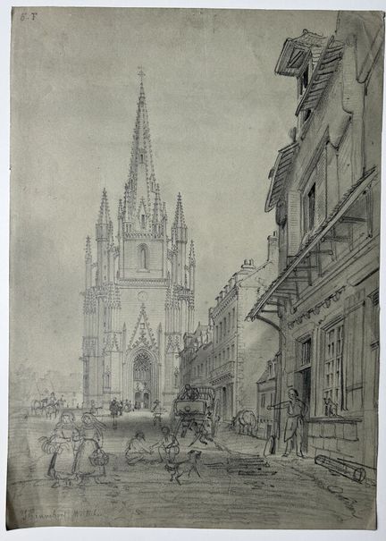
87 - MORBIHAN (56) - "HENNEBONT". 19th century. Sketch in pencil on greenish wove paper. Located "Hennebont Morbihan" in gray pencil lower left. Preparatory drawing for a lithograph by Eugène Cicéri, "L'Eglise d'Hennebont", published in "La Bretagne contemporaine", Nantes, Charpentier, 1865. Provenance: Fonds of the Charpentier workshop run by Pierre-Henri (1788-1854) and his son Henri-Désiré (1806-1883), printers and publishers based in Paris, then Nantes (from 1854). 30.9 x 21.9 cm. Condition A
Estimate €200 - €300 -
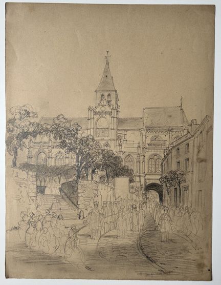
88 - MORBIHAN (56) - [Procession to SAINTE ANNE D'AURAY]. 19th century. Pencil drawing on wove paper. Located in gray pencil lower right. Provenance: Fonds of the Charpentier workshop run by Pierre-Henri (1788-1854) and his son Henri-Désiré (1806-1883), printers and publishers based in Paris, then in Nantes (from 1854). 32 x 24.3 cm. Condition A (few small stains on the right-hand edge, otherwise in good condition).
Estimate €200 - €300 -
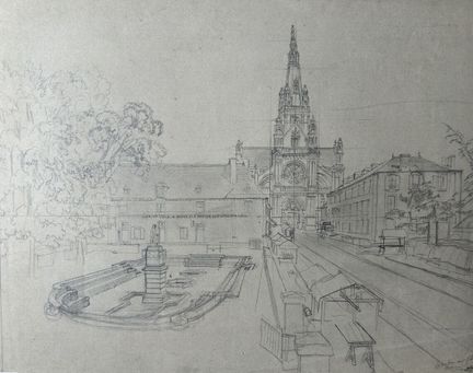
89 - MORBIHAN (56) - [SAINTE ANNE D'AURAY]. 19th century. Sketch in pencil on wove paper. Situated in pencil on verso. Provenance: Fonds of the Charpentier workshop run by Pierre-Henri (1788-1854) and his son Henri-Désiré (1806-1883), printers and publishers based in Paris, then in Nantes (from 1854). 24.5 x 30.3 cm. Condition A (well preserved).
Estimate €200 - €300 -
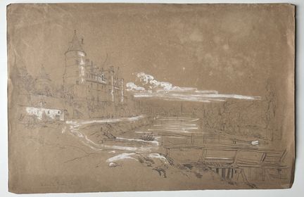
90 - MORBIHAN (56) - "Château de JOSSELIN (Morbihan)". 19th century. Sketch in pencil heightened with white gouache, on brown wove paper. Situated in pencil lower right. Preparatory drawing for the lithograph titled "Château de Josselin (Morbihan)", published in the "Galerie Armoricaine", Nantes, Charpentier. Provenance: Fonds of the Charpentier workshop run by Pierre-Henri (1788-1854) and his son Henri-Désiré (1806-1883), printers and publishers based in Paris, then Nantes (from 1854). 28.7 x 43
Estimate €200 - €300 -
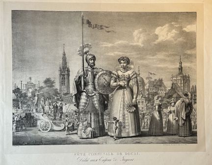
91 - NORD (59) - DOUAI - "Fête communale de Douai, dedicated to the Children of Gayant". 1827. Lithographed by E. Wallet. Proof on Chine appliqué paper, printed by Engelmann in Paris. Good margins. 56 x 75 cm. A/B condition (a few short tears in the margins with slightly dusty edges, otherwise good condition).
Estimate €200 - €300 -
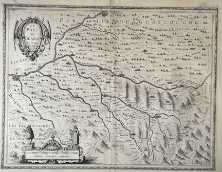
92 - PYRENEES-ATLANTIQUES (64) - HONDIUS - MAP of the "PAYS de BEARN". c.1630. Map engraved by Hamers Veldt. laid paper. Title cartouche upper left, Frontières de Navarre illustrated lower left. Margins. 40.5 x 53 cm. Condition A (trace of original median vertical fold, good condition).
Estimate €150 - €200 -
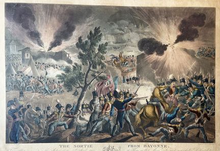
93 - PAYS-BASQUE - PYRENEES ATLANTIQUES (64) - BAYONNE - "The sortie from BAYONNE (April 14, 1814)". 1836. Etching and aquatint by Thomas SUTHERLAND (1785 - 1838), after the painting by W. Heath. Antique colors. Proof with the letter, on wove paper, formerly laminated. Copper margins. 39.5 x 56 cm. Condition B (cut at the copper mark, a few stains in the insolated copper margins and some handling marks).
Estimate €150 - €200 -
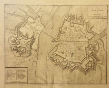
94 - PAYS-BASQUE - PYRENEES ATLANTIQUES (64) - BAYONNE - "Plan des villes et citadelle de BAYONNE". Late 18th century. Engraved plan. Large margins. 57.5 x 83 cm. Condition A (a few tears in the wide margins, trace of original median fold, good condition).
Estimate €150 - €200 -
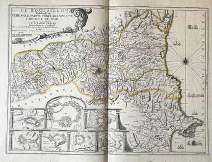
95 - PYRENEES-ORIENTALES (66) - MAP of "ROUSSILLON, ROUSSILLON, subdivided into Cerdagne, Capsir, Conflans, Vals de Carol et de Spir, where the L'Ampourdan still stands, part of La cerdagne. Mis au jour par Nicolas de FER, Géographe de Sa Majesté Catholique. À Paris, dans l'ile du Palais, à l'enseigne "A la Sphère Royale, avec privilège du Roy,... , 1706." avec en cartouche: les Forts et Ville de: Villefranche, Perpignan, Mont-Louis, Bellegarde, Collioure, Puicerda, et Roses. Map engraved by H.
Estimate €200 - €300 -
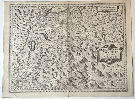
96 - MAP OF SAVOIE (73) - HONDIUS - "Sabaudia ducatus La SAVOIE". c.1630. Engraved map on laid paper, with address "Amstelodami / Judocus Hondius excudit". Margins. 40.5 x 53 cm. Condition A (trace of original median vertical fold consolidated on verso, good condition).
Estimate €150 - €200 -
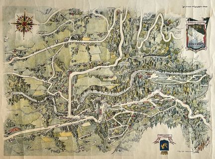
97 - HAUTE-SAVOIE (74) - PLAN of "SAINT GERVAIS LES BAINS". Early 20th century. Color lithograph after Ripart. Wove paper. Margins. 50 x 63 cm. Condition B (trace of water at the bottom of the subject, slight traces of handling and a short consolidated tear in the lower margin).
Estimate €100 - €200 -
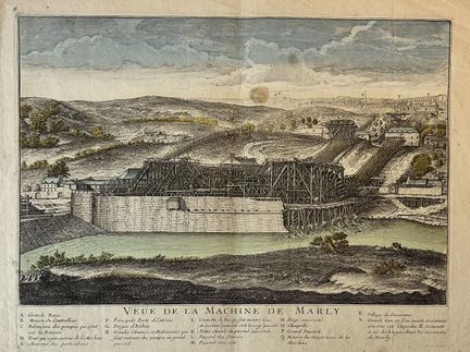
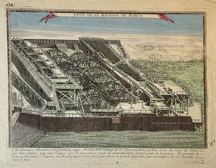
98 - YVELINES (78) - "Veüe de la MACHINE DE MARLY". 18th century. Etching in old colors. Proof on watermarked laid paper (letters). Legend in the tablet. Good margins. 32 x 46 cm. Condition B (a small brown spot in the sky, rare small freckles and handling marks in the margins).
Estimate €100 - €200 -
99 - YVELINES (78) - "Veüe de la MACHINE DE MARLY". 18th century. Etching in old colors. Proof on laid paper. Good margins. 32 x 49 cm. Condition B (rare short tears and a small hole in the margins, a small tear to the right in the subject).
Estimate €100 - €200 -
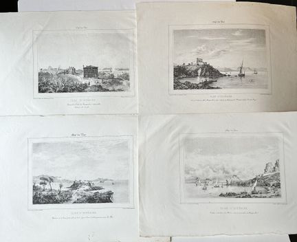
100 - VAR (83) - HYERES - Reunion of 4 lithographs depicting the Islands of HYERES. 19th century. Drawn and lithographed by Ferdinand Duboc. Proofs on wove paper, printed by Canquoin in Toulon. Full margins. Approx. 30 x 45 cm each. Condition A (generally good).
Estimate €200 - €300
About the sale
ATTENTION: LOT COLLECTION FROM THURSDAY APRIL 04TH
Collection from our offices : by appointment
- Monday to Friday, 09:30 to 12:30 and 14:00 to 17:30
- Possibility of appointing a relative: notify us by e-mail or give him or her power of attorney, and the person will then present him or herself with proof of identity.
Shipment within the European Union: jewelry, paintings, books, silverware, ceramics, glassware, etc.
- Shipment via DHL, quotation on request
- Professional transport, list available on request
Shipping outside the European Union :
- Professional transport, list available on request
Terms of sale
Show the terms of sale
Auctions Fees
· Buyer fee : 28% taxes included
· Live fee : 1.8% taxes included
Conditions de règlement / / Payment
· Cash up to €1000 for French nationals
· Credit card EXCEPT AMEX
· Bank transfer
Picking up or scheduling a shipping