

French archives and advertising posters.
Monday 20 February 2023 at 14:00
9 rue de Provence, 75009 Paris
423 lots
-
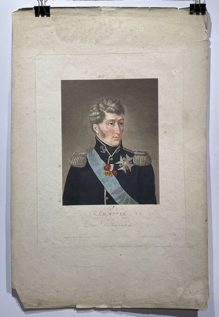
201 - (NOUVELLE-AQUITAINE - 16 - ANGOULEME) - [ Son Altesse Royale Monseigneur le Duc d'Angoulème] - published in Paris, at Bulla, rue Saint Jacques - deposited at Direction Générale - (494mm x 320mm) - Condition B. Freckles, stains.
Estimate €80 - €120 -
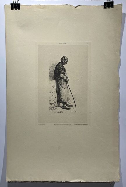
202 - (BOURGOGNE - FRANCHE-COMTE) - [Mendiante Bourguigonne] - From the "Salon de 1880", plate 519 - Ad. Guillon pinx and sculp - published by Vve. A. Cadart in Paris, 56 Boulevard Haussemann. - Engraving on laid paper - (492mm x 318mm) - Condition A.
Estimate €80 - €120 -
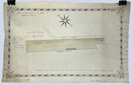
203 - (BOURGOGNE - FRANCHE-COMTE - 71 - CHALON SUR SAONE) - ANONYMOUS - [ Extract from the General Plan of the Citadel] - Manuscript plan of the external and internal fortifications of Châlon sur Saone. (280mm x 440mm) - Condition A-. Slight peripheral creasing and soiling.
Estimate €80 - €120 -
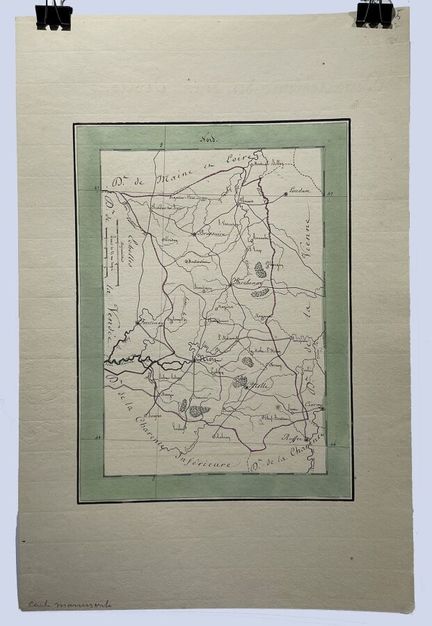
204 - (NOUVELLE AQUITAINE - 79 - DEUX SEVRES) - ANONYMOUS - [ Deux Sèvres] - Handwritten map of the department of Deux Sèvres (285mm x 205mm) - Condition A.
Estimate €80 - €120 -
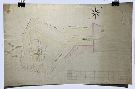
205 - (BOURGOGNE - FRANCHE-COMTE - 71 - CHALON SUR SAONE) - ANONYMOUS - [ Chalon sur Saône] - Handwritten map of a part of Chalon sur Saône. It shows the Bastion Saint-Paul, one of the elements of the fortifications built by Bellarmato, a famous engineer in the 16th century (305mm x 465mm) - B condition. Brown stains and scattered freckles.
Estimate €100 - €200 -
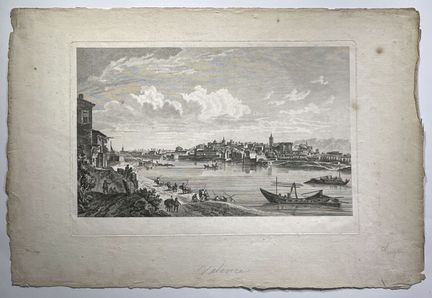
206 - (AUVERGNE - RHONE ALPES - 26 - VALENCE) - [ Valence] - View of a part of Valence, of the Epervière and of the river activities which take place there. In the distance the city. Copper engraving on laid paper (355mm x 535mm) - Condition A-. Brown stains and scattered freckles.
Estimate €100 - €200 -
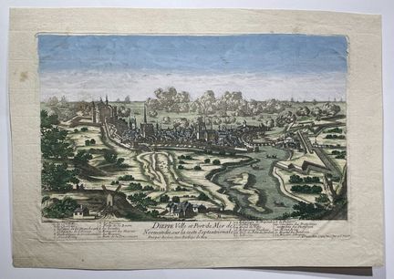
207 - (NORMANDY - 76 - DIEPPE) - CREPY, Louis - [ Dieppe Ville et Port de Mer de Normandie...] - Paris, 1690-1720. Bird's-eye view of the French town of Dieppe, including a list of the main buildings in the lower part. Engraved by Pierre Aveline. Copper engraving on laid paper (265mm x 380mm) - Condition A. Marginal brown stains. In colors.
Estimate €100 - €200 -
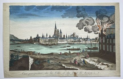
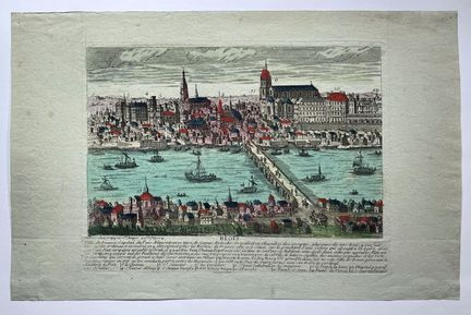
208 - (NORMANDY - 76 - ROUEN) - CHEREAU, Jacques - [ Perspective view of the City and the Bridge of Rouen] - Paris, ca. 1780. Optical view illustrating a fire in Rouen, from the 18th century in period colors. Original copperplate engraving on laid paper with watercolor highlights of the period. Published by Jacques Chéreau in Paris around 1780. copperplate engraving on laid paper (288mm x 450mm) - Condition A. Marginal brown stains. In colors.
Estimate €100 - €200 -
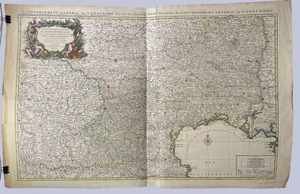
209 - (PACA - 84 - AVIGNON) - SANSON, Nicolas - [ The General Government of Languedoc, divided into three general lieutenancies]. - Paris, ca. 1696. Map of Languedoc by Sanson, from Pau to Avignon. Published by J. Covens and C. Mortier. Copper engraving on laid paper (645mm x 890mm) - Condition A. Good condition, small marginal tears. Period colors. In two assembled sheets.
Estimate €350 - €450 -
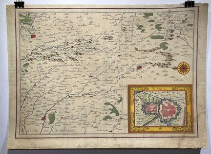
210 - (GRAND EST - 54- NANCY) - TASSIN, Nicolas - [ Nancy] - Paris, ca. 1634. Map of the Champagne region, with an insert of a map of Nancy. Copper engraving on laid paper (405mm x 560mm) - Condition B. Yellowed paper. Periphery of the map weakened and reinforced with the framing adhesive. Scattered stains, soiling and stains. Period colors.
Estimate €100 - €200 -
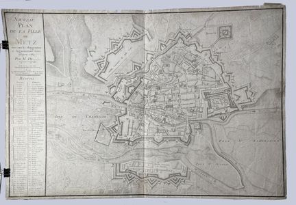
211 - (GRAND EST - 57 - METZ) - BEZAUCHE, Jean-Claude - [ Nouveau Plan de la Ville de Metz] - Paris, 1784. Plan of Metz with all the changes and increases made until 1784. Copper engraving on laid paper (570mm x 835mm) - Condition A-. Periphery of the map weakened, scattered wetness, soiling and stains.
Estimate €100 - €200 -
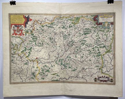
212 - (GRAND EST - 54 - LORRAINE) - ORTELIUS, Abraham - [ Lorraine. Lotharingiae nova descriptio] - Antwerp, 1598. Decorative map including Metz and Nancy and hundreds of villages and place names. Adorned with three cartouches. Latin text on verso. Copper engraving on laid paper (340mm x 500mm) - Condition A. Period colors.
Result €250Estimate €250 - €350 -
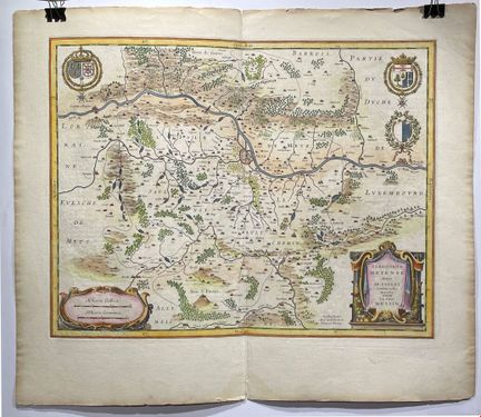
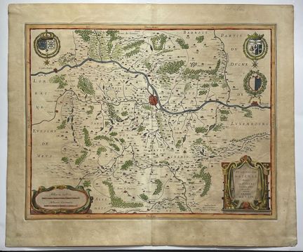
213 - (GRAND EST - 57 - METZ) - BLAEU, Willem - [ Territorium Metense] - Amsterdam, 1635. Beautiful engraved map in color centered on Metz. Cartouche decorated with a chain of leaves and fruits and three coats of arms. The author of this map was the French printer Abraham Fabert (1560-1638). Latin text on the back. Copper engraving on laid paper (385mm x 500mm) - Condition A. Period colors.
Estimate €150 - €200 -
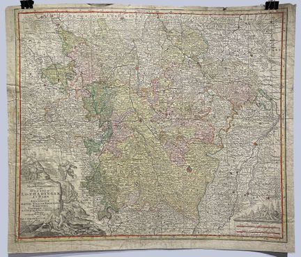
214 - (BIG EAST - 54 - LORRAINE) - LOTTER, Conrad - [ Mappa Geographica Ducatus Lotharingiae] - Augsburg, 1760. Detailed geographical map of the Lorraine region in France. Includes a decorative cartouche. Shows borders, administrative divisions, towns and villages, place names, rivers and mountains. Copper engraving on laid paper (500mm x 570mm) - Condition B. Creasing, scattered brown spots, verso reinforced by numerous restorations. Period colors.
Estimate €100 - €200 -
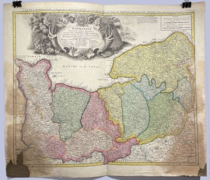
215 - (NORMANDY) - HOMANN, Heirs - [ Normannia Galliae celebris Provincia in terras suas Ballisiatus] - Nuremberg, 1740. decorative map of Normandy, published by the Homann Heirs. Includes an elaborate allegorical cartouche. Copper engraving on laid paper (480mm x 565mm) - C condition. Brown stains, lower right and left corners missing. Period colors. As is.
Result €200Estimate €100 - €200 -
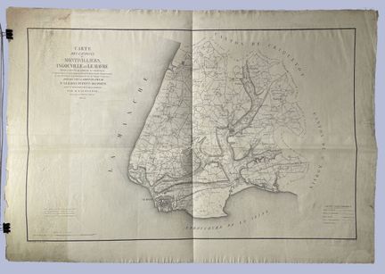
216 - (NORMANDY - 76 - MONTVILLIERS) - LALOUETTE - [ Map of the cantons of Montivilliers, Ingouville, Le Havre...] - Paris, 1835. Map of the Upper Normandy region, by Mr. Lalouette, chief surveyor of the cadastre. Printed in lithography at Bouchard's. (585mm x 905mm) - Condition B. Traces of mold on the left part, soiling and marginal tears.
Estimate €100 - €200 -
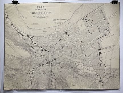
217 - (NORMANDIE - 76 - ELBEUF) - TOURNE, E. - [ Plan d'ensemble de la ville d'Elbeuf] - Elbeuf, 1876. Lithographic map of Elbeuf, with contour lines to serve for the Hydrolic Studies of a water distribution (435mm x 580mm) - Condition A-. A few scattered brown marks, small lack in the lower left part.
Estimate €100 - €200 -
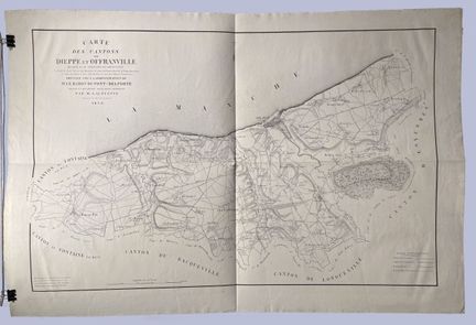
218 - (NORMANDY - 76 - DIEPPE) - LALOUETTE - [ Map of the cantons of Dieppe and Offranville ...] - Paris, 1836. Map of the Upper Normandy region, by Mr. Lalouette, chief surveyor of the land registry. Printed in lithography at Bouchard's. (575mm x 905mm) - State A.
Estimate €150 - €200 -
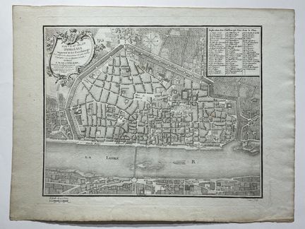
219 - (CENTRAL - VAL DE LOIRE - 45 - ORLEANS) - DE CYPIERRE - [ Nouveau Plan d'Orléans, augmenté de ses faubourgs...] - Paris, 1778. Plan of Orleans, published by Letourmy, engraved by Lattré (220mm x 270mm) - Condition A.
Estimate €100 - €200 -
220 - (CENTER - VAL DE LOIRE - 41 - BLOIS) - CREPY, Jean Baptiste - [ Blois ] - Paris, XVIIIth. View of Blois, with a numbered legend of the main buildings. Etching on green tinted laid paper (225mm x 345mm) - Condition A. Beautiful colors.
Estimate €120 - €150 -
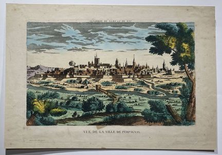
221 - (OCCITANIA - 66 - PERPIGNAN) - HOCQUART - [ View of the city of Perpignan] - Paris, XVIIIth. View of Perpignan, in Paris at Hocquart ainé, successor of Basset. Etching on laid paper (225mm x 345mm) - Condition A-. brown spots, freckles. Colored.
Estimate €100 - €200 -
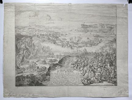
222 - (NORMANDY - 76 - ROUEN) - DE HOOGE, Romein - [ The great retreat of the Duke of Parma] - Paris, 17th. Engraving of a battle fought in Rouen, during the Siege of Caudebec in 1592. Etching on laid paper (270mm x 335mm) - Condition A-. Soiling, small tear in the upper part.
Estimate €100 - €200 -
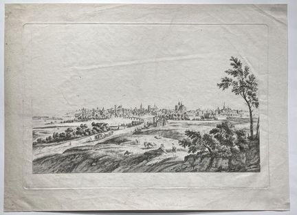
223 - (BURGUNDY - FRANCHE-COMTE - 89 - AUXERRE) - MASQUELIER, Louis Joseph - [ 1st view of the city of Auxerre - On the Grand Chemin de Dijon ] - Paris, 18th century. View of Auxerre, by Louis Joseph Masquelier, student of Philippe Le Bas. 1st edition before the letter. Copper engraving on laid paper (240mm x 360mm) - Condition A.
Estimate €100 - €200 -
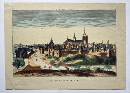
224 - (PAYS DE LA LOIRE - 72 - LE MANS) - HOCQUART - [ View of the city of Le Mans] - Paris, XVIIIth. View of Le Mans, in Paris at Hocquart ainé, successor of Basset. Etching on laid paper (200mm x 285mm) - State A. Colored.
Estimate €100 - €200 -
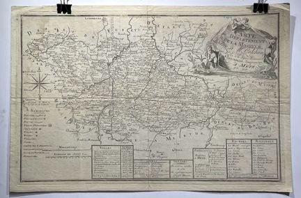
225 - (GRAND EST - 57 - LA MOSELLE) - VERRONNAIS - [ Map of the Department of Moselle] - Metz, XVIIIth. View of the Moselle, dedicated to Mr. Colchen and printed by Verronnais in Metz. Etching on laid paper (300mm x 465mm) - Condition A-. Mottling in the upper left part.
Estimate €100 - €200 -
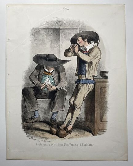
226 - (COSTUMES - BRITTANY - 56 - VANNES) - DARJOU, Henri Alfred - [ Costumes of Even Arrondissement of Vannes (Morbihan)] - Paris, 1865. Lithographed plate n° 14, illustrating the costumes of Brittany, by A. Darjou and A. Leroux, published by the Bureau of the Journal Les Modes parisiennes et du Journal Amusant, n.d., 1865. (325mm x 249mm) - Condition A.
Estimate €100 - €200 -
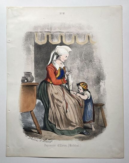
227 - (BRITTANY - 56 - ELVEN) - DARJOU, Henri Alfred - [ Paysanne d'Elven] - Paris, 1865. Lithographed plate n° 18, illustrating the costumes of Brittany, by A. Darjou and A. Leroux, published by the Bureau of the Journal Les Modes parisiennes et du Journal Amusant, n.d., 1865. (325mm x 249mm) - Condition A.
Estimate €100 - €200 -
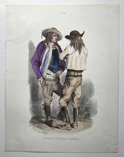
228 - (BRITTANY - 56 - MORBIHAN) - DARJOU, Henri Alfred - [ Costumes of Faouet (Morbihan)] - Paris, 1865. Lithographed plate n° 13, illustrating the costumes of Brittany, by A. Darjou and A. Leroux, published by the Bureau of the Journal Les Modes parisiennes et du Journal Amusant, n.d., 1865. (325mm x 249mm) - Condition A.
Estimate €100 - €200 -
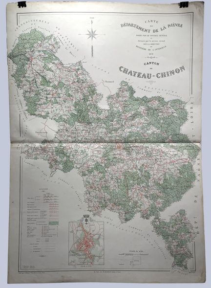
229 - (BOURGOGNE - FRANCHE-COMTE - 58 - NIEVRE) - MINISTERE DE L'INTERIEUR - [ Map of the Department of Nièvre...] - Paris, 1878. Map of the Canton of Chateau-Chinon, engraved by A. Simon, drawn by the Vicinal Service under the direction of the Ministry of the Interior. Lithograph (850mm x 635mm) - Condition A. Some soiling.
Estimate €100 - €200 -
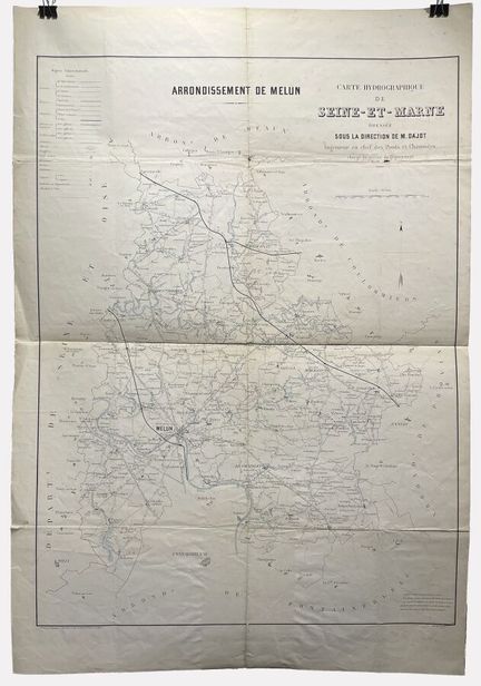
230 - (ILE DE FRANCE - 77 - MELUN) - REGNIER ET DOURDET - [ Hydrographic map of Seine-et-Marne..] - Paris, 1878. Map of the department of Seine et Marne, centered on Melun (850mm x 635mm) - Condition B. Soiling, marked central folds accompanied by tears. Large tear in lower central part.
Estimate €100 - €200 -
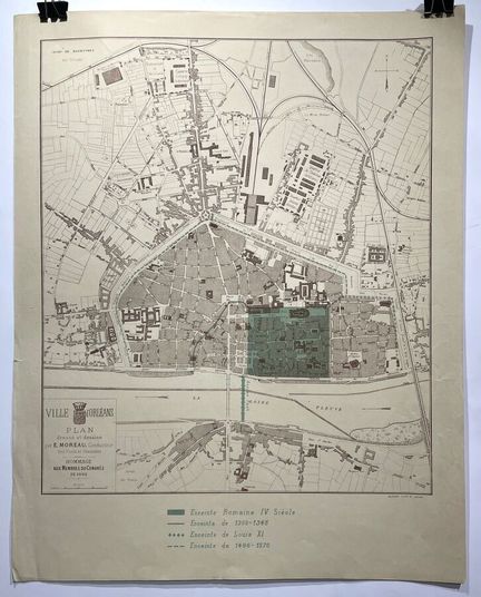
231 - (CENTRE - VAL DE LOIRE - 45 - ORLEANS) - MOREAU, E. - [ Ville d'Orléans] - Orléans, 1892. Plan of Orleans drawn by E. Moreau. Lithographed by Jacob (470mm x 355mm) - Condition A.
Estimate €100 - €200 -
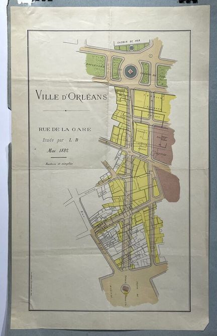
232 - (CENTRAL - VAL DE LOIRE - 45 - ORLEANS) - BAROUSSE - [ City of Orleans] - Paris, 1882. Plan of the street of La Gare in Orléans. Printed by Barousse, Paris. Lithograph (395mm x 230mm) - Condition A.
Estimate €100 - €200 -
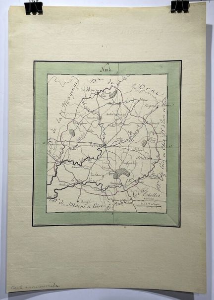
233 - (PAYS DE LA LOIRE - 72 - LE MANS) - ANONYMOUS - [ Le Mans ] - Paris, ca. 1850. Handwritten map of the Grand Ouest region, centered on Le Mans. (250mm x 220mm). - Condition A. Large margins.
Estimate €100 - €200 -
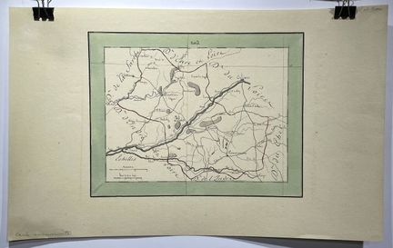
234 - (CENTER - VAL DE LOIRE - 41 - BLOIS) - ANONYMOUS - [ Loir-et-Cher] - Paris, ca. 1850. Handwritten map of the Centre-Val de Loire region, centered on Blois. Lithograph (220mm x 250mm) - Condition A. Large margins.
Estimate €100 - €200 -
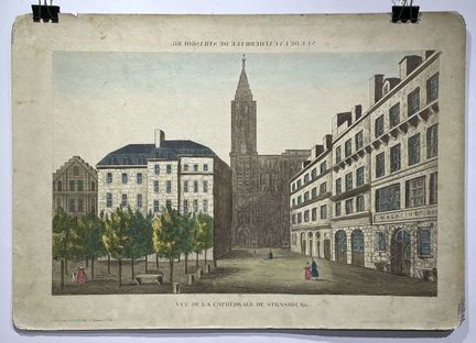
235 - (GRAND EST - 67 - STRASBOURG) - BASSET, Paul André - [ View of the Strasbourg Cathedral], Paris, ca. 1800. Optical view heightened in colors with watercolor, of the Cathedral of Strasbourg - ( 285mm x 400mm) - Condition B-. Generalized soiling. Rust stain. Back glued on a rigid cardboard support. Period colors.
Estimate €100 - €200 -
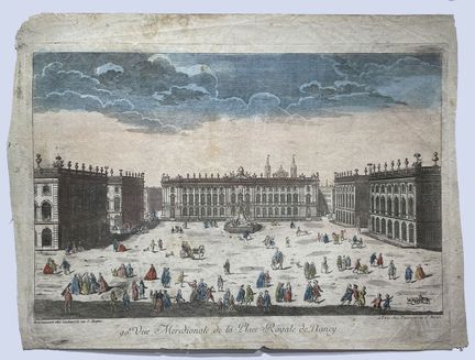
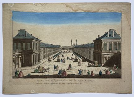
236 - (GRAND EST - 54 - NANCY) - BASSET, Paul André - [ Vüe méridionale de la Place Royale de Nancy], Paris, ca. 1800. Optical view heightened in color with watercolor, representing the view of the Place Royale of Nancy. Plate no. 90. Published by Daumont in Paris ( 285mm x 405mm) - Condition B. Generalized soiling. Period colors.
Estimate €100 - €200 -
237 - (BIG EAST - 54 - NANCY) - CHEREAU, Jacques - [ Southern view of the large square called La Carriere in Nancy ], Paris, ca. 1780. Optical view of the square of La Carriere in Nancy. Plate n° 31. Published by Chereau in Paris. 300mm x 415mm - Condition B. Yellowing and marginal wetness. Period colors.
Estimate €100 - €200 -
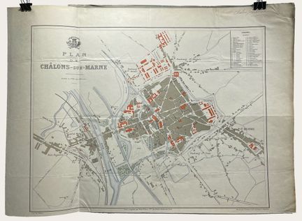
238 - (BIG EAST - 51 - CHALON SUR MARNE) - TRAXLER, E - [ Map of Châlons-sur-Marne ], Paris, ca. 1870. Plan of Châlon sur Marne, engraved and printed by Erchard Frères. Published by E. Le Roy ( 455mm x 635mm) - Condition A. Glued to sheet.
Estimate €100 - €200 -
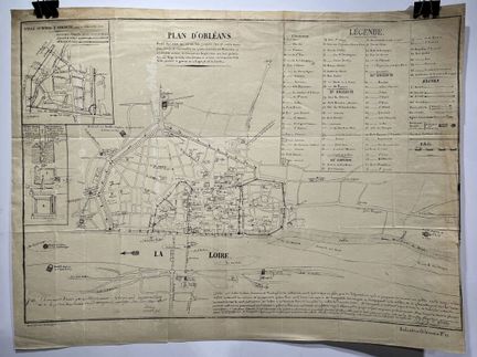
239 - (CENTRE - VAL DE LOIRE - 45 - ORLEANS) - VERGNAUD ROMAGNESIS, D. - [ Plan d'Orléans ... ], Paris, 1829. Autographed facsimile plan of Orleans drawn on those of 1780, with an insert of a plan of the city or town of Avenum around 1300, as well as a plan of the Tourelles. ( 365mm x 480mm) - Condition A-. Some white spots on the subject.
Estimate €100 - €200 -
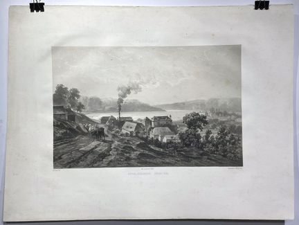
240 - (AUVERGNE - RHONE ALPES - 03 - TRONCAIS) - SABATIER ET BAYOT - [ Tronçais ], Paris, 1856. Lithograph of the view of the main settlement of Tronçais, printed by Lemercier, drawn by Edmond Tudot and lithographed by Sabatier and Bayot. ( 400mm x 540mm) - Condition A-. Some light foxing.
Estimate €100 - €200 -
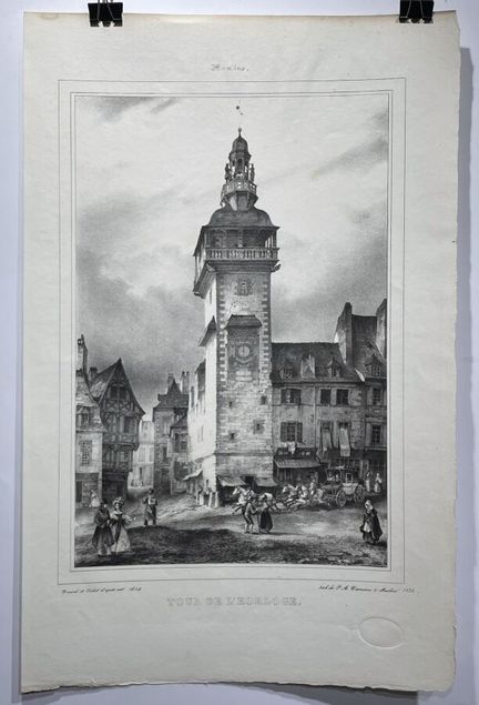
241 - (AUVERGNE - RHONE ALPES - 03 - MOULINS) - DESROSIERS, P.A. - [ Clock Tower ], Moulins, 1836. Lithography of the Clock Tower in Moulins, drawn by Tudot and Durand and lithographed by P.A Desrosiers. ( 515mm x 340mm) - Condition A. Presence of a dry stamp of the publisher in the lower right part.
Estimate €100 - €200 -
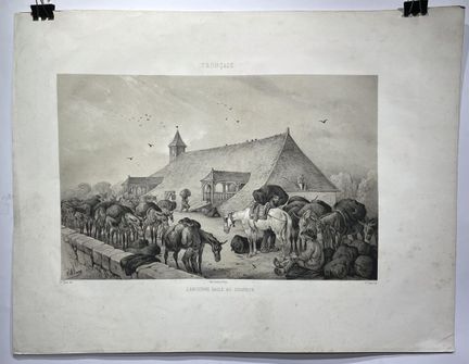
242 - (AUVERGNE - RHONE ALPES - 03 - TRONCAIS) - ADAM, Victor - [Tronçais ], Paris, 1856. Lithograph of the view of the old coal hall in Tronçais, printed by Lemercier, drawn by Edmond Tudot and lithographed by Victor Adam ( 400mm x 520mm) - Condition A-. Some light foxing and dusting.
Estimate €100 - €200 -
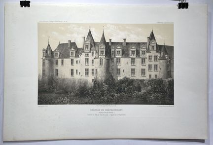
243 - (PAYS DE LA LOIRE - 44 - CHATEAUBRIANT) - PETIT, Victor - [ Château de Châteubriant ], Paris, 1870. Lithograph of the facade on the ditches of the Château de Chateaubriant, built in 1524 by Jean Laval, drawn by Victor Petit and lithographed by Bequet Frères. Plate n°96 (375mm x 555mm) - Condition A-. Some traces of handling. Signature in the plate.
Estimate €100 - €200 -
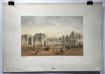
244 - (AUVERGNE - RHONE ALPES - 03 - VICHY) - CLERGET, H. - [ Vichy ], Paris, 1860. Color lithograph of the new thermal establishment of Vichy, drawn by H. Clerget, lithographed by Lemercier and published by Talbot ( 315mm x 450mm) - Condition A. Dust and foxing. Lower left corner corroded. Stamp in ink of the Dépot Légal.
Estimate €100 - €200 -
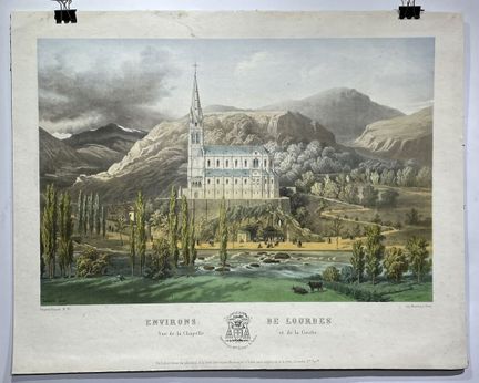
245 - (OCCITANY - 65 - LOURDES) - DUFOUR, Paul - [ Environs de Lourdes ], Paris, 1860. Color lithograph of a view of the surroundings of Lourdes, view of the Chapel and the Grotto drawn by Lataste, printed by Monrocq and published by Paul Dufour. Plate n°36. ( 455mm x 570mm) - Condition A-. Dust and handling marks.
Estimate €100 - €200 -
246 - (GRAND EST - 57 - METZ) - BLAEU, Willem - [ Territorium Metense ] - Amsterdam, 1635. Beautiful engraved map in color centered on Metz. Cartouche decorated with a chain of leaves and fruits and three coats of arms. The author of this map was the French printer Abraham Fabert (1560-1638). Latin text on the back. Copper engraving on laid paper (385mm x 500mm) - Condition A. Period colors. Yellowed paper
Estimate €150 - €200 -
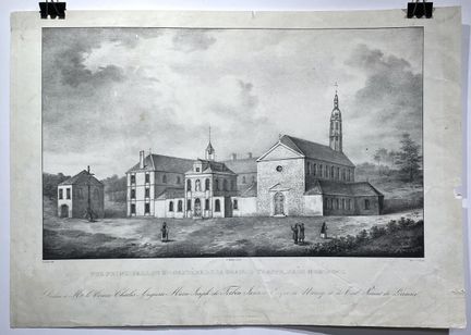
247 - (NORMANDY - 85 - MORTAGNE) - COURTIN, E. - [ Main view of the Monastère de la Grande Trappe ], Paris, ca. 1860. Lithograph of the main view of the Monastère de la Grande Trappe, near Mortagne, drawn by E. Courtin and published by E. Courtin ( 330mm x 470mm) - Condition A-. Dust and handling marks. Marginal tears.
Estimate €100 - €200 -
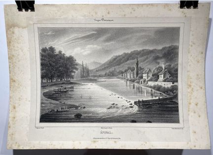
248 - (GRAND EST - 88 - EPINAL) - BLANCHARD, Emile - [ Epinal ], Paris, ca. 1860. Lithograph of a view of Epinal, in the Vosges, drawn by Emile Blanchard and published by Cantener. ( 190mm x 250mm ) - Condition A-. Glued on sheet. Marginal foxing and wetness in the upper left part.
Estimate €100 - €200 -
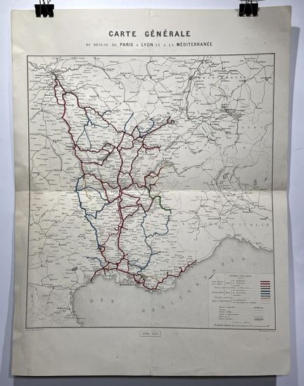
249 - (FRANCE) - AVRIL FRERES - [ General map of the network from Paris to Lyon and the Mediterranean ] - Paris, 1864. Map of the railways from Paris to Marseille through Lyon. Printed by Monrocq and engraved by Avril frères. (515mm x 390mm) - Condition A.
Estimate €100 - €200 -
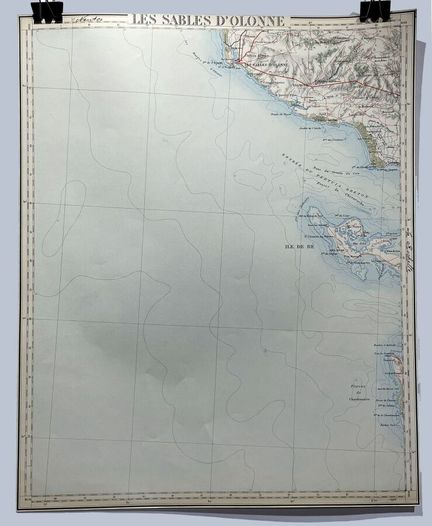
250 - (PAYS DE LA LOIRE - 85 - SABLES D'OLONNE) - ANONYMOUS - [ Les Sables d'Olonne ] - Paris, 1920. Antique map of Les Sables d'Olonne with handwritten annotations "Nantes" and "La Rochelle". (425mm x 345mm) - Condition A.
Estimate €100 - €200
About the sale
Selling expenses 28% VAT included