

ENGRAVINGS & PRINTS
Wednesday 5 May 2021 at 14:00
9, rue de Provence, 75009 Paris
330 lots
-
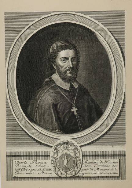
51 - CHINA - MACAO - Portrait of "Charle Thomas MAILLARD de TOURNON, Patriarch of Antioch Cardinal of the S.E.R. Legat Alatere for the Missions of China, died in MACAO on June 8, 1710, aged 42 years". 18th century. Etching and burin engraving. Proof on laid paper, cut to the subject and formerly glued by the corners on a cream laid paper. Charles Thomas Maillard de Tournon, first appointed Latin Patriarch of Antioch in 1701 and then Apostolic Visitor in charge of promoting the Catholic faith in China
Estimate €150 - €200 -
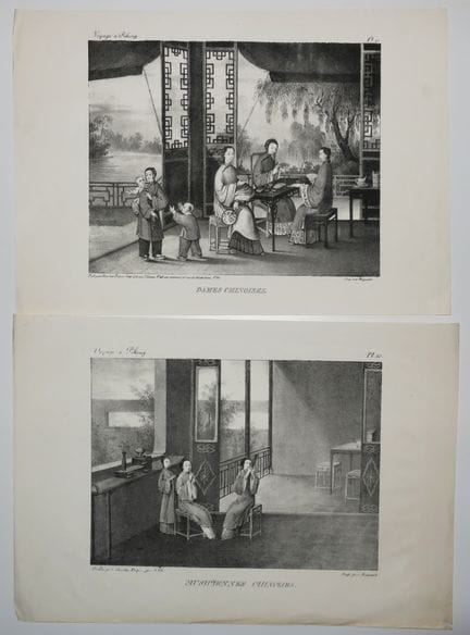
52 - CHINA - Scenes of life, Meeting of 2 engravings : "CHINESE MUSICIANS" & "Chinese Ladies". c.1830. 2 lithographs. Printed by Brégeaut, on wove paper. Plates from the book "Voyage à PEKING" published by Dondey-Dupré (1766-1847), rue St Louis, n°46 au Marais and rue de Richelieu, n°67. Margins for both. About 20 x 29 cm each. Condition A (Good condition). Set of 2 pl.
Estimate €100 - €150 -
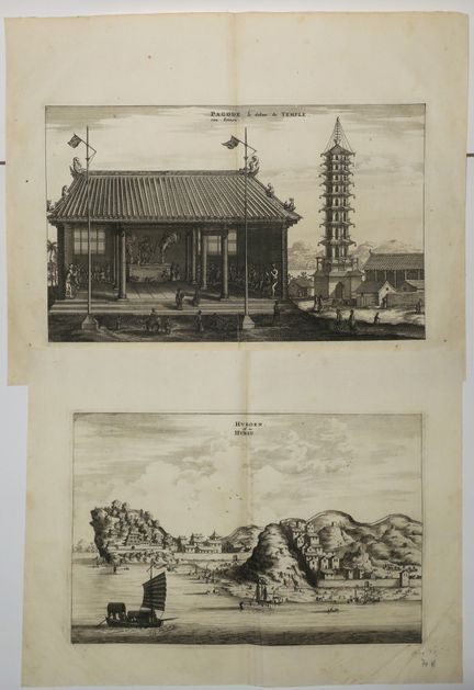
53 - CHINA - J. NIEUHOF - Reunion of 2 plates of the XVIIth: 1- View of "HUKOEN or HUKEU" & 2- "PAGODE the inside of the Temple". End of XVIIth. Engraved with a burin. Proofs on laid paper. Margins. About 28 x 35 cm each. Condition A.
Estimate €100 - €150 -
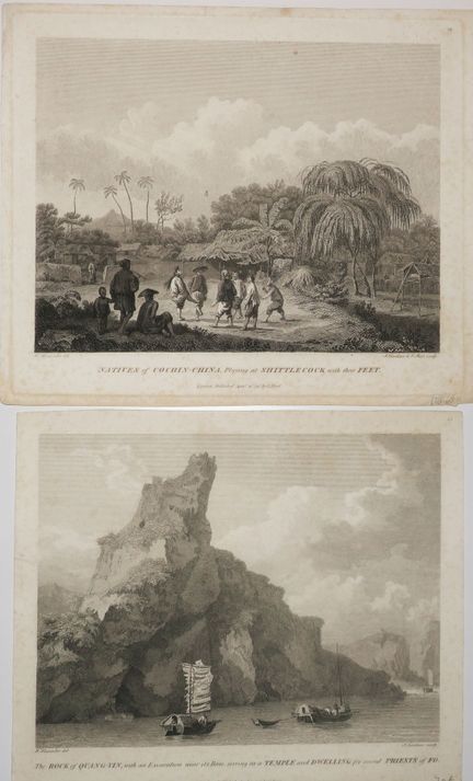
54 - CHINA - Set of 2 engravings : 1- "Natives of COCHIN-CHINA, Playing at SHITTLECOCK with their feet" & 2- "The ROCK of QUANG-YIN, with an Excavation near its Base, serring as a Temple and Dwelling for several Priests of Fo". 1796. Two engravings by LANDSEER, after drawings by William Alexander. Proofs on wove paper, published by G. Nicol in London. Small margins. Approximately 22.5 x 26.5 cm each. Condition B (sparse light foxing, small hole filled in the sky for the 2nd plate). Set of 2 plates.
Estimate €150 - €200 -
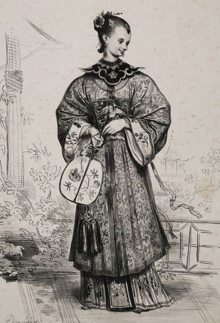
55 - CHINA - COSTUME - A. DEVERIA - "Chinese". 19th century. Lithograph by Achille Deveria (Paris 1800 1857). Signed lower left in the plate. Proof on wove paper, printed by Fonrouge. Published by Osterwald aîné, in Paris and by Fonrouge, Quai Conti, n°, near the Pont-Neuf. Small margins. 40 x 29,5 cm. Condition C (Freckles).
Estimate €80 - €100 -
56 - CHINA - 18th century PERFORATED OPTICAL VIEW - "View of PORCELLAIN TOWER at NANCKING in China". Engraved by F. Habermann. Colours of the time. Sold in Augsburg at the common Negoce of the Imperial Academy of Liberal Arts, with the Privilege of His Imperial Majesty and with the prohibition to make or sell copies. Small margins of the copper. This optical view has the particularity of being perforated and can thus be illuminated on the back to create an effect of passage from day to night. Some ar
Estimate €150 - €200 -
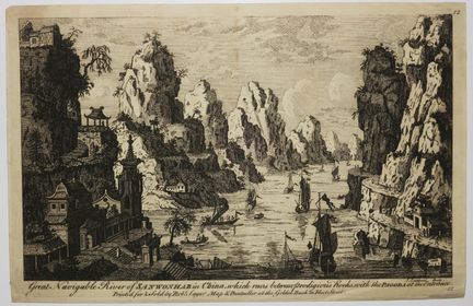
57 - CHINA - RARE view of [The Sanwonhab River]. c.1750-1760. "Great Navigable River of SANHONWAB in China, which runs between prodigious Rocks with the Pagoda at the entrance". Engraved by Jalmes Caldwal. Proof on laid paper, published by Robert Sayer (Map & Printseller). Small margins. Plate 12 of a suite of 12 plates (China views). RARE. 18 x 27,5 cm. Condition A (Good condition).
Estimate €200 - €300 -
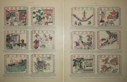
58 - CHINA - NATIONALISM IN CHINA - 19th century. 2 plates of 6 illustrations each titled as follows: "The torments of hell reserved for Christians", "To celebrate the birth of a child, sacrifice a pig and a goat", "Give back to the pigs what comes from the goats", "Down with the foreigners! fire their books!", "Foreign pirates routed by the sacred fan", "General submission of pigs and goats", "China to the Chinese!", "The torture of the pig and goat", "The priests of Bouddah and Taou exterminating t
Estimate €200 - €300 -
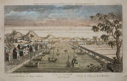
59 - VIETNAM (Cochinchina) - OPTICAL VIEW - "A Lake and Village of Cochinchina". c.1760. Engraving in old colors. Watermarked laid paper. With the address "A Paris, chez Basset rue St Jacques à Ste Geneviève". Margins. View representing the village of Yang-ka in Cochinchina. 29,3 x 42,7 cm. Condition C (Two small holes, one of which reaching the subject on the left and stains reaching the subject).
Estimate €150 - €200 -
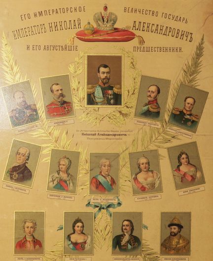
60 - RUSSIA - [NICOLAS II and his august predecessors]. c.1900. Chromolithograph, printed and published in Russia. 64 x 45 cm. Condition C (Glued in full to a frame spine, traces of wetness and handling).
Estimate €150 - €200 -
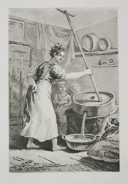
61 - POLAND - NORBLIN DE LA GOURDAINE (after) "Woman making gruel". Engraved with aquatint by Philibert Louis DEBUCOURT (Paris 1755 Belleville 1832). Ref: Fenaille, n°463. Rare proof of the first state of two, before letter, on wove paper. Plate 39 of the suite of 50 pieces "Polish Costumes". Margins. 32,5 x 22,3 cm.
Estimate €100 - €150 -
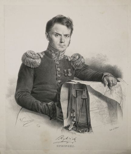
62 - POLAND - PORTRAIT of RYBINSKI. c.1830. Lithographed by VIGNERON. Signed lower left in the plate. Proof on China paper applied, printed by Villain. Margins. Maciej Rybiski (Slawuta 1784 - Paris 1874) was a Polish general, briefly commander-in-chief of the Polish army during the insurrection of 1830-1831. 36 x 28,7 cm. Condition B (very light stain at foot and small crease in left margin).
Estimate €100 - €150 -
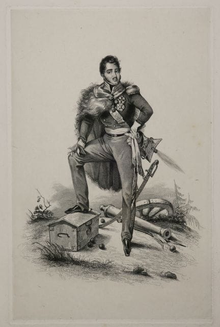
63 - POLAND - A full-length PORTRAIT of Józef Antoni PONIATOWSKI (Polish Prince, military and statesman of the 19th century & Nephew of the King of Poland Stanislas Auguste Poniatowski). 19th century. Engraving. Proof without letter, on China paper. Margins. 28,5 x 20 cm. Condition A (Small trace of wetness in the lower margin).
Estimate €100 - €150 -
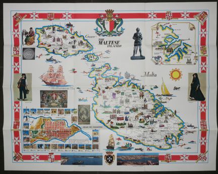
64 - MALTA - "PICTORIAL MAP OF MALTA". c.1950. TOURIST MAP of the Islands of Malta, GOZO & COMINO. Illustrated and printed in colour. At foot Views of Grand Harbour & Marsamwett Harbour. Bottom left: Map of the city of Valletta. Copyright M.S.T.A Malta / I.M.A.G Siracusa. Folded. 51,5 x 64,5 cm. Condition A.
Estimate €150 - €200 -
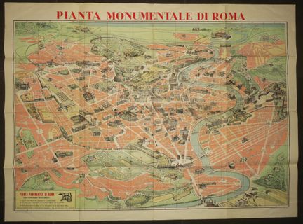
65 - ITALY - MONUMENTAL PLAN OF ROME. "Pianta monumentale di Roma, con circa 500 monumenti". 1950-1960. Illustrated by Trabacchi. Printed in colors. Edition Mauro GIGLI. Arti Grafiche Panetto & Petrelli, Spoleto, Roma. On the back is the list of monuments with a map of the roads. Margins. Folded. 76 x 103 cm. Condition A/B.
Estimate €120 - €150 -
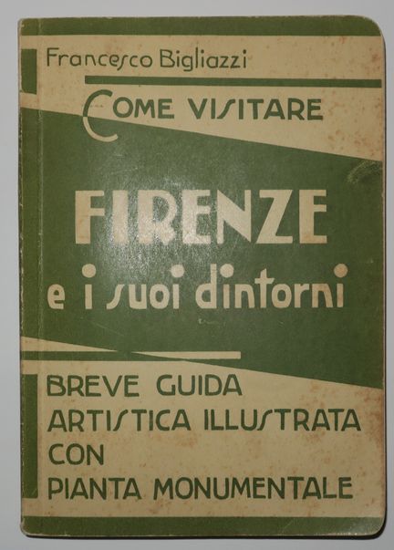
66 - ITALY - FLORENCE - TOURIST GUIDE - "Como vistare FIRENZE e i suoi dintorini, Breve Guida artistica illustrata con PIANTA MONUMENTALE", Francesco BIGLIAZZI, Milano, Cesare Capello, 1940. 134pp + folded colour map of the city. Guide in Italian. 15 x 10,5 cm. Condition A (some light foxing to cover otherwise good condition).
Estimate €80 - €100 -
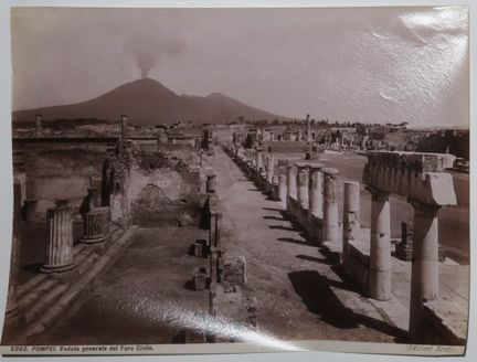
67 - ITALY - OLD PHOTO - LE VESUVE - View of "POMPEI, Veduta generale del Foro Civile". (Edizioni Brogi). Purple stamp on the back "Albert Hautecoeur / (Mon Martinet) / 12, Boulevard des Capucines, Paris". 19 x 24,7 cm. Condition A (Good condition).
Estimate €80 - €100 -
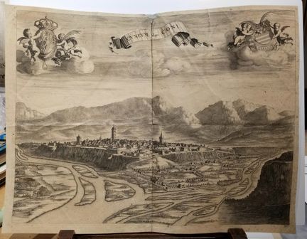
68 - ITALY - PIEMONT - BLAEU J. "Cuneum vulgo Coni". Burin. Proof on laid paper. From the work of Blaeu: "Novum theatrum Pedemonti et Sabaudiae". Margins. 47 x 62 cm. Condition C (Some folds, tears and small stains).
Estimate €100 - €150 -
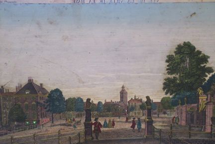
69 - NETHERLANDS - 18th century PERFORATED OPTICAL VIEW - "View of the City of THE HAGUE and House of the Prince of ORANGE". Engraved by Jacob Wangner. Antique color. This optical view has the particularity of being perforated and can thus be illuminated on the back to create an effect of passage from day to night. Some are painted on the back to create an illusion by making other figures appear when switching from face to back lighting. 29.5 x 43.7 cm. Condition B/C (Tablet missing below subject, so
Estimate €150 - €200 -
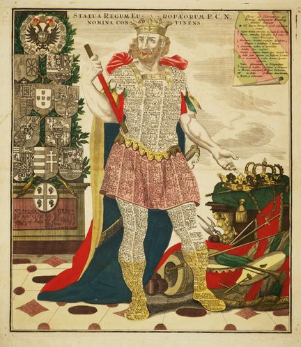
70 - ALLEGORIC & CURIOUS MAP of Europe - SEUTTER Matthew- "Statua Regum europaeorum P.C.N. Nomina continens". c.1728. Burin. Proof in old colours, on laid paper. Handwritten annotations in ink in the left-hand box under the arms. This allegorical map represents an imposing king with on his left his trophies (crowns, sceptres, weapons, musical instruments...); and on his right a coat of arms (with that of Germany at the top). On his body and armour are the kings of the different European nations from
Estimate €300 - €400 -
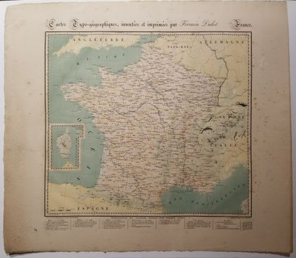
71 - MAP OF FRANCE - RARE "Typo-geographical map invented and printed by FIRMIN-DIDOT". Paris, 1823. Based on the map of Ponts-et-Chaussées, under the direction of Barbié du Bocage (1760 1825) and drawn by J. Langlois. Printed in colours on wove paper. The legend in the lower margin explains the different colours as indicators of the geographical characteristics of the landscape ("This map illustrates the relief printing process, which requires 8 passes starting with blue, then red, brown, dark and
Estimate €300 - €400 -
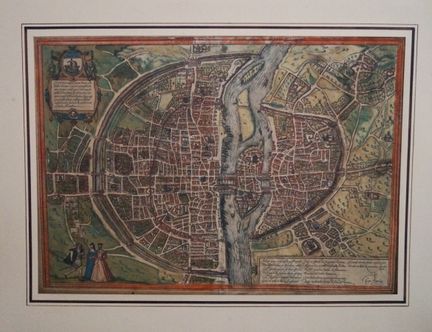
72 - PLAN OF PARIS (75) - BRAUN & HOGENBERG - "Lutetia Parisiorum". 16th century. Etching, heightened with wash. From the collection "Civitates orbis terrarum liber primus". Latin text on the reverse. Reference: Boutier, n°15. Taschen, Braun and Hogenberg, p.61. Margins. This plan is copied from the "First Plan" executed around 1530, which Sebastian Münster also used in a smaller representation for his "Cosmographia" in 1569. At the top left is a cartouche with the coat of arms of Paris with a Lati
Estimate €400 - €500 -
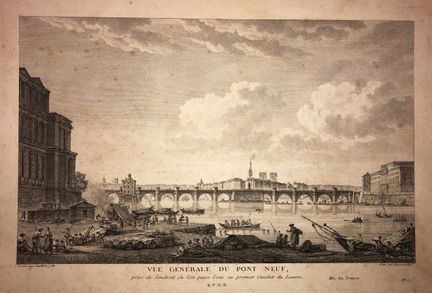
73 - PARIS (75) - "General view of the PONT-NEUF, taken from the place where the water is passed at the first Guichet du Louvre". Late 18th century. Engraved with etching and burin by François DEQUEVAUVILLER (17451807), after a drawing by Jean-Baptiste F. GENILLION in 1780. Margins. 32,5 x 47,5 cm. Condition C (Glued in full on cardboard and some foxing).
Estimate €60 - €80 -
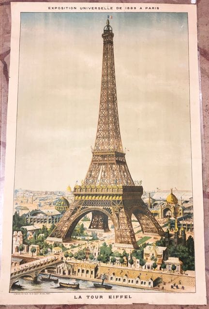
74 - PARIS (75) - EIFFEL TOWER - UNIVERSAL EXHIBITION of 1889 in Paris. The Eiffel Tower. Large lithograph in colours by F. Appel & Parrot. Printed by Ménétrier, publisher Fayard. All margins. 107 x 70 cm. Condition B/C (Some tears formerly restored.)
Estimate €500 - €600 -
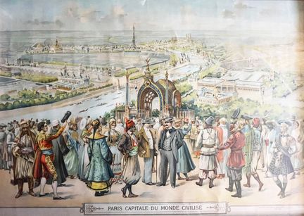
75 - UNIVERSAL EXHIBITIONS - EIFFEL TOWER - "PARIS, Capital of the Civilized World - Universal Exhibition of 1900". Chromo-lithography on vellum. Printed by the Société Toulousaine de Chromolithographie Toulouse, Paris, ca. 1900. Framed. 50,5 x 71 cm with the subject in view. 58 x 77.5 cm with frame - Condition A (not examined outside its frame).
Estimate €800 - €1,000 -
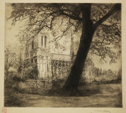
76 - PARIS (75) - [VIEW OF NOTRE-DAME]. 1925. Original etching by Edouard Henri LEON (Paris 1873-1968). Ref: I.F.F After 1800, p.518. Proof on wove paper, numbered 6 from an edition at 50 copies, dedicated "To the friend Helvig /Bien amicalement", dated and signed in pencil by the artist. Margins. 37,5 x 40 cm. Condition A (Margin edges and verso slightly faded).
Estimate €100 - €150 -
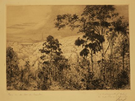
77 - PARIS (75) - EIFFEL TOWER - "PARIS seen from the Bois de MEUDON". Original etching engraved by Fernand PINAL (1881-1958). Signed in the lower left corner of the composition. Proof on cream wove paper, titled, dedicated "à Mademoiselle Helvig, en respectueux hommage" and countersigned in pencil by the artist. Good untrimmed margins. 32,5 x 50 cm. Condition A (Rare stains or foxing in the good margins).
Estimate €100 - €150 -
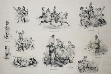
78 - CURIOSITY - PARIS (75) - "PHYSIONOMY OF PARIS, Before, during and after February 24 and 25, 1848". 19th century. Original lithograph by Victor ADAM (Paris 1801-Viroflay 1867). Proof on wove paper. Signed at the bottom in the plate. Printed by A. Godard. Published by Goupil, Vibert & Cie, 15 Bd Montmartre and 10 rue d'Enghien; and in London by Gambart & Cie. 32.5 x 39.3 cm. Condition B/C (Margins cut, a short tear reaching the subject at the top and bottom, a small dent in the paper on the right
Estimate €80 - €100 -
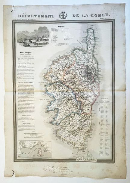
79 - CORSICA - MAP of the "Department of Corsica - Geographic map from the Atlas of the departments of France", by Donnet and Monin and by M. B. Dusillon, Paris 1841. Adorned with a vignette representing a view of the chief town and a statistical text concerning the administration, agriculture, industry, trade, historical monuments, antiquities and famous men. Engraved map printed on strong paper. Boundaries in old colours. Handwritten certificate at the bottom of the page and drystamp in the upper r
Estimate €400 - €600 -
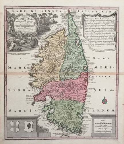
80 - CORSICA - SEUTTER MAP - "INSULA CORSICA olim REGNI TITULO INSIGNIS, nunc Genuensis Reipublicae potestati subjecta, juxta recentissimam designationem mappa Geographica aeri incisa", by MATTHAEUM SEUTTER (Georg Matthaüs SEUTTER (1678 - 1757)), Augsburg (Augusta Vindelicorum), c.1730. Etched map on laid paper. Colours. Good margins. Beautiful map of Corsica rich in topographical and historical elements. Top left: title in Latin within a precious figured cartouche (a Corsican, wearing a dagger on h
Estimate €650 - €700 -
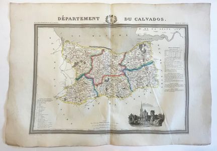
81 - NORMANDY (14) - MAP of the "Department of CALVADOS - Geographical map from the Atlas of the departments of France", by Donnet and Monin and by M. B. Dusillon, Paris 1841. Adorned with a vignette representing a view of the chief town and a statistical text concerning the administration, agriculture, industry, trade, historical monuments, antiquities and famous men. Engraved map printed on strong paper. Boundaries in old colours. Margins. 56 x 74 cm. Condition A (Paper slightly yellowed, marked fo
Estimate €120 - €150 -
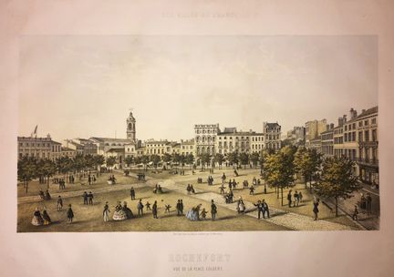
82 - CHARENTE-MARITIME (17) - "ROCHEFORT, View of the Place Colbert". c.1860. Lithograph in colours by Ch. MERCEREAU. Proof on wove paper. Plate from the series "Les villes de France". Printed by Frick Frères, in Paris and published by Amand Giraud, Librairie Nouvelle, in Rochefort. Margins. 48 x 65 cm. Condition A (some soiling).
Estimate €120 - €150 -
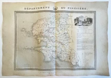
83 - BRITTANY (29) - MAP of the "Department of FINISTERE- Geographical map from the Atlas of the departments of France", by Donnet and Monin and by M. B. Dusillon, Paris 1841. Adorned with a vignette representing a view of the chief town and a statistical text concerning the administration, agriculture, industry, trade, historical monuments, antiquities and famous men. Engraved map printed on strong paper. Boundaries in old colours. Good margins. Handwritten certificate at the bottom of the page. 56
Estimate €150 - €200 -
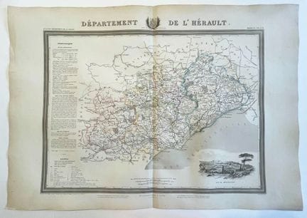
84 - LANGUEDOC (34) - MAP of the "Department of HERAULT - Geographic map from the Atlas of the departments of France", by Donnet and Monin and by M. B. Dusillon, Paris 1841. Adorned with a vignette representing a view of the chief town and a statistical text concerning the administration, agriculture, industry, trade, historical monuments, antiquities and famous men. Engraved map printed on strong paper. Boundaries in old colours. Good margins. 56 x 74 cm. Condition A (Small restored tear in left mar
Estimate €120 - €150 -
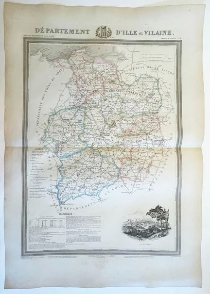
85 - BRITTANY (35) - MAP of the "Department of ILLE-ET-VILAINE - Geographic map from the Atlas of the departments of France", by Donnet and Monin and by M. B. Dusillon, Paris 1841. Adorned with a vignette representing a view of the chief town and a statistical text concerning the administration, agriculture, industry, trade, historical monuments, antiquities and famous men. Engraved map printed on strong paper. Boundaries in old colours. Good margins. 74 x 56 cm. Condition B (Small marginal foxing, p
Estimate €150 - €200 -
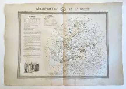
86 - CENTRE (36) - MAP of the "Department of INDRE - Geographic map from the Atlas of the departments of France", by Donnet and Monin and by M. B. Dusillon, Paris 1841. Adorned with a vignette representing a view of the chief town and a statistical text concerning the administration, agriculture, industry, trade, historical monuments, antiquities and famous men. Engraved map printed on strong paper. Boundaries in old colours. Good margins. Handwritten certificate at the bottom of the page. 56 x 74 cm
Estimate €150 - €200 -
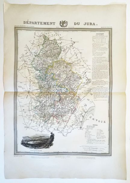
87 - JURA (39) - MAP of the "Department of Jura - Geographical map from the Atlas of the departments of France", by Donnet and Monin and by M. B. Dusillon, Paris 1841. Adorned with a vignette representing a view of the chief town and a statistical text concerning the administration, agriculture, industry, trade, historical monuments, antiquities and famous men. Map printed on strong paper. Boundaries in old colours. Handwritten certificate at the bottom of the page. Margins. 56 x 74 cm. Condition B (
Estimate €150 - €200 -
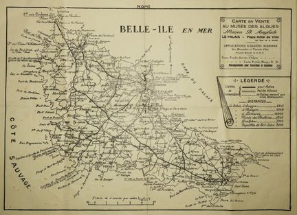
88 - MORBIHAN (54) - MAP OF "BELLE-ILE EN MER" (Map on sale at the Algae Museum / Maison B. Anglade / Le Palais - Place Hôtel de ville [...]). Beginning of XX th century. Margins. 32 x 44 cm. Condition A/B (Some traces of median folds, a short tear in the upper margin and small stains in the lower left corner).
Estimate €150 - €200 -
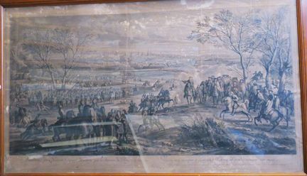
89 - NORTH (59) - "VALENCIENNES stormed and saved from pillage by the King's insanity, March 16, 1677". c.1685. Engraved with etching and burin by Robert BONNART (Paris 1652-1733), after F. VANDER MEULEN (Brussels 1632-Paris 1690). Reference: I.F.F XVIIth, n°141. Printed in the 19th century. Margins. Framed. 67 x 109 cm. Condition C/D (Paper damaged, insolate... not examined outside its frame).
Estimate €150 - €200 -
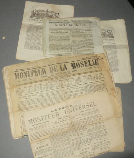
90 - MOSELLE (57) – LOT de 26 JOURNAUX DE MOSELLE 1870 à 1878 + 6 exemplaires d’autres journaux divers (Gazette de France…). Etat A/B.
Estimate €150 - €200 -
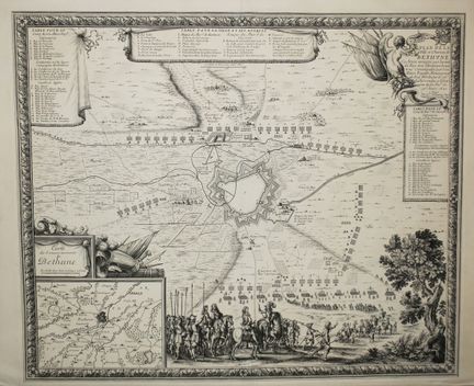
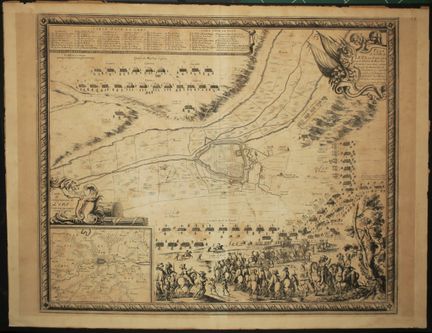
91 - PAS-DE-CALAIS (62) - "PLAN de la Ville de BETHUNE en ARTOIS assiégée par l'Armée du Roy très Chrétien Louis xuy (LOUIS XIV), commandée pae son Altese Royalle Monseigneur le Duc d'Orléans le 26è Juillet rendue à l'obéissance de Sa Majesté le 30 Aoust 1645". In Paris, by the Sr. de BEAULIEU, Ing. Geographer ord. of the King, with priv." Engraved map. laid paper. At bottom left the "MAP of the Government of Bethune", at top left the Table for the Camp of His Royal Highness and further to
Estimate €100 - €150 -
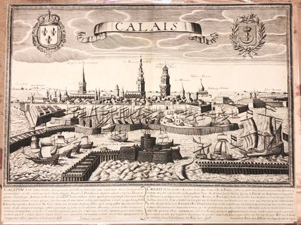
92 - PAS-DE-CALAIS (62) - JOLLAIN (Gérard) - VIEW of "CALAIS". c.1680. Etching and burin. Proof on watermarked laid paper (bunch of grapes). Sold in Paris at Jollain, rue St Jacques in the city of Cologne. RARE and BEAUTIFUL VIEW with the legend in French and Latin on the history of the city. Fine margins of the copper. 38,5 x 51 cm. Condition B/C (Cut inside the copperplate mark, rare light foxing, trace of old median vertical fold and restored tear to the right in the sky).
Estimate €100 - €150 -
93 - PAS-DE-CALAIS (62) - "PLAN de la Ville de LENS en ARTOIS assiégée par l'Armée du Roy très Chrétien Louis xuy (LOUIS XIV) commandée par le Mareschal de GASSION le 23 septembre, rendue à l'obéissance de Sa Majesté le 3 du mois d'octobre ensuivant 1647". In Paris, by the Sr. de BEAULIEU, Engineer and Geographer, Ord. of the King with Priv. of His Majesty. Rare and beautiful engraved map. Watermarked laid paper (Jesus). At the top left the Table for the Camp and further right the Table for
Estimate €100 - €150 -
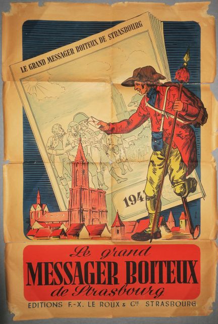
94 - BAS-RHIN (67) - AFFICHE "LE GRAND MESSAGER BOITEUX DE STRASBOURG". 1947. En couleurs. Editions F-X. Le Roux & Cie, à Strasbourg. Pliée. 65 x 45 cm. Etat B (Quelques déchirures).
Estimate €100 - €150 -
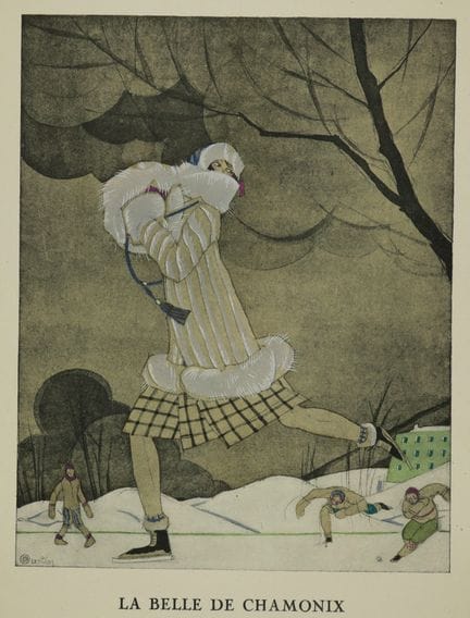
95 - CHAMONIX (74) - ICE SKATE - Charles MARTIN - "La belle de Chamonix, Jaquette hermine et renard blanc de Max-A. Leroy". 1924. Stencil. Plate 37 of the Gazette du Bon Ton. Margins. Good condition. Illustration from La Gazette du Bon Ton, one of the most beautiful fashion magazines of the 20th century, celebrating the talent of French designers and artists in the midst of the art deco era. 24,5 x 19 cm. Condition A.
Estimate €150 - €200 -
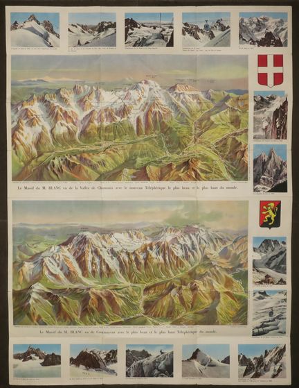
96 - MONT-BLANC - HAUTE-SAVOIE (74) - "PANORAMIC MAP of the MONT-BLANC MASSIF, seen from the Valley of CHAMONIX and the Valley of COURMAYEUR with the New Highest and Most Beautiful Cable Car in the World" (Les Glaciers du Triolet, L'Aiguille du Midi, La mer de Glace, Les Aiguilles du Dru, Les Grandes Jorasses, Téléphérique du Mont-Blanc, ...). c.1960. Illustrated from the photos of Georges TAIRRAZ (1900-1975) and printed in colors. On the back, an AUTOMOBILE MAP ALPES OF FRANCE AND ITALY. Edition:
Estimate €120 - €150 -
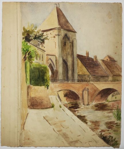
97 - SEINE-ET-MARNE (77) - MORET-SUR-LOING - [Porte de BOURGOGNE sur le Loing]. c.1930. AQUARELLE on wove paper. 29 x 24 cm. Condition A (creases on the left edge of the sheet not reaching the subject and rare scattered foxing).
Estimate €120 - €150 -
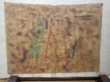
98 - YVELINES (78) - [JOUY-EN-JOSAS]. c.1875. Plan drawn in ink. Certified lower right "Plan and [] certified exact by the undersigned surveyor, Versailles May 25, 1875? / Dronet? On the reverse side a drawing of the front of a house. 33,2 x 44,1 cm. Condition C (Many accidents).
Estimate €150 - €200 -
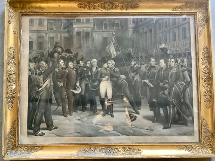
99 - NAPOLEON - "FAREWELL OF FONTAINEBLEAU (April 20, 1814)". c.1829. Beautiful and large plate engraved with aquatint by Jean-Pierre Marie JAZET (Paris 1788 1871), after the painting executed by Horace VERNET (Paris 1789 1863). Reference: I.F.F After 1800, n°138. Proof on wove paper. Provenance: Chateau de Hamme Mille. The original painting is kept in the National Museum of Malmaison Castle. Dimensions with its period frame: 120 x 92 cm. Condition B/C (tear at the top left reaching the subject, not
Estimate €400 - €500 -
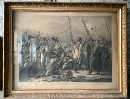
100 - NAPOLEON - "Return from Elba (March 7, 1815)". 1827. Beautiful and large plate engraved with aquatint by Jean-Pierre Marie JAZET (Paris 1788 1871), after the painting by Charles de STEUBEN (Bauerbach in Thuringia 1788-Paris 1856). Ref: I.F.F After 1800, n°119. Proof on wove paper. Margins. Provenance: Chateau de Hamme Mille. Dimensions with its period frame: 127 x 100 cm. Condition A (not examined outside its frame).
Estimate €400 - €500

About the sale
Selling expenses : 28 % TTC on a voluntary basis
Internet fees :
+1.5% ex VAT of the hammer price (i.e. +1.8% incl. VAT) for voluntary lots.
Terms of sale
Show the terms of sale
Frais de vente : 28 % TTC en volontaire
Frais internet :
+1.5% HT du prix d'adjudication (soit +1.8% TTC) pour les lots volontaires.