

Prints, curiosa, photographs...
Monday 16 September 2024 at 12:30
9 rue de Provence, 75009 Paris
305 lots
-
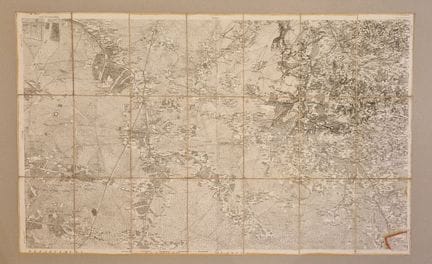
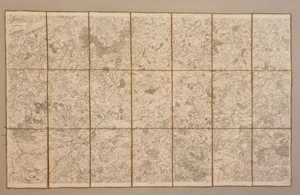
51 - JEAN DOMINIQUE CASSINI - "Carte de France" - XVIIIe siècle - par Jean-Dominique Cassini (1671-1712), à Paris chez Vignon Marchand de Cartes de Georgraphie, rue Dauphine vis à vis celle d'Anjou - Carte n°41 sur papier vélin, avec la mention temponné "Ex Libris de Cayrol" - Dimensions : H : 600 mm x W : 920 mm - Condition A : Good, traces of handling, yellowed paper (LILLE DOUAI - 59)
Estimate €100 - €200 -
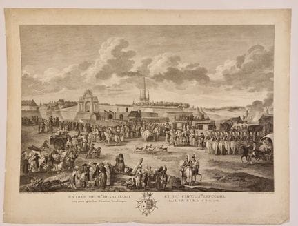
52 - WATTEAU, L. - "Entrée de Mr Blanchard et du chevalier Lepinard, cinq jours après leur Afcenfion Aeroftatique, dans la Ville de Lille, le 26 Août 1785" - XVIIIth century - painted by L. Watteau, professor at the Lille Academy, engraved by Helman of the same Academy - Engraving on wove paper - Sheet size: 360 x 470 mm / subject: 290 x 420 mm - Condition B: Dusty and darkened edges (LILLE-59)
Estimate €300 - €600 -
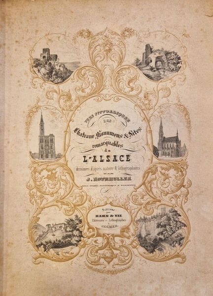
53 - JACQUES ROTHMULLER - "Vue pittoresques des châteaux et des sites remarquables de l'Alsace." - 1839 - drawings after nature and lithographed by Jacques Rothmuller with descriptive and historical texts, published by Han et Vix éditeurs/lithographes in Coimar - Dimensions: H: 300 mm x W: 230 mm - Condition A - Freckling on the pages and slight yellowing. - (LIVRE-ALSACE-67)
Estimate €425 - €850 -
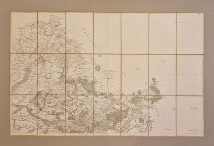
54 - JEAN DOMINIQUE CASSINI - "Carte de France" - 18th century - by Jean-Dominique Cassini (1671-1712) - Map no. 64 on wove paper, with "Ex Libris de Cayrol" stamped on it - Dimensions: H: 600 mm x W: 920 mm - Condition A: Good, traces of handling, yellowed paper (MANS-72)
Estimate €100 - €200 -
55 - JEAN DOMINIQUE CASSINI - "Carte de France" - 18th century - by Jean-Dominique Cassini (1671-1712) - Map no. 24 on wove paper, with the temponné "Ex Libris de Cayrol" - Dimensions: H: 600 mm x W: 920 mm - Condition A: Good, traces of handling, yellowed paper (YVETOT-76)
Estimate €100 - €200 -
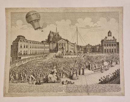
56 - "L'ascension des Montgolfiers au dessus de Versalles avec trois animaux, expérience Aerostatique du 9 septembre 1783." - XVIIIe - In the presence of their Majesties of the royal family and 130 thousand spectators by Monsieur Montgolfier with a balloon 57 feet high. - Engraving on wove paper - Size: 320 x 420 mm - Condition A: soiling and dusting. (VERSAILLES - 78)
Result €500Estimate €500 - €1,000 -
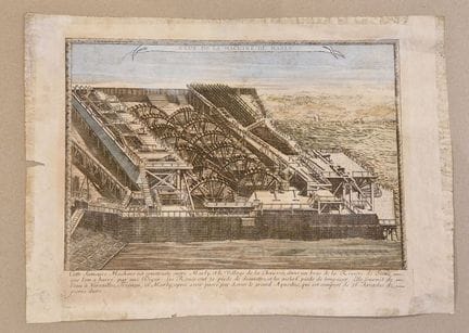
57 - MARLY - "Veue de la Machine de Marly" - "This famous Machine is built between Marly, and the Village de la Chaussée, in an arm of the Seine River, which has been dammed by a dike. The Rouës are 30 feet in diameter, and the aisles are 6 feet long. It supplies water to Versailles, Trianon, and Marly, after passing over the Grand Acqueduc, which is composed of 36 Arcades of hard stone." - 1720 - 1750 - Etching enhanced with watercolor on laid paper - Sheet size : H : 310 x W : 422 mm / Subject :
Estimate €150 - €200 -
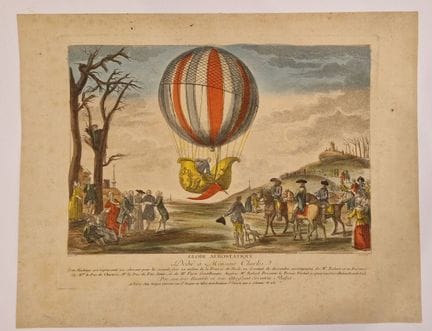
58 - CHEREAU, J. - "Globe Aerostatique" - XVIIIe - à Paris chez Jacques Chereau rue St Jacques, au defsus de la Fontaine St Severin aux 2 colonnes n°257 - Color engraving on wove paper - With the mention "Dédié à Monsieur Charles, cette machine est représenté ici s'élevant pour la seconde fois au milieu de la Prairie de Nesle, où il venait de descendre, accompagné de Mr Robert et en Présence de Monseigneur le Duc de Chartes (....) by his very humble and obedient servant Bafset." - Sheet si
Estimate €600 - €1,000 -
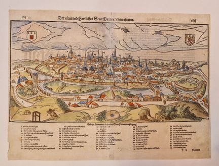
59 - SEBASTIAN MUNSTER - "Der alten und herzlichen Statt Puttiers contrafactur" - View of Poitiers by Sebastian Munster in 1579. - Double page, caption in German, text on verso. - Woodcut on laid paper, enhanced with watercolor. - Sheet dimensions: H. 303mm x W. 408mm - Subject dimensions: H. 205mm x W. 403mm - Condition A - Good condition, despite small marginal tears and soiling. (POITIERS-86)
Result €100Estimate €100 - €200 -
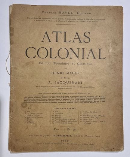
60 - MAGER, H. - "Colonial Atlas" - XIXth. Atlas Colonial, popular and classic edition, by Henri Mager, text by A, dated 1890. Jacquemart. 22-page atlas of all former French colonies worldwide. Work honored by subscription from the Ministry of Public Instruction, the Ministry of Agriculture, the Ministry of Marinet and the Ministry of Commerce, Industry and Colonies. List of maps: French colonies / Obock and Djiboutil / Madagascar and Comoros / Reunion / Kerguelen / Indo-China / India / Cochinchina /
Result €150Estimate €150 - €200 -
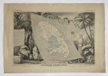
61 - LEVASSEUR, V. - "Colonies Françaises - Martinique Amérique du Sud" - c. 1850 - Map of Martinique, from Victor Levasseur's Atlas national illustré. Illustration, by Raymond Bonheur, shows the island's main agricultural productions and a bust of Josephine. Partially watercolored. - Dimensions: 285 x 425 mm - Condition A. Browned paper, marginal tears. (MARTINIQUE)
Estimate €100 - €200 -
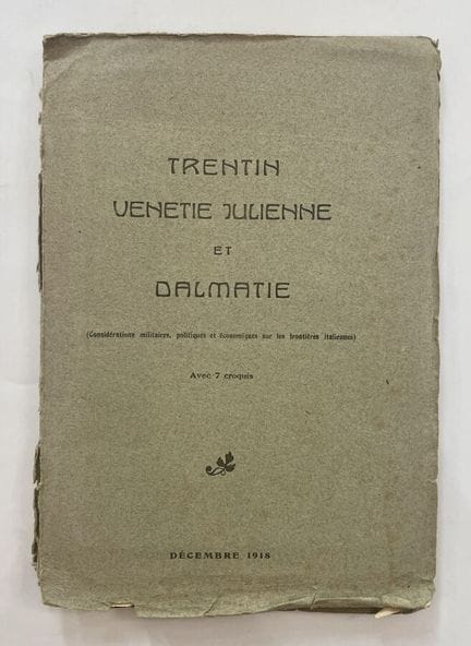
62 - "Trentino-Venetia-Julia and Dalmatia" - XXth. Cartographic work illustrating the "Military, Political and Economic Considerations on the Italian Frontier", analyzing the national future of Dalmatia, South Tyrol and Veneto after the First World War. Enriched with 7 large-format folding maps of the regions concerned. December 1918. Size: 320 x 220 mm. Condition A-. Traces of handling. Tears to cover. Two cards have a few tears stopped with acid-free adhesive (ITALY).
Estimate €200 - €300 -
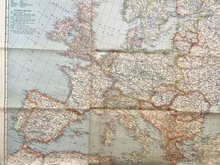
63 - NATIONAL GEOGRAPHIC SOCIETY - [ Europe and near east ], Washington, 1940. Map of Europe and the Near East. Features major bays, lakes, rivers, glaciers, islands, mountains... Cartographic insert of the Middle East. Color lithograph. Dimensions: 855 x 985 mm. A- condition. Short tears to original folds. (EUROPE)
Estimate €80 - €100 -
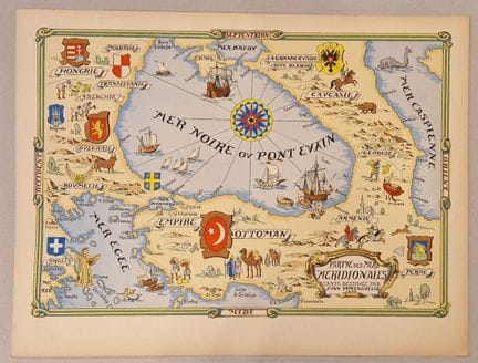
64 - PORTAGUELLA, J. - [ Partye des mers meridionales... ], c. 1950. Reprint of Juan Portaguella's map of the Black Sea. Stencil engraving on heavy paper. Dimensions: 495 x 650 mm. Condition A. Original folds. (BLACK SEA)
Estimate €150 - €200 -
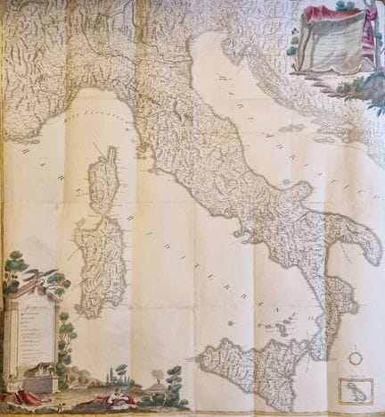
65 - IGNAZIO HEYMANN - "Italy, the small and large sovereignty republics of Italy, inculating the public post offices and their distances." - 18th century - Engraving on wove paper, with period coloring. - Dimensions: H: 1080 mm x W: 950 mm - Condition A - Marked folds, restoration on verso, short marginal tears. - (EUROPE - ITALY)
Estimate €600 - €1,200 -
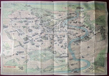
66 - MAURO GIGLI - [ Pianta panoramica di Roma... ], c. 1960. Monumental folding map of the city of Rome. On verso the list of monuments with a road map. Dimensions: 700 x 1000 mm. Condition A. Original folds, short tears. Some handling marks in margins. (ITALY-ROME)
Estimate €80 - €100 -
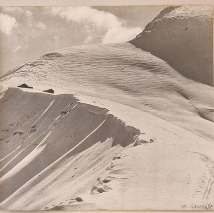
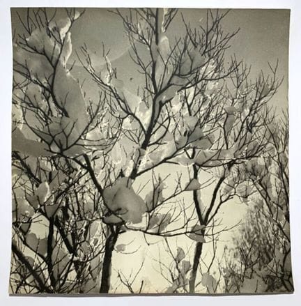
67 - GANEAU, F. - [ Antique photograph of the Swiss Alps ], Paris, 20th century. Original antique photograph of the snow-covered Swiss Alps, black & white print. By Ganeau. Signed in the lower right corner (455 x 455 mm). Condition A. Good condition. Slight surface defects. Silver print on heavy paper, medium format. (XXe-SUISSE-PHOTOGRAPHIE)
Estimate €150 - €200 -
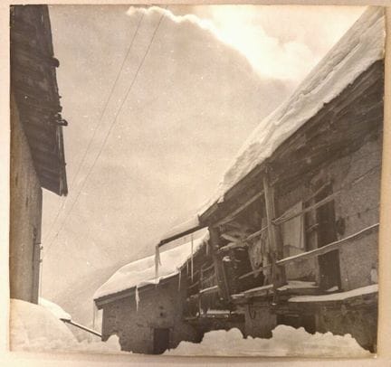
68 - ANONYMOUS. - [ Antique photograph of the Swiss Alps ], Paris, 20th century. Original vintage photograph of a Swiss chalet, black & white print (455 x 455 mm). Condition A-. Good condition. Slight surface defects, two small tears at bottom edge. Silver print on heavy paper, medium format. (XXe-SUISSE-PHOTOGRAPHIE)
Estimate €150 - €200 -
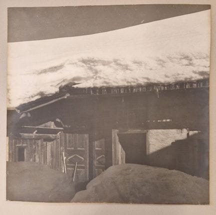
69 - ANONYMOUS. - [ Antique photograph of the Swiss Alps ], Paris, 20th century. Original vintage photograph of a Swiss chalet, black & white print (455 x 455 mm). Condition A. Good condition. Slight surface defects. Silver print on heavy paper, medium format. (XXth-SWITZERLAND-PHOTOGRAPHY)
Estimate €150 - €200 -
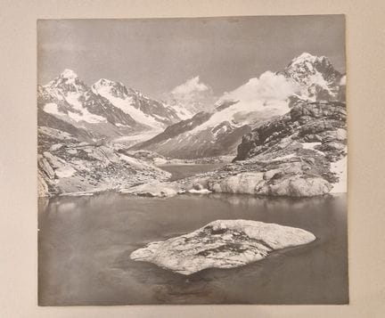
70 - TAIRRAZ, P. - [ Antique photograph of Chamonix-Mont-Blanc], Paris, 20th century. Original vintage photograph of Chamonix-Mont-Blanc, black & white print. By Pierre Tairraz, photographer's stamp on back (455 x 455 mm). Condition A-. Good condition. Slight surface defects. Medium-format monochrome silver print on heavy paper. (XXe-PHOTOGRAPHIE-CHAMONIX MONT BLANC (74))
Result €150Estimate €150 - €200 -
71 - ANONYMOUS. - [ Antique photograph of the Swiss Alps ], Paris, 20th century. Original antique black & white photograph of the Swiss Alps (455 x 455 mm). Condition A. Good condition. Slight surface defects. Silver print on heavy paper, medium format. (XXth-SWITZERLAND-PHOTOGRAPHY)
Estimate €150 - €200 -
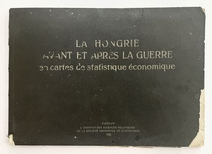
72 - INSTITUT DES SCIENCES POLITIQUES... - [ Hungary before and after the war in maps of economic statistics ], 1926. Work reporting on the effects of the First World War in Hungary, in economic, productive, trade and intellectual terms, illustrated by graphs, tables and maps and enriched by explanatory writings. (265 x 375 mm). Condition A. Lacks, tears and handling marks on cover. Interior in good condition.
Estimate €150 - €200 -
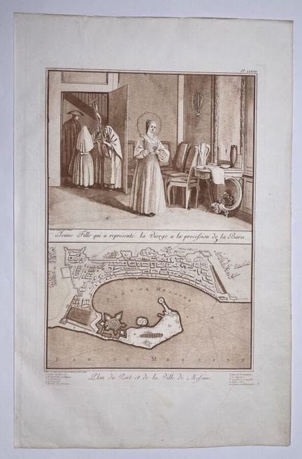
73 - HOUEL, J.P. - "Jeune fille qui a représenté la vierge à vla procefsion de la Bara, Plan du port et de la ville de Mefsine." - 1782 - Drawn and engraved by Jean-Pierre Houel (draftsman and painter), published in Paris. Plate LXXVIII. from the book "Voyages pittoresques des îles de Sicile, Malte et Lipari." - Aquatint printed in sepia on wove paper. - Sheet size: 500 x 330 mm / Subject: 350 mm x 230 mm - Condition A. Marginal foxing and handling marks. (SICILY, MALTA, LIPARI)
Estimate €150 - €300 -
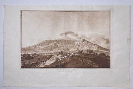
74 - HOUEL, J.P. - "View of the summit of Etna between Rocca della Capra and Trifoglietto." - 1782 - drawn and engraved by Jean-Pierre Houel (draftsman and painter), published in Paris. Plate CV. from the book "Voyages pittoresques des îles de Sicile, Malte et Lipari." - Aquatint printed on sepia, wove paper. - Sheet size: H: 320 mm x W: 490 mm / subject: H: 230 mm x W: 360 mm - Condition A. Marginal foxing and handling marks. (SICILY, MALTA, LIPARI)
Estimate €300 - €600 -
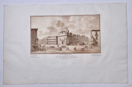
75 - HOUEL, J.P. - "VIe Vue de Messine, Quartier appelé Quatro-fontane" - 1782 - drawn and engraved by Jean-Pierre Houel (draftsman and painter), published in Paris. Plate LXXXV. from the book "Voyages pittoresques des îles de Sicile, Malte et Lipari." - Aquatint printed in sepia, wove paper. - Sheet size: 325 x 500 mm / Subject: 190 x 295 mm - Condition A. Marginal foxing and handling marks. (SICILY, MALTA, LIPARI)
Estimate €150 - €300 -
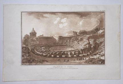
76 - HOUEL, J.P. - "Amphitheater of Catania..." - 1782 - Designed and engraved by Jean-Pierre Houel (draftsman and painter), published in Paris. Plate CXXXIII. from the book "Voyages pittoresques des îles de Sicile, Malte et Lipari." - Aquatint printed in sepia, wove paper. - Sheet size: 325 x 500 mm / Subject: 260 x 370 mm - Condition A. Marginal handling marks and wetness. (SICILY, MALTA, LIPARI)
Estimate €150 - €300 -
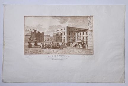
77 - HOUEL, J.P. - "Ve vue de Messine - Place de Sainte Marie de la Porte..." - 1782 - Designed and engraved by Jean-Pierre Houel (draftsman and painter), published in Paris. Plate LXXXIV, from the book "Voyages pittoresques des îles de Sicile, Malte et Lipari." - Aquatint printed in sepia, wove paper. - Sheet size: 325 x 500 mm / Subject: 190 x 295 mm - Condition A. Marginal handling and wetness. (SICILY, MALTA, LIPARI)
Estimate €150 - €300 -
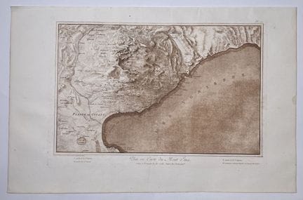
78 - HOUEL, J.P. - "Plan ou carte du Mont Etna" - 1782 - Drawn and engraved by Jean-Pierre Houel (draftsman and painter), published in Paris. Plate LXXXIV, from the book "Voyages pittoresques des îles de Sicile, Malte et Lipari." - Aquatint printed in sepia, wove paper. - Sheet size: 325 x 500 mm / Subject: 260 x 370 mm - Condition A. Marginal handling marks and wetness. (SICILY, MALTA, LIPARI)
Estimate €150 - €300 -
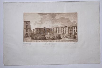
79 - HOUEL, J.P. - "1re vue de Messine - Place de la Cathédrale" - 1782 - Drawn and engraved by Jean-Pierre Houel (draftsman and painter), published in Paris. Plate LXXX, from the book "Voyages pittoresques des îles de Sicile, Malte et Lipari." - Aquatint printed in sepia, wove paper. - Sheet size: 325 x 500 mm / Subject: 185 x 290 mm - Condition A. Marginal handling and wetness. (SICILY, MALTA, LIPARI)
Estimate €150 - €300 -
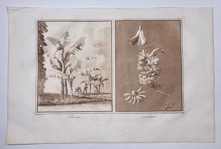
80 - HOUEL, J.P. - "Bananier - Fruit du Bananier" - 1782 - Drawn and engraved by Jean-Pierre Houel (draftsman and painter), published in Paris. Plate XLI, from the book "Voyages pittoresques des îles de Sicile, Malte et Lipari." - Aquatint printed in sepia on wove paper. - Sheet size: 325 x 500 mm / Subject: 250 x 365 mm - Condition A. Marginal handling marks and wetness. (SICILY, MALTA, LIPARI)
Estimate €300 - €600 -
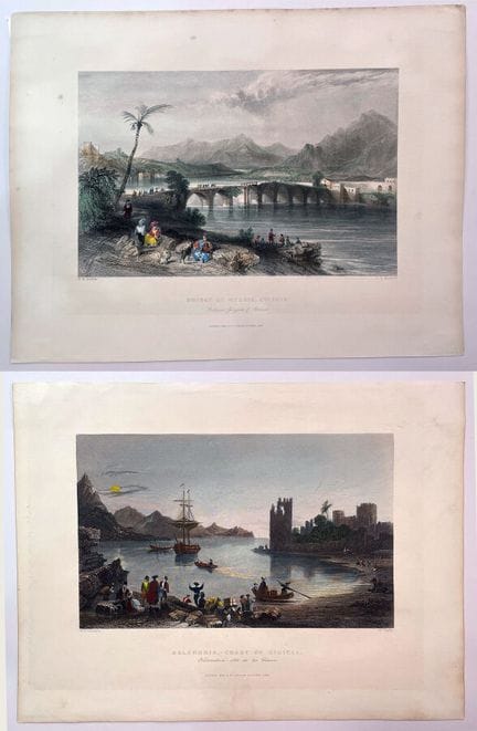
81 - FISHER SON & CO - [ Bridge of Messis... - Kalendria, Coast of Cilicia ], 1839. Set of two engravings, views of Turkey, drawn by W. H. Bartlett and engraved by J. S. Murdock and W. Taylor. Taylor. 1. panoramic view of the stone bridge between Gorgola and Adana on the south coast of Turkey with numerous Ottoman soldiers. 2. panoramic view of the Kalendria Coast. Published by London & Paris: Fisher Son & Co, 1839. Etchings enhanced in color. Dimensions: 210 x 270 mm. Condition A. (CILIC
Estimate €70 - €90 -
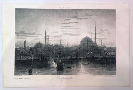
82 - [ Constantinople - Turkish pleasure house ], 19th century. Set of two engravings, views of Turkey. 1. Vue de Constantinople, drawn by Bouquet, engraved by Stéphane Tournus, printed by Chardon. 2. Vue d'une maison de plaisance de Turque, drawn by Dawin and engraved by Lepetit. Etchings. Condition A. (CILICIA-TURKEY)
Result €80Estimate €80 - €100 -
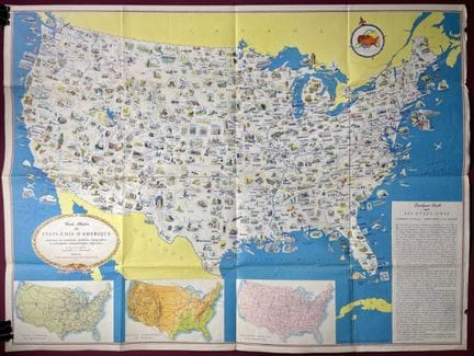
83 - GENERAL DRAFTING CO - [ Illustrated map of the United States of America... ], c. 1950. Decorative map of the United States, showing resources, products, topography and major regional features. Size: 605 x 815 mm. Condition A-. Original folds, short tears. Beautiful colors. (UNITED STATES)
Estimate €80 - €100 -
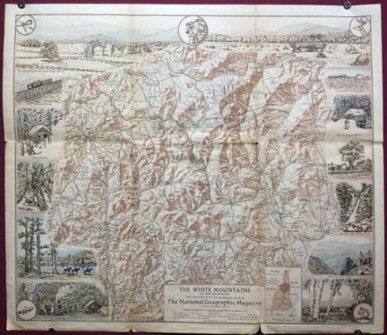
84 - NATIONAL GEOGRAPHIC SOCIETY - [ The White Mountains of New Hampshire ], Washington, 1937. Map showing the White Mountains of New Hampshire, renowned for its picturesque villages and vast wilderness. Surrounding the map are illustrations of various tourist attractions. Cartographic insert of the area concerned. Dimensions: 435 x 505 mm. Condition A. Original folds. (UNITED STATES)
Estimate €80 - €100 -
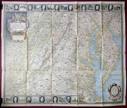
85 - NATIONAL GEOGRAPHIC SOCIETY - [ Historic and scenic reaches of the nation's capital ], Washington, 1938. Map centered on the states of Virginia, Maryland and Delaware, with the capital city of Washington at its center. Surrounding the map are several vignettes of famous Americans and historic sites in the areas shown on the map. Dimensions: 665 x 795 mm. Condition A. Original folds. (UNITED STATES)
Estimate €80 - €100 -
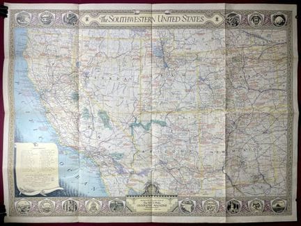
86 - NATIONAL GEOGRAPHIC SOCIETY - [ The Southwestern United States ], Washington, 1940. Map of the Southwestern United States showing sea, air and land routes, national parks, reserves and monuments, battlefields and Indian reservations. Provides information on exploration routes with dates. Dimensions: 655 x 880 mm. Condition A. Original folds. (UNITED STATES)
Estimate €80 - €100 -
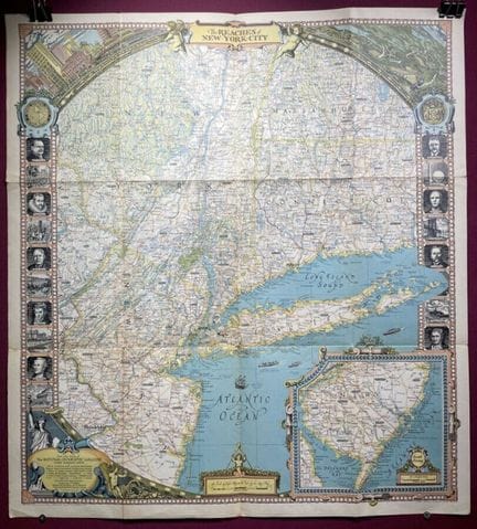
87 - NATIONAL GEOGRAPHIC SOCIETY - [ The reaches of New-York City ], Washington, 1939. Decorative map of New York State, Manhattan, Long Island and the surrounding areas of New Jersey, Massachusetts and Connecticut. Surrounding illustrations of famous people and places. Cartographic insert of the southern part of New Jersey, the upper left corner shows the New York skyline and the right a scene along the Hudson River. Dimensions: 740 x 675 mm. A condition. Original folds. (UNITED STATES)
Estimate €80 - €100 -
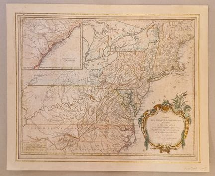
88 - DE VAUGONDY, R. - [ Partie de l'Amérique septentrionale... ] 1755. Carte de la partie septentrionale de l'Amérique, qui comprend le cours de l'Ohio, la Nouvelle Angleterre, la Nlle York, le New Jersey, la Pensylvanie, le Maryland, la Virginie, la Caroline. By Robert De Vaugondy. Engraving on laid paper, in color. Dimensions: 510 x 640 mm. B condition. Generalized foxing, browned paper. Mounted on soft cardboard (AMERICA).
Estimate €300 - €400 -
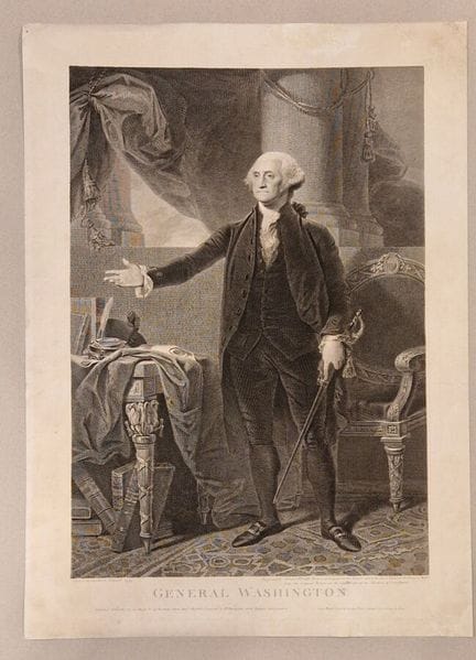
89 - STUART, G. - [ General Washington ] 1800. Portrait of General Washington, after a 1797 painting by Gabriel Stuart. Engraved by Jeames Heath, historical engraver to the Prince of Wales. Published in London in 1800. Engraving on laid paper. Dimensions: 510 x 640 mm. B condition. Some restored damage to the paper in the margins, subject in very good condition (AMERICA/PORTRAIT).
Estimate €200 - €300 -
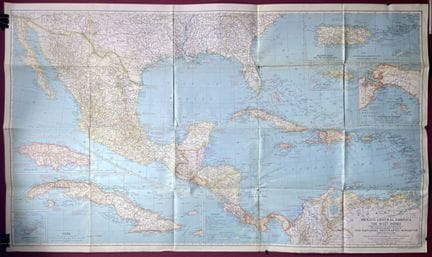
90 - NATIONAL GEOGRAPHIC SOCIETY - [ Mexico, Central America and the West Indies... ], Washington, 1939. Map of Central America and the Caribbean Archipelago. Cartographic inserts of Jamaica, Cuba, Bermuda, Puerto Rico and Virgin Islands, Saint Thomas and Panama. Color lithograph. Dimensions: 950 x 675 mm. Condition A. Original folds. (CENTRAL AMERICA)
Estimate €80 - €100 -
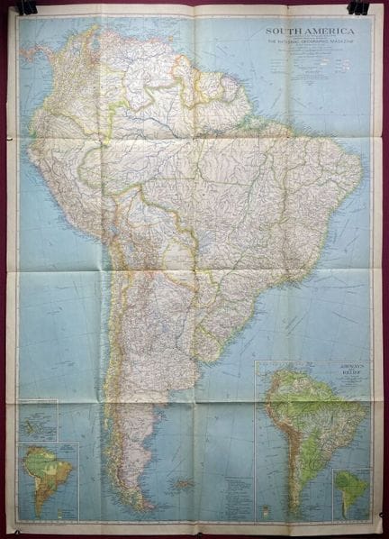
91 - NATIONAL GEOGRAPHIC SOCIETY - [ South America... ], Washington, 1937. Map of South America showing major mountains, capes, rivers, lakes, islands...Cartographic insert of the Galapogos Islands. Color lithograph. Dimensions: 950 x 675 mm. Condition A. Original folds. (SOUTH AMERICA)
Estimate €80 - €100 -
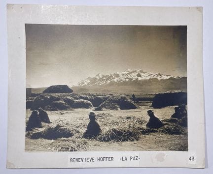
92 - HOFFER, G. - "Bolivie - La Paz" - 20th century. Set of thirteen color, sepia or black-and-white silver prints, mounted on cardboard, by Geneviève Hoffer. Dimensions: 205 x 253 mm (photos) / 255 x 305 mm (cardboard). Condition A. (BOLIVIA)
Estimate €200 - €300 -
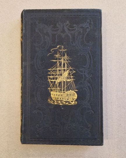
93 - MARMONTEL - "Les Incas ou la destruction de l'empire du Pérou." - 1843 - by Marmontel, fourth edition revised and purged by a society of ecclesiastics, printed by Ad Mane et Cie in Tours - Composed of 4 steel engravings. - Dimensions: H: 180 mm x W. 100 mm - Condition A/B: Some foxing and yellowing on book pages, slight tear on inside edge. (LIVRE-PEROU)
Estimate €200 - €300 -
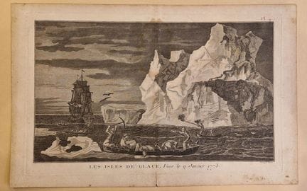
94 - BERNARD DIREX - "Les isles de Glace, vues le 9 janvier 1773" - 1773 - by Bernard Direx - Engraving on wove paper, plate n°4 - Sheet size : 270 x 420 mm / subject : 210 x 350 mm - Condition B : Marked central fold, dust and brown stain (ST TERRE DE FEU AMERIQUE DU SUD)
Estimate €350 - €700 -
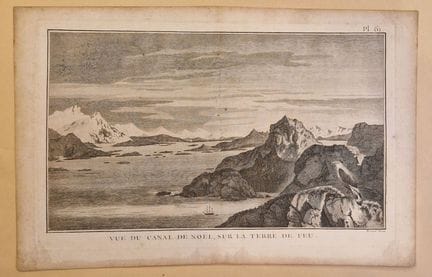
95 - BERNARD DIREX - "Vue du Canal de Noel, sur la Terre de Feu" - 1773 - by Bernard Direx - Engraving on wove paper, plate n°61 - Sheet size : 270 x 420 mm / subject : 210 x 350 mm - Condition B : Marked central fold, dust and brown spots on the edges (ST TERRE DE FEU SOUTH AMERICA)
Estimate €350 - €700 -
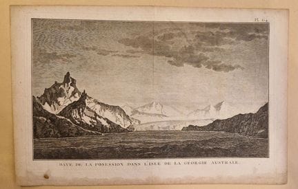
96 - CAOK - "Baye de la Posession dans l'Isle de la Géorgie Australe - 1773 - by Caok- Engraving on wove paper, plate n°64 - Sheet size : 270 x 420 mm / subject : 210 x 350 mm - Condition B : Marked central fold, dusting and brown stains on edges (ST TERRE DE FEU AMERIQUE DU SUD)
Estimate €250 - €500 -
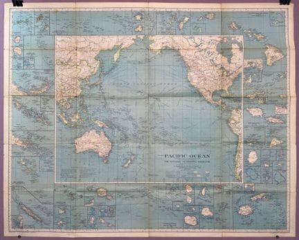
97 - NATIONAL GEOGRAPHIC SOCIETY - [ Pacific Ocean ], Washington, 1936. Map centered on the Pacific Ocean showing sea, air and land routes, time zones, glaciers, mountains... Cartographic inserts all around the central subject. Color lithograph. Dimensions: 795 x 985 mm. Condition A. Original folds. (PACIFIC)
Estimate €80 - €120 -
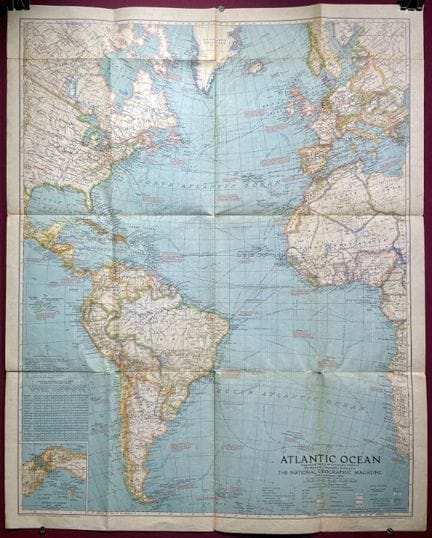
98 - NATIONAL GEOGRAPHIC SOCIETY - [ Atlantic Ocean ], Washington, 1939. Map centered on the Atlantic Ocean showing sea, air and land routes, time zones, glaciers, mountains... Cartographic insert of the Isthmus of Panama. Color lithograph. Dimensions: 790 x 635 mm. Condition A. Original folds. (ATLANTIC)
Estimate €80 - €120 -
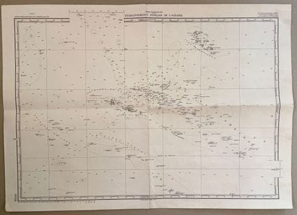
99 - SERVICE HYDROGRAPHIQUE DE LA MARINE - "South Pacific Ocean - Etablissement Français de l'Océanie" - XXth. Nautical chart of Oceania, by the French Navy Hydrographic Service. Focusing on the Tuamotou, Tubaï, Cook and Marquesas archipelagos. Published in June 1949. Dimensions: 530 x 745 mm. A condition. Marked centerfolds (OCEANIA)
Estimate €70 - €90 -
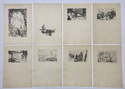
100 - CORNEAU, E. - "Entre le ciel et l'eau" - XXe - Set of 16 original etchings by Eugène Corneau, printed separately from Roland Dorgeles' "Entre le ciel et l'eau", published in 1930. Titage sur Japon - Dimensions: 190 x 130 mm - Condition A. (ASIE)
Estimate €100 - €200
About the sale
Terms of sale
Show the terms of sale
- Buyer's fee: 28% VAT included in addition to the hammer price
Methods of payment
In our office, 9 Rue de Provence, 75009 Paris :
- Cash up to €1,000
- Credit card (except Amex)
At a distance :
- Bank transfer (the RIB can be found at the bottom of this e-mail and at the bottom of the payment slip)
- Credit card (except Amex) via this link: https://drouot.com/fr/paiement/DrouotCaudronOVV
Collection and delivery methods
Collection from our offices, 9 Rue de Provence, 75009 Paris: by appointment starting from Thursday the 19th
- Monday to Friday from 09:30 to 12:30 and from 14:00 to 17:30
- You can appoint a relative as your proxy: email us or give him or her power of attorney, and the person will then come to the office with proof of identity.
Shipment within the European Union :
- Shipment via DHL, quote available on request
- Professional transport, list available on request
Shipment outside the European Union :
- Professional transport, list available on request