

SALE OF ANTIQUE & MODERN PRINTS LIVE - BY PHONE AND PURCHASE ORDERS
Wednesday 10 May 2023 at 14:00
9 rue de Provence, 75009 Paris
386 lots
-
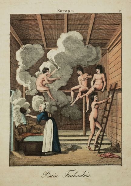
51 - FINLAND - "FINLAND BATH (Finnish)". 19th century. Engraving in old colors. Vellum paper. Margins. 25 x 19 cm. Condition A/B (insolation).
Estimate €100 - €200 -
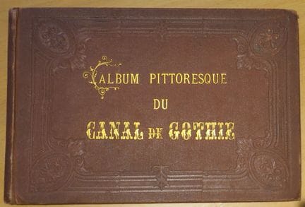
52 - SWEDEN - "PITTORAL ALBUM of the GOTHIE CANAL, from STOCKHOLM to GOTHEMBURG". Stockholm, Alb. BONNIER, Bazaar at the North Bridge. Complete album of his 20 lithographs representing in particular Stockholm, Mem, Wreta Kloster, Motala, Wadstena, Wenersborg, Göteborg... + 2 detailed maps of the Gothic Canal. Hard cover, titled "Picturesque album of the Gothic Canal". 16 x 13 cm. A/B condition (some scattered foxing).
Estimate €200 - €300 -
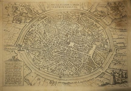
53 - BELGIUM - PLAN OF BRUGES - "Brvgae Flandricarvm vrbivm ornamenta", by BRAUN & HOGENBERG. 16th. Engraved plan, printed on laid paper. French text on verso. Margins. 42,5 x 57 cm. Condition B/C (stain at upper right reaching the corner of the subject, trace of original median vertical fold).
Estimate €250 - €300 -
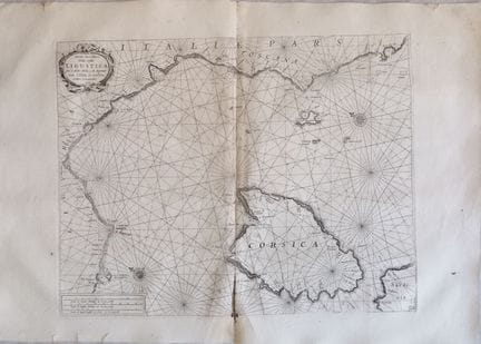
54 - CORONELLI - ITALY - MAP OF THE LIGURIAN COASTS - "Carta Marittima della Costa Ligustica fra C.delle Melle, e M. Argentato Con l'Isola di Corsica, et altre Circonvicine (& de la CORSE)". Venice, 1698. Etching. laid paper. On the reverse, engraved view of Antibes and Forte Croisette. Beautiful marine map in double sheet, taken from the last volume of the Atlante Veneto, published in Venice in 1698 (resumption of the Genoese edition of 1664 in 1 volume, with minimal variations). 40 x 52 cm on c
Estimate €450 - €600 -
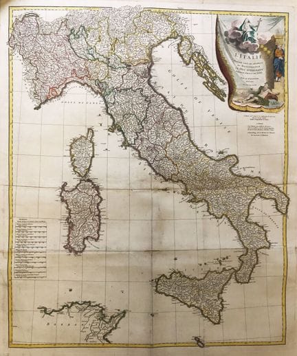
55 - ITALY - MAP of "ITALY published under the auspices of Monseigneur the Duke of Orleans, First Prince of the Blood", by Sr. d'Anville, 1743, with privilege of the King. Large engraved map, in 2 united sheets. Older colors. laid paper. Good margins. Rolled. 98 x 85 cm. Condition A/B (some restorations).
Estimate €350 - €400 -
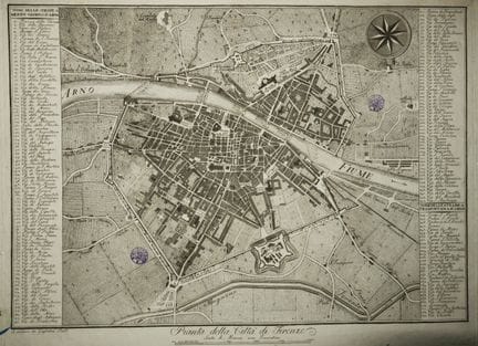
56 - ITALIE - PLAN DE FLORENCE - "Pianta della Citta di Firenze". Plan gravé, imprimé sur papier vergé. Se vend chez Guglielmo Piatti. Revêtu d'un cachet violet. Deux colonnes de renvois sur les côtés du plan. Marges. 41,5 x 55,5 cm. Etat B (rares petites taches et courte déchirures dans les marges légèrement empoussiérées).
Estimate €250 - €300 -
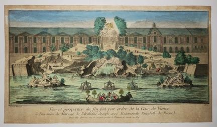
57 - AUTRICHE - VIENNE - FEU D'ARTIFICE - "Vue et perspective du feu fait par ordre de la Cour de Vienne à l'occasion du Mariage de l'Archiduc Joseph avec Mademoiselle Elizabeth de Parme". 18ème. Eau-forte en coloris ancien. Epreuve sur papier vergé. A Paris, chez Chereau rue St Jacques proche la Fontaine St Séverin au Coq. Petites marges. 25,8 x 45,8 cm. Etat A (légèrement insolée sinon bon état de conservation).
Estimate €100 - €200 -
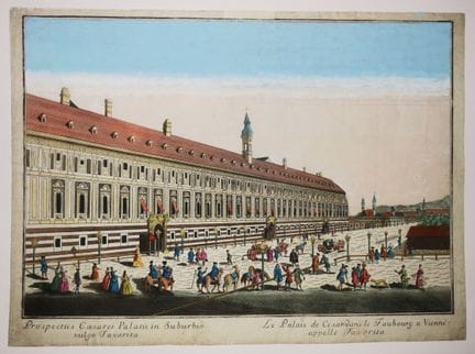
58 - AUSTRIA - VIENNA - "Caesar's Palace in the Faubourg in VIENNA called Favorita". 18th century. Etching and burin in old colors. Layered paper. Small margins. 31,5 x 42,8 cm. Condition A (some small restorations in the margins).
Estimate €100 - €200 -
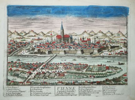
59 - AUSTRIA - VIEW of "VIENNA, Capital of Austria". 18th century. Etching in old colors. Bluish laid paper. In Paris, at Basset le jeune, St Jacques au coin de la rue des Mathurins à Ste Geneviève. Margins. 20,3 x 29 cm. Condition A (good state of preservation).
Estimate €100 - €200 -
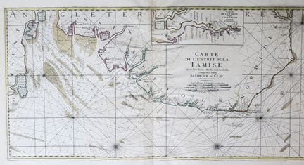
60 - UNITED KINGDOM - TAMISE - MAP (MARINE) of the Entrance of the TAMISE with the Banks Passes Isles and Costes comprised between SANDWICH and CLAY". 1693. Beautiful and large engraved map, on laid paper. Older colors. With at the top a MAP of the Thames from the Isle of Greene to LONDON". Surveyed and engraved by order of the King, in Paris 1693. Good margins. Folded in two. 62 x 98 cm. Condition A (good condition).
Estimate €300 - €400 -
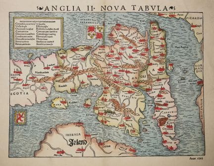
61 - UNITED KINGDOM - MUNSTER - "ANGLIA II NOVA TABULA". Engraved card. Antique colors. Watermarked laid paper. Margins. The Munster map of England was the first separately printed map of England and a cartographic landmark in the history of British maps. The map faces east at the top and extends as far north as Edinburgh, also showing the east coast of Ireland. 32.5 x 42 cmm. A/B condition (trace of original old vertical median fold, short tear in lower and upper margin at fold).
Estimate €250 - €300 -
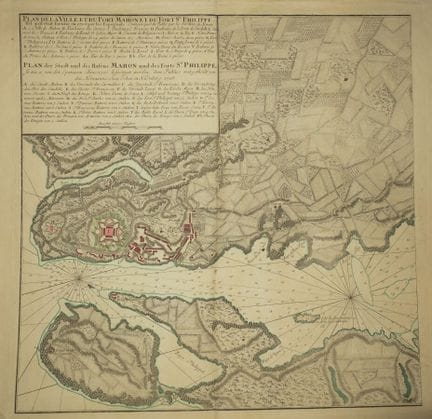
62 - BALEARES (Minorca) - "PLAN OF THE CITY AND PORT OF MAHON and of the FORT ST PHILIPPE, as it was fortified in 1706 by the Spaniards. Published by the Heirs of HOMAN". XVIIIth century. Bilingual engraving (French and German). laid paper. Colored borders. Margins. Folded in two. 53 x 69 cm - Condition A (good general condition).
Estimate €200 - €300 -
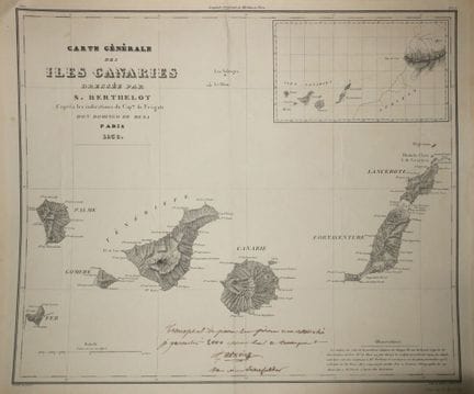
63 - SENEFELDER - CANARY ISLANDS - SPAIN - "GENERAL MAP of the Canary Islands drawn up by S. Berthelot according to the indications of Cap. De Frégate Don Domingo de Mesa", Paris, 1836. Lithograph printed by Adrien, in Paris. Chine paper applied on vellum. Proof with the following handwritten mention in brown ink: "Transport de pierre sur pierre non retouché / je garantis 2000 épreuves sur le transport / (signé) Adrien / par de Senefelder". Inscribed in grey pencil at the bottom right: "Succ. de
Estimate €800 - €1,000 -
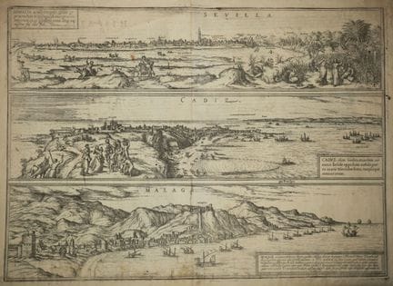
64 - SPAIN - [VIEWS OF SEVILLE, CADIZ & MALAGA], Braun & Hogenberg, c.1574. Etching, printed on laid paper. Latin text on verso. Trace of original median vertical fold. Plate from "Civitas Orbis Terrarum". Margins. 42 x 52 cm. Condition B (a few stains mainly on the margins and a short tear in the upper margin).
Estimate €300 - €400 -
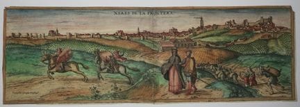
65 - SPAIN - "XERES DE LA FRONTERA". Etching and burin after Georgius HOEFNAGLE. Old colors. Layered paper. Latin text on the back. 15,5 x 46,3 cm. Condition B (trace of an old vertical median fold consolidated).
Estimate €200 - €300 -
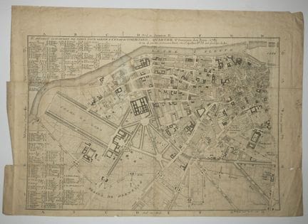
66 - PARIS (75) - PLAN OF SOUTH-WEST PARIS - "II ème division sud-ouest de Paris pour servir à l'état actuel de Paris - Quartie ST GERMAIN DES PRES", 1789. Engraved plan. laid paper. Cross-references on the left side of the plan. Margins. 36 x 51 cm. Condition B (rare traces of old folds and a few short tears in the margins, two of them reaching a little the subject, light stain in the middle).
Estimate €100 - €200 -
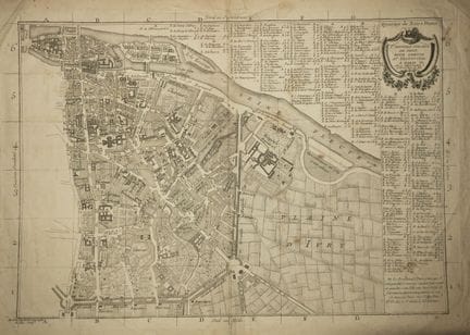
67 - PARIS (75) - PLAN OF SOUTH-EAST PARIS - "Quartier de Notre-Dame / Ière division Sud-Est de Paris pour servir au provincial", in Paris, with approval and privilege of the King. Engraved plan. laid paper. Cross-references on the right side of the plan. Margins. 40 x 52 cm. Condition B (rare traces of old folds, some tears in the margins).
Estimate €100 - €200 -
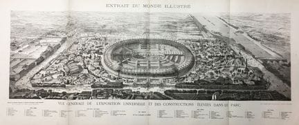
68 - PARIS - "General view of the EXPOSITION UNIVERSELLE (DE PARIS) and the buildings erected in the Park", 1867. RARE large bird's eye view from "Monde illustrée". Signed "A. Deroy" & "E. Roevens" in the plate. Printed by Auguste Vallée, 15 rue Bréda. Electrotypes from "Monde illustré". Margins. 31.5 x 101 cm for the subject. 48 x 116 cm the sheet. Condition A (original folds, good condition).
Estimate €100 - €250 -
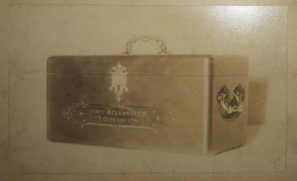
69 - PARIS (75) - ANCIENT PHOTO - [Box containing the Russian and French coins placed in the first stones of the ALEXANDER III BRIDGE (October 7, 1896)]. 15 x 24 cm. Condition A (some slight traces of handling).
Estimate €100 - €200 -
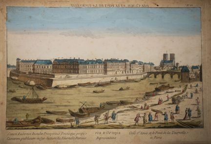
70 - PARIS (75) - OPTICAL VIEW representing the ISLE ST LOUIS and the Pont de la Tournelle in Paris". 18th century. Engraving in old colors. Layered paper. Margins. 32,5 x 47,5 cm. Condition B/C (some foxing and slightly insolate).
Estimate €100 - €200 -
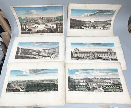
71 - PARIS (75) - SET of 6 VIEWS OF PARIS: View of the Place des Victoires, View of the great facade of the Old Louvre, General view of Paris, View of the Royal Palace, View of the new Place of Louis XV and View of the Place of Louis the Great. Etchings. Proofs on laid paper. Colored. 40 x 59 cm approximately each plate. Condition A.
Estimate €200 - €300 -
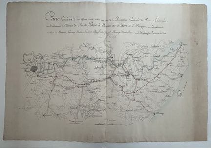
72 - General map of the different routes studied by order of the Direction générale des Ponts et Chaussées, for the establishment of the Railway from Paris to ROUEN, to HÂVRE and to DIEPPE, with secondary branches to BEAUVAIS, GOURNAY, MEULAN, LOUVIERS, ELBOEUF, NEUFCHATEL, FECAMP, MONTIVILLIERS and with the RAILWAY of the Northern Borders by CREIL. Lithographed map enhanced with red and blue wash. Wove paper. 60 x 87 cm. Condition A (edges of the sheet slightly sunned and with some traces of han
Estimate €100 - €200 -
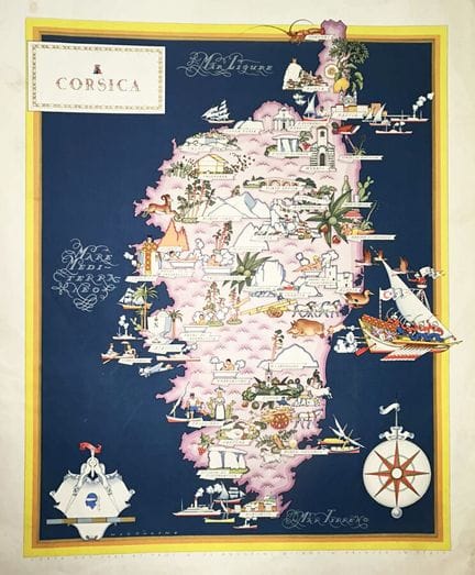
73 - CORSICA - MAP of CORSICA - "CORSICA". 1940. Lithography in colors, on wove paper. Printed and published in Italy by Prof. G. de Agostini in Milan. 70 x 49,5 cm. Condition B (some short tears in the margins slightly dusted, rare small traces of handling).
Estimate €150 - €200 -
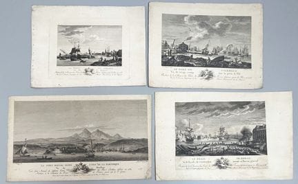
74 - BRITTANY / MARTINIQUE - 4 VIEWS by and after OZANNE: The Port of CROISIC, The Port of Painbeuf, The Port of BREST & The Royal Fort in the Isle of MARTINIQUE. Set of 4 engravings. About 20 x 30 cm each. Condition A/B.
Estimate €100 - €200 -
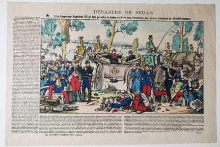
75 - ARDENNES (08) - SEDAN - NAPOLEON III - "Désastre de Sedan, L'Ex-Empereur Napoléon III se fait prendre à Sedan et livre aux Prussiens une armée française de 80 000 hommes". Imagerie d'Epinal. XIXème. Bois gravé et typographie. Coloris ancien. Imprimée et éditée chez Pinot & Sagaire à Epinal. Marges. 28 x 41 cm. Etat A (bon état de conservation).
Estimate €100 - €200 -
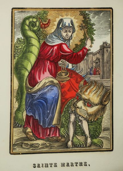
76 - TARASCON - BOUCHES-DU-RHÔNE (13) - IMAGERIE D'AVIGNON (84), chez CALVET LEBLOND - «Sainte MARTHE, Patronne de TARASCON, Priez pour nous». XIXème. Gravure sur bois. Coloris ancien. Papier vélin. Bonnes marges. 37 x 24 cm - Etat A (bel état de conservation).
Estimate €100 - €200 -
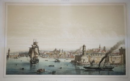
77 - BOUCHES-DU-RHÔNE (13) - VIEW of "MARSEILLE, View of the Port of Joliette". 19th century. Beautiful lithograph in colors after LEBRETON. Printed by Becquet, in Paris. Vellum paper. Good margins. 51,5 x 75 cm. Condition A/B (rare freckles).
Estimate €100 - €200 -
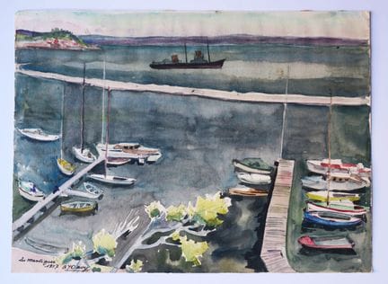
78 - BOUCHES-DU-RHÔNE (13) - MARTIGUES. 1957. Watercolor on paper. Situated, dated and signed "AY Davy" (?). 24,5 x 33,3 cm. Condition A (good condition).
Estimate €100 - €200 -
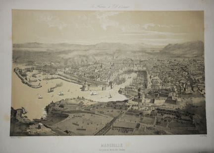
79 - BOUCHES-DU-RHÔNE (13) - VIEW of "MARSEILLE, View taken above the Catalans". 19th century. Lithograph after a drawing by Guesdon. Proof on wove paper, printed by Lemercier and published by Springer. Margins. 40 x 57 cm. Condition A (some light foxing on the margins and on the reverse).
Estimate €300 - €400 -
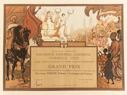
80 - ART DÉCO - EXHIBITION - MARSEILLE 1922 - Raymond de La NÉZIÈRE (1865 - 1953) - "Exposition Nationale Coloniale Marseille", 1922. Commemorative diploma of GRAND PRIX to the Collectivity of the Chambre Syndicale de Vins, Spiritueux et Liqueurs de l'Yonne. Mr. DEBAIX Brothers in Coulanges-la-Vineuse. Lithograph printed in colors. Vellum paper. Signed in the plate by R. de la Nézière, lower left. Imp. MOULLOT Marseille (November 18, 1922). 53,5 x 68,5 cm. Condition A (very good condition, some
Estimate €150 - €300 -
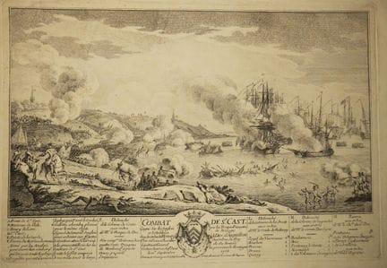
81 - CÔTES D'ARMOR (22) - OZANNE - "COMBAT de ST CAST en 1758, pendant la guerre de Sept Ans". 1758. Gravure originale à l'eau-forte et au burin par Nicolas OZANNE (1728-1811). Epreuve sur papier vergé filigrané (lettres). Avec renvois dans la tablette. Bonnes marges. 36 x 52,5 cm. Etat A/B (rares plis d'impression, bon état de conservation).
Estimate €100 - €200 -
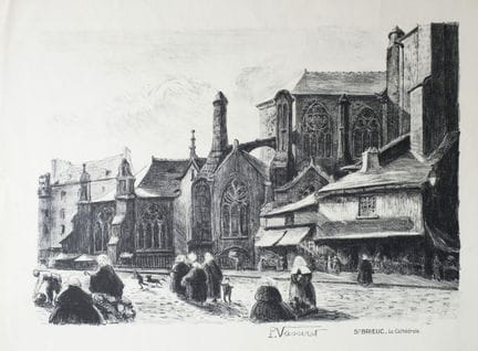
82 - CÔTES D'ARMOR (22) - "ST BRIEUC, The Cathedral". Lithograph by P. Vasserat (active at the beginning of the XXth). Proof on wove paper. Good margins. 41,5 x 53,8 cm. Condition A (some soiling and rare light foxing in the good margins, otherwise good condition).
Estimate €100 - €200 -
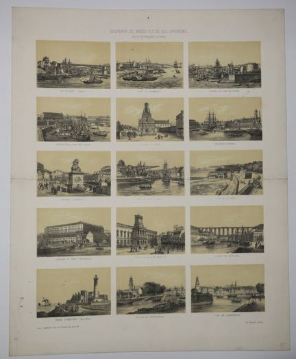
83 - FINISTERE (29) - BREST AND ITS SURROUNDINGS - "Souvenir de Brest et ses environs". 19th original lithograph by DEROY. Vellum paper. Printed by Becquet in Paris and published by E. Morier. Margins. Composition with 15 small views representing among others the Viaduct of MORLAIX, a view of LANDERNEAU, the Lighthouse of St Mathieu... 49 x 39,3 cm. Condition A/B (trace of old median horizontal fold).
Estimate €200 - €300 -
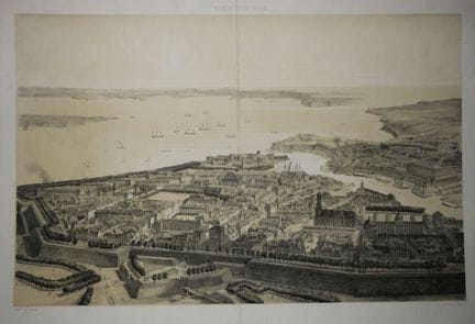
84 - FINISTERE (29) - 2 aerial views of BREST: "General view of the Port taken from the Rade" & "View of the city and the Rade taken from the Glacis". 19th century. Two original lithographs after Guesdon. Proofs on wove paper, printed by Lemercier. 38 x 52 cm approximately each plate. Condition A/B (trace of old vertical fold in the middle).
Estimate €200 - €300 -
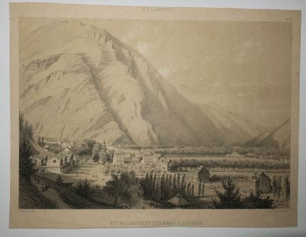
85 - HAUTE-GARONNE (31) - LUCHON - "Thermal establishment in Luchon". 19th century. Lithographed by E. Paris. Wove paper. Printed by Thierry Frères, in Paris. Small margins. 23 x 30 cm. Condition A (good condition).
Estimate €100 - €200 -
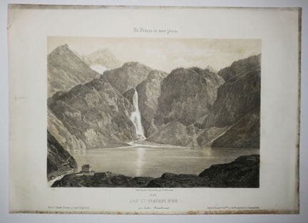
86 - HAUTE-GARONNE (31) - "Lake and Waterfall of Oo, near Luchon". 19th century. Original lithograph by Ch. Mercereau. Vellum paper. Printed by Frick frères and published by F. Sinnett, in Paris. Margins. 26,5 x 37,5 cm. Condition A (rare foxing on the edges of the margins dusted, good condition).
Estimate €100 - €200 -
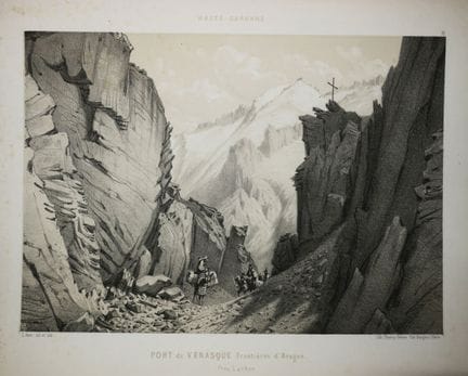
87 - HAUTE-GARONNE (31) - "PORT of VENASQUE Frontiers of Aragon, near LUCHON". 19th century. Original lithograph by E. Paris. Vellum paper. Printed by Thierry frères, in Paris. Margins. 27,5 x 34,5 cm. Condition A (some marginal foxing, formerly laminated, otherwise good condition).
Estimate €100 - €200 -
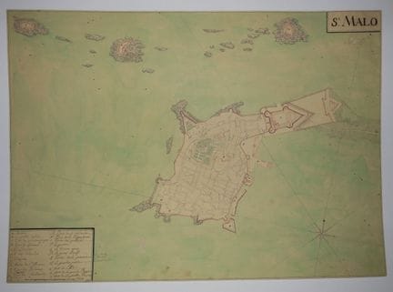
88 - BRITAIN - ILLE-ET-VILAINE (35) - ST MALO - RARE MANUSCRIPT PLAN OF SAINT MALO. 19th century. Drawn in pencil, ink and watercolor, on watermarked laid paper (crowned double-headed eagle). With handwritten references at the bottom left. 39,2 x 54,5 cm. Condition A (very rare small freckles, good general condition).
Estimate €2,000 - €3,000 -
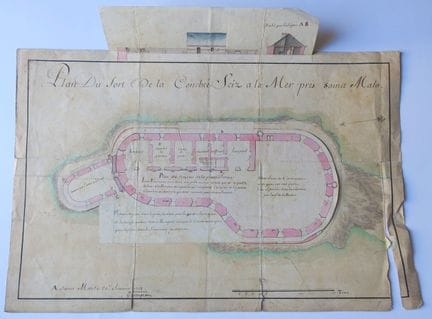
89 - BRITAIN - ILLE-ET-VILAINE (35) - RARE MANUSCRITED PLAN OF THE FORT DE LA CONCHEE sciz à la Mer near SAINT-MALO. Plan drawn in pencil, ink and watercolor. Layered paper. Located and dated lower left "A Saint Malo 20e février 1712" (and signed Gavengeau?). Above the Plan at the level of the platform and below the Plan of the Underground. 34 x 50.5 cm. Condition B (some folds and tears, foxing).
Estimate €3,000 - €4,000 -
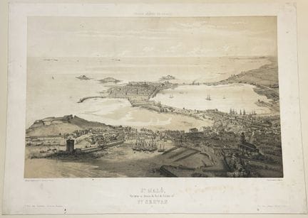
90 - BRITAIN - ILLE-ET-VILAINE (35) - (Aerial) VIEW of "ST MALO, view taken above the Port of Solidor in St SERVAN". 19th century. Original lithograph by A. Guesdon. Proof on wove paper, printed by Lemercier in Paris. Published by A. Hauser in Paris and by Benderittes in St Malo. Dry stamp of the publisher in lower margin. Margins. 37 x 51 cm. Condition B (some foxing in the margins, subject in good condition).
Estimate €400 - €800 -
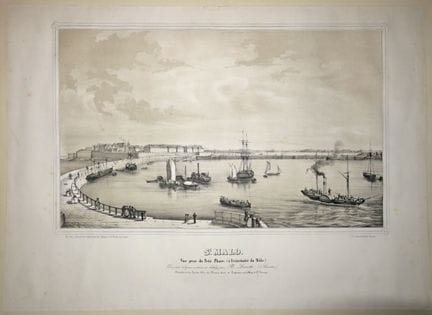
91 - BRITAIN - ILLE-ET-VILAINE (35) - VIEW of "ST MALO, View from the Little Lighthouse (at the end of the Mole)". 19th century. Lithographed by H. Lorette, on wove paper. Printed and published by Landais & Oberthur in Rennes. Margins. 41 x 56,5 cm. Condition A (some rare light marginal foxing, formerly mounted by the edges on wove paper, good condition).
Estimate €300 - €600 -
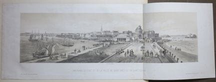
92 - BRITAIN - ILLE-ET-VILAINE (35) - "PANORAMA of the PORT and the city of SAINT MALO and SAINT SERVAN". 19th century. Original lithograph by Deroy. Proof on wove paper, printed by P. Frick in Paris. Published by G. Lalonde, in Paris. Margins. Folded in two. 31,5 x 89 cm. Condition A (some light foxing on the margins, subject in good condition).
Estimate €300 - €600 -
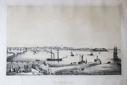
93 - BRITAIN - ILLE-ET-VILAINE (35) - VIEW of "ST SERVAN, view taken from St MALO". 19th century. Original lithograph by H. Lorette. Proof on wove paper. Printed and published by Landais & Oberthur, in Rennes. Margins. 40,5 x 52 cm. Condition B (some rare light foxing).
Estimate €300 - €600 -
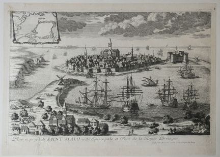
94 - BRITAIN - ILLE-ET-VILAINE (35) - "PLAN and profile of SAINT MALO, Episcopal city and Port of High Brittany". End of 17th century. Etching by Pierre Aveline. Proof on laid paper. Margins. 24 x 33,5 cm. Condition A (a short tear consolidated in the tablet, formerly mounted by the edges on a strong paper, good general condition).
Estimate €100 - €200 -
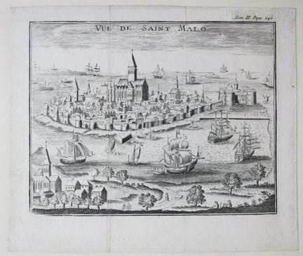
95 - BRETAGNE - ILLE-ET-VILAINE (35) - "VUE de SAINT MALO". 18ème. Gravure à l'eau-forte et au burin. Papier vergé. Marges. 17 x 19,7 cm. Etat B (deux légères traces d'ancien pli vertical d'origine, anciennement montée par les bords sur papier fort, bon état général).
Estimate €100 - €200 -
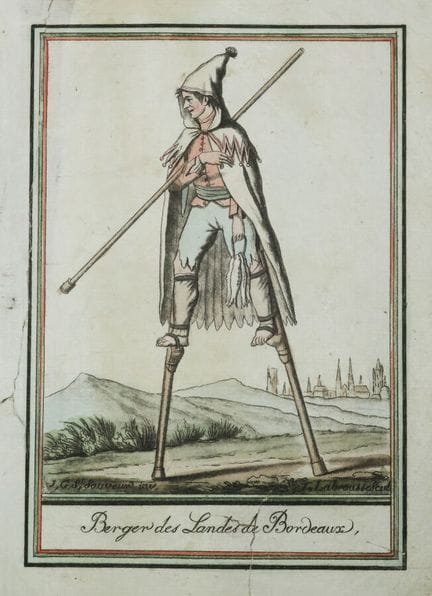
96 - LANDES (40) - "Man of the LANDES of Bordeaux putting his stilts" & "Shepherd of the LANDES of Bordeaux". 18th century. Engraved by L. LABROUSSE, after a drawing by ST SAUVEUR. Old colors. Proofs on blue laid paper. Margins. 24,5 x 17,5 cm approximately each. Condition A (rare short marginal tears, otherwise good condition for the 1st; tears in the margins, one of which reaching the title and the bottom of the subject consolidated on the reverse). Set of 2 plates.
Estimate €100 - €200 -
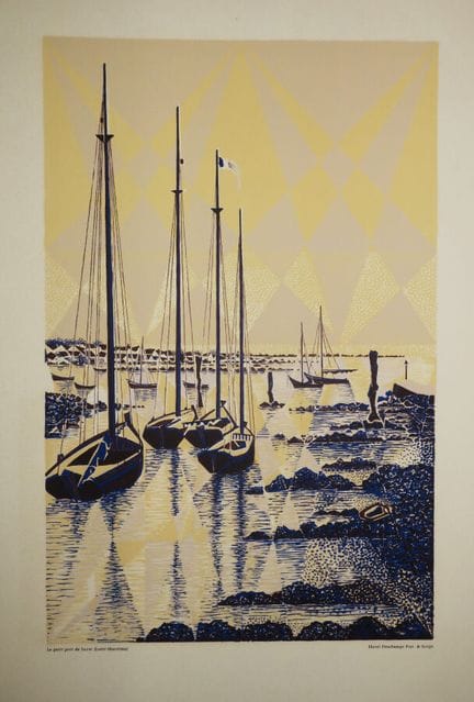
97 - LOIRE-ATLANTIQUE (44) - "Le petit Port de Lerat" (Loire-Maritime)". Lithograph by Henri Deschamps, printed in colors. Nice proof on cream wove paper. All margins. 46 x 32 cm. Condition A (good condition).
Estimate €100 - €200 -
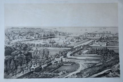
98 - MANCHE (50) - VUE de "CHERBOURG, Vue prise de la Montagne du Roule". 19ème. Lithographie originale par Th. Du Moncel. Epreuve sur papier vélin, imprimée par Lemercier et publiée chez A. Hauser. Marges. 40 x 55,8 cm. Etat A/B (quelques rousseurs majoritairement marginales et légère petite trace de pli en bas à droite).
Estimate €100 - €200 -
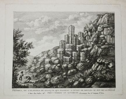
99 - PUY-DE-DÔME (63) - "Mountains of clay, undermined and degraded by rainwater near ISSOIRE in Auvergne" & "PRISMS, or Columns of Basalt which pass to the state of balls in the PUY DE LA VEILLE". 2 etchings engraved by PIERRON & De MACHY, after the drawings of Cen BESSON. Proofs on wove paper. In Paris, at Basset Md d'estampes rue St Jacques n°670. Good margins for the 2. 29 x 42,5 cm approximately each. A/B condition (some stains in the margins slightly dusted). Set of 2 plates.
Estimate €100 - €200 -
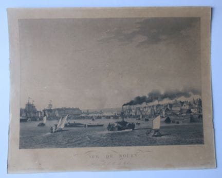
100 - SEINE-MARITIME (76) - "VUE DE ROUEN, Prise de l'Ile de la Croix". 19th century. Engraved by GARNERAY. Proof on wove paper, lined. In Paris, at Basset. Copper margins. 41 x 51 cm. Condition C (insolate and faded).
Estimate €100 - €200
About the sale
Selling expenses : 28 % TTC on a voluntary basis
Internet fees :
+1.5% ex VAT of the hammer price (i.e. +1.8% incl. VAT) for voluntary lots.
Terms of sale
Show the terms of sale
Frais de vente : 28 % TTC en volontaire
Frais internet :
+1.5% HT du prix d'adjudication (soit +1.8% TTC) pour les lots volontaires.