

SALE OF ANTIQUE & MODERN PRINTS LIVE - BY PHONE AND PURCHASE ORDERS
Friday 7 October 2022 at 14:00
9 rue de Provence, 75009 Paris
245 lots
-
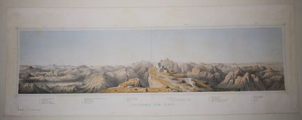
51 - EGYPT - SINAI - "PANORAMA VOM SINAI". 19th century. Lithograph printed in colors. Nice proof on wove paper. Cross-references in the lower margin. Margins. 20 x 52,5 cm. Condition A (good condition).
Estimate €100 - €150 -
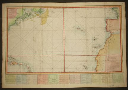
52 - ATLANTIC OCEAN - "REDUCED MAP (MARINE) of a part of the ATLANTIC or Western OCEAN []", published by Order of the King, by Mrs. de Verdun de la Crenne, Ch.er de Borda and Pingré, 1775. Prepared and engraved by Petit. Large and beautiful colored nautical chart. laid paper. At the foot the Table of Latitudes and Longitudes of the main Points of this map. Margins. 60 x 87 cm. Condition B (slight traces of old folds).
Estimate €200 - €300 -
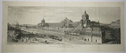
53 - RUSSIA - "VIEW OF ORANIENBAUM, Pleasure House of His Imperial Majesty of all the Russias &c, on the Gulf of FINLAND opposite GRONSTADT". 18th century. Beautiful engraving in panorama format by Née, after the drawing executed by Mr. Chr. De LESPINASSE. Layered paper. Margins. 29 x 70 cm. Condition A (slight traces of old original vertical folds, good general condition).
Estimate €200 - €300 -
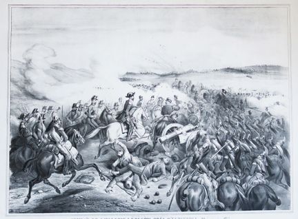
54 - WAR OF CRIME - "Cavalry Combat at KOUGHIL near EUPATORIA, September 29, 1855. Charge of the 4th Hussar and the 7th & 9th Dragon commanded by General d'ALLONVILLE". 19th century. Large lithograph, on wove paper. Margins. 57 x 74 cm. Condition A (a short tear in the upper margin, slight traces of handling in the margs, good general condition).
Estimate €100 - €150 -
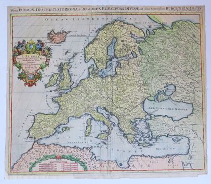
55 - MAP OF EUROPE - "Nova Europae description in Regna & Regiones Praecipuas divisae [] Authore H. JAILLOT / Europe divided into its principal States subdivided into their Provinces presented to Monseigneur le Duc de Bourgogne", 1696. Beautiful engraved map, on laid paper. Colored. Nice title cartouche in the upper left corner. Small margins and copperplate margins. 50,5 x 59,5 cm. Condition B/C (rare short consolidated tears on the edges and middle folds, some restorations).
Estimate €200 - €300 -
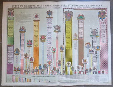
56 - EUROPE - RARE TABLE of the "States of Europe with their ARMOIRIES and national colors, their surface area, absolute and relative population, and the population of their principal cities by Constant DESJARDINS", Paris, 1859. Lithography in colors, on wove paper. Printed by Caillet, rue Jacob. At the author's house, 6 rue Bourbon le Chateau near the rue de Buci. Margins. Folded in two. 55 x 71 cm. Condition A (slightly dusty, good general condition).
Estimate €200 - €300 -
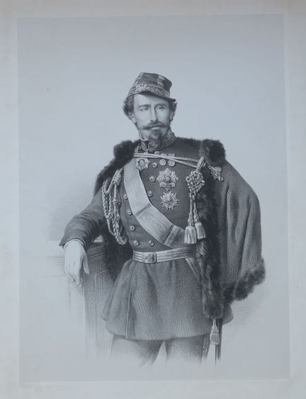
57 - ITALY - PORTRAIT OF GARIBALDI. 19th century. Litrhography. Proof before the letter, on china paper applied. 34,5 x 25 cm for the subject. 57 x 40 cm for the sheet. Condition B (some stains in the good margins slightly dusted).
Estimate €50 - €100 -
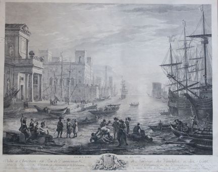
58 - SICILY - "OLD PORT OF MESSINA". XVIIIth century. Large etching and burin by Jacques-Philippe LE BAS (1707-1783), after the painting by Claude LE LORRAIN (1604-1682). Mounted under marie-louise. Copper margins. Beautiful marine engraving with numerous figures and vessels. 53 x 66 cm approximately for the engraving. Condition C (a few wormholes and tears filled and/or consolidated on the reverse side, rare small scratches, subject in good general condition).
Estimate €150 - €200 -
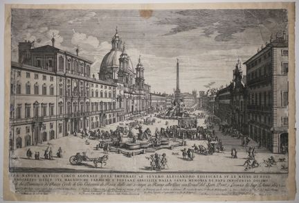
59 - ITALY - PLACE NAVONE - "PLAZA NAVONA antico circo agonale dell' Imperatore severo Alessandro Edificata su le Riune di Esso col Prospetto delle sue []". 1693. Etching and burin by Gommarus WOUTERS (1649-1696). Ref: Hollsetin, n°3. Proof with the letter, on laid paper. Published by de Rossi. 42,7 x 64 cm for the engraving. 45,3 x 67 cm with the support. Condition C/D (cut to the subject and damaged, formerly laminated on strong paper, tears consolidated and lacks filled, as is).
Estimate €150 - €200 -
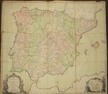
60 - POSTS - "MAP OF SPAIN and PORTUGAL including the ROUTES OF THE POSTS and others of these two Kingdoms, by Mr BRION Engineer-geographer of the King". In Paris, at the Sr. DESNOS, engineer geographer for the Globes and Spheres, rue St Jacques au Globe", 1766. With privilege of the King. Large engraved map (in 6 sheets), on laid paper. Colors. Title cartouche at lower left. Margins. Folded. Beautiful map showing the routes of the Iberian Peninsula posts. 77 x 85 cm. Condition B (rare small stains a
Estimate €200 - €300 -
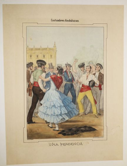
61 - SPAIN - ANDALUSIAN COUTUME - "Una pendencia" (Costumbres Andaluzas). 1854. Lithograph by Antonio CHAMAN. Signed lower right in the plate. Printed in colors and gum arabic. Strong vellum paper. Printed by C. Santigosa, in Seville. Margins. 52,5 x 39 cm. Condition A (rare small stains in the good margins, good general condition).
Estimate €120 - €150 -
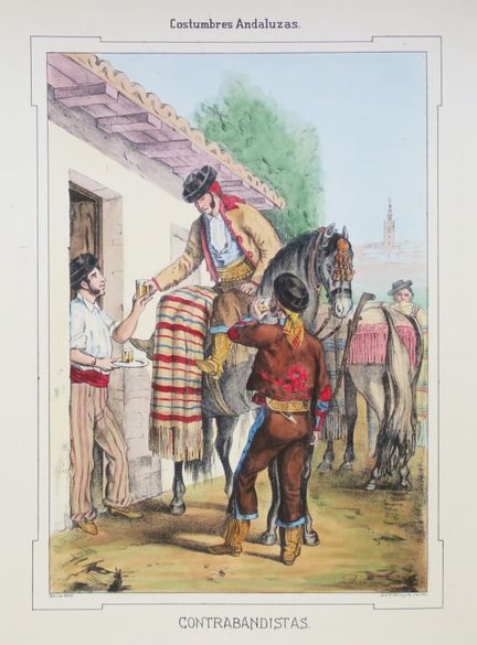
62 - SPAIN - ANDALUSIAN COUTUME - "Contrabandistas" (Costumbres Andaluzas). 1852. Lithograph by Antonio CHAMAN. Signed lower right in the plate. Printed in colors and gum arabic. Strong wove paper. Printed by C. Santigosa, in Seville. Margins. 53,5 x 40 cm. Condition A (small piece of paper epimmed in the left margin otherwise good condition).
Estimate €120 - €150 -
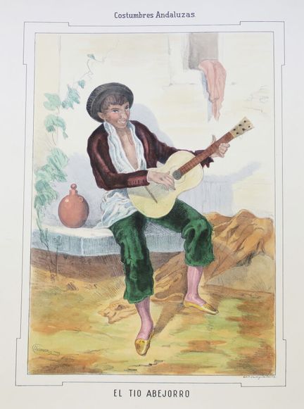
63 - SPAIN - ANDALUSIAN COUTUME - "El tio Abejorro" (Costumbres Andaluzas). c.1852. Lithograph by Antonio CHAMAN. Signed lower right in the plate. Printed in colors and gum arabic. Strong wove paper. Printed by C. Santigosa, in Seville. Margins. Very good condition. 53,5 x 40 cm. Condition A.
Estimate €120 - €150 -
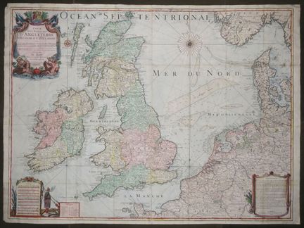
64 - UNITED KINGDOM & NORTH SEA - "MAP (MARINE) of the Kingdoms of ENGLAND, SCOTLAND and IRELAND with the sea-coasts of France, Holland, Germany, Denmark and Norway which surround the North Sea, where are marked the Banks and Soundings &c. Dressée, sur plusieurs cartes particulierses, memoires, et autres faites sur les lieux; par Operations Geometriques, Gravée et Dediée Au Roy D'Angleterre D'Ecosse et d'Irlande", by Charles INSELIN. In Paris, at Mondhare and Jean de Beauvais n°4, 1793. Large eng
Estimate €400 - €600 -
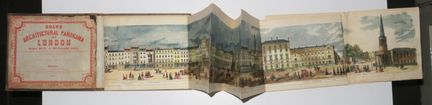
65 - ENGLAND - RARE "GRAND ARCHITECTURAL PANORAMA OF LONDON, Regnet Street to Westminster Abbey from original drawings made expressly for the work by R. SANDEMAN Architect and executed on wood by George C. LEIGHTON". Published by WHITELAW, in London in 1849. Engraved wood. Folded and in its original illustrated cloth cover. Nice colors. Good condition. 15 x 18 cm folded. 14,5 x 680 cm. Condition A (worn cover with some stains, slight handling marks, good condition)
Estimate €400 - €600 -
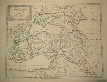
66 - TURKEY - MINOR ASIA - MAP of the "States of the EMPIRE OF THE TURQS in ASIA", by Sr SANSON d'Abbeville, ordinary geographer of the King". In Paris, at Pierre MARIETTE, rue St Jacques à l'Espérance. With privilege for twenty years. XVIIth. Engraved map. Colored boundaries. Laid paper. Margins. 52 x 69 cm. Condition A (some light foxing, formerly laminated on cardboard).
Estimate €150 - €200 -
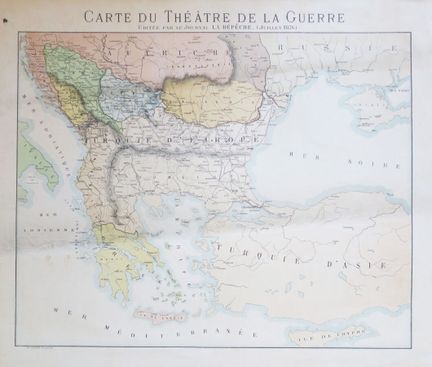
67 - TURKEY / GREECE - "MAP OF THE WAR", published by the newspaper La Dépêche (July 1876). Lithograph in colors, on wove paper. Printed by Sirven, in Toulouse. Margins. 50 x 58 cm. Condition A/B (rare small stains and slightly dusty, otherwise good general condition).
Estimate €100 - €150 -
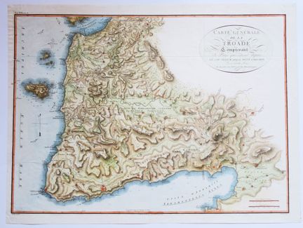
68 - GREECE - "General map of the TROADES including the Country which extends from CAPE SIGEUM to MOUNT GARGARON, surveyed on the spot and subjected to Astronomical Observations". 1819. Engraved map, printed on wove paper. Colors. Copper margins. 48,5 x 64,5 cm. Condition A (good general condition).
Estimate €200 - €300 -
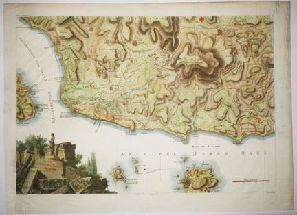
69 - GREECE - "MAP OF THE PLAIN OF TROY surveyed in 1786 and 1787", after L.F CASSAS. 19th century. Engraved map, printed on wove paper. Colors. Margins. 46,5 x 62 cm. A/B condition (a few rare small stains and slight traces of handling).
Estimate €200 - €300 -
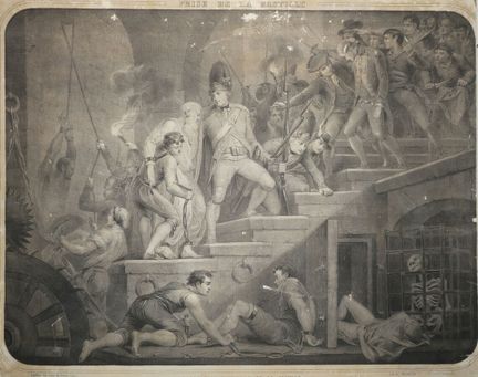
70 - PARIS - FRENCH REVOLUTION - "PRISE DE LA BASTILLE / Scene in the interior of the Bastille". 19th century. Lithograph, on wove paper. Printed by the widow Gosselin and published by Gadola, in Paris. 54,5 x 63 cm. Condition C/D (margins cut and formerly pasted in full on cardboard, scratches and some spidering, as is).
Estimate €100 - €150 -
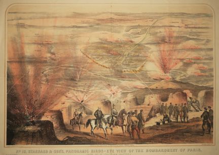
71 - PARIS - [Siege of Paris]. "N°10 Stannard & son's, PANORAMIC BIRDS-EYE VIEW of the BOMBARMENT OF PARIS, from n°12 Prussian Battery", 1871. Lithographed by Packer & Griffin. Printed in colors and published by Stannard & Son. Vellum paper. Margins. 55.5 x 76 cm. B condition (slight traces of old folds, rare short tears light marginal foxing, rare small holes at the middle fold).
Estimate €200 - €300 -
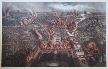
72 - "PARIS FIRED, Night of May 24 to 25, 1871". 19th century. Large lithograph by Ch. Pichot (1817-1903). Nice proof in colors, on wove paper. Printed by Lemercier & Cie, in Paris. Published at M. Martinet, 172 rue de Rivoli and 12 boulevard des Capucines, in Paris. Margins. 63 x 93 cm. Condition A (rare small stains and short tears in the slightly dusty margins, good general condition).
Estimate €600 - €80 -
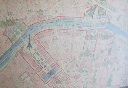
73 - PARIS - "PLAN de l'EXPOSITION UNIVERSELLE de 1900, dressé spécialement pour l'Agenda-Buvard des Magasins du BON MARCHE, Paris". c.1900. Engraved plan after Guibal's drawings, in colors. Printed by Erhard Frères, in Paris. Margins. 54,5 x 69 cm. Condition A/B (formerly mounted on cardboard, traces of handling on the margins).
Estimate €100 - €150 -
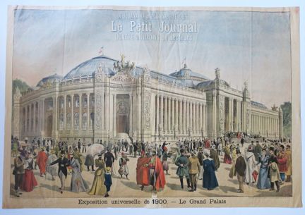
74 - PARIS - "EXPOSITION UNIVERSELLE de 1900 - LE GRAND PALAIS / Le Petit journal, Quatre millions de lecteurs". Large color illustration, circa 1900. Printed on MARINORI's chromotypographic rotary press. Margins. 59,5 x 86 cm. Condition A (a few short tears and small lacks in the margins, otherwise good general condition).
Estimate €100 - €150 -
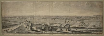
75 - RARE PANORAMIC VIEW OF PARIS - "VEUE de PARIS du côté de BELLEVILLE, dessinée de la Maison, entre les deux Moulins, au-dessus de la Courtille en 1736". Very large etched view by Sr MILCENT. laid paper. In Paris, at the widow Chereau, rue St Jacques aux piliers d'or. Caption under the subject. Margins. 37 x 104,5 cm. Condition B/C (missing and consolidated tears in the dusty margins, some traces of handling and dusting, slight insolation on the right and traces of folds).
Estimate €800 - €1,200 -
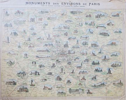
76 - PARIS - RARE MAP of the "MONUMENTS of the ENVIRONS OF PARIS", according to the documents communicated by the Commission of the Historical Monuments", by Henri BRESSLER. Circa 1900. Drawn up especially for the Magasins du Bon Marché. Engraved map, printed in colors. Printed by G. de Malherbe, de Vaugirard in Paris. Margins. 52,5 x 66 cm. Condition A (some short tears, folds and stains in the margins, traces of old original folds).
Estimate €100 - €150 -
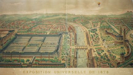
77 - PARIS - "EXPOSITION UNIVERSELLE de 1878 / PANORAMA DES PALAIS et PARCS DU CHAMP DE MARS et du TROCADERO". XIXth. Drawn and lithographed by A. CHENEVEAU. Proof in colors. Printed by Becquet and published by Anc. M. Martinet, Alfred Hautecoeur, in Paris. Margins. 50,5 x 81 cm. Condition C/D (vertical tear in the middle, insolate paper flaking in the margins, formerly pasted in full on cardboard, plate damaged).
Estimate €200 - €300 -
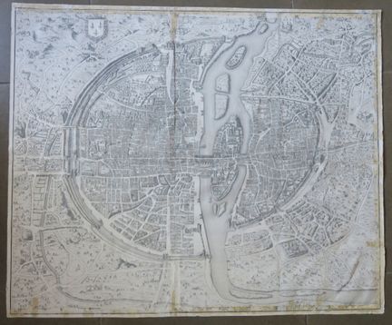
78 - MAP OF PARIS - "City, Town and University of PARIS". Plan engraved by Guillaume DHEULLAND. Proof of a 19th century print on strong wove paper. Copper margins. 68,5 x 82,5 cm. Condition C (trimmed at the copperplate mark, paper spotted in some places, stains and short tears on the edges, some accidents).
Estimate €200 - €300 -
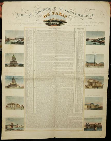
79 - PARIS - "HISTORICAL and CHRONOLOGICAL TABLE of PARIS, with the principal events connected with it from its origin to the present day. Containing the famous men born in Paris and the times of the foundations and restorations of the main monuments, those of the inventions and discoveries in the arts and commerce [...]". c.1835. Engraving and typography. Large table printed on 2 united sheets. Colored. laid paper. In the center the chronological Précis and on the edges views of Paris (including Pl
Estimate €200 - €300 -
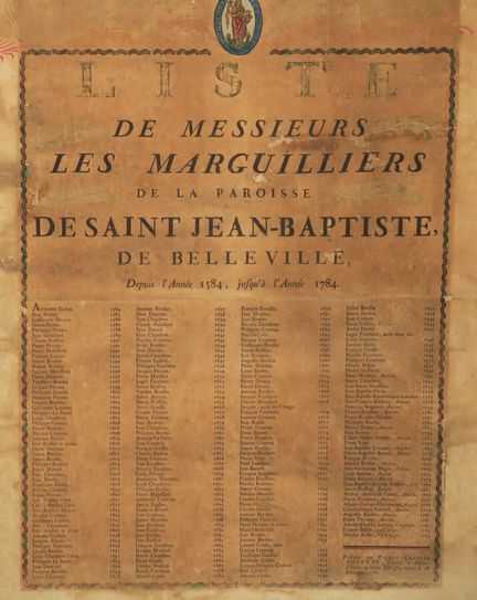
80 - PARIS - PLACARD - "LIST OF Sirs THE MARGUILLIERS of the PARISH OF SAINT JEAN-BAPTISTE of BELLEVILLE since the Year 1584 until the Year 1784". laid paper. Presented by PIERRE-CHARLES ROUUEAU, Cantor & Schoolmaster of the said Parish, since December 18, 1781. Margins. 60 x 45,3 cm the sheet. 64 x 50 cm the support. Condition D (formerly pasted in full on stiff paper, insolate, stains, damaged plate).
Estimate €100 - €150 -
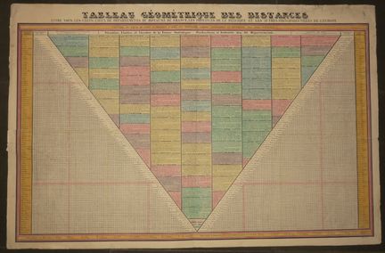
81 - EUROPE / FRANCE - "GEOMETRIC TABLE OF DISTANCES between all the chief towns of the departments of the Kingdom of France, the Provinces of Belgium, and the other main cities of Europe, calculated in leagues of post and drawn up according to the best itinerary maps and the most recent documents". Lithography in colors. Vellum paper. Margins. 68 x 103 cm. Condition A (rare short marginal tears, tears at the level of the median folds at the top and on the right otherwise good general condition).
Estimate €150 - €200 -
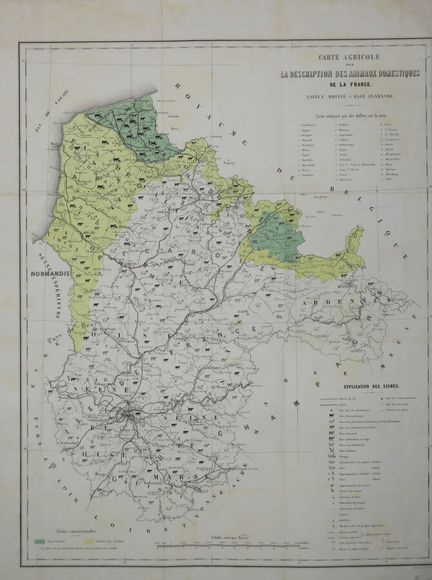
82 - "AGRICULTURAL MAP for the Description of the DOMESTIC ANIMALS of France, Bovine Species - Flemish Race". 19th century. Map printed in colors. Margins for three sides. 57 x 44,5 cm. Condition A (slight traces of original folds and light foxing).
Estimate €150 - €200 -
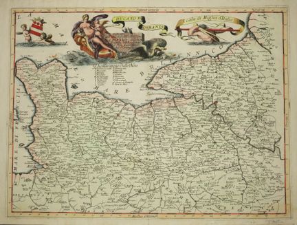
83 - MAP OF NORMANDY - CORONELLI - "Ducato di NORMANDIA". c.1690. Engraved map, on laid paper. Colored. Published in Venice. Margins. Beautiful decorative map of Normandy showing in detail cities, and towns such as Bayeux, Caen, Haure de Grace (Le Harve), etc. To the east Versaille and Saint-Germain while to the south Chartres. 49,5 x 69,5 cm. Condition A (trace of original median vertical fold, good condition).
Estimate €300 - €400 -
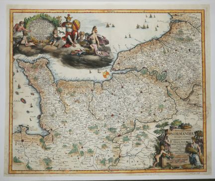
84 - MAP OF NORMANDY - "Nova et accurata NORMANDIAE ducatus tabula Portubus Littoribus [...]", by F. DE WIT. c.1680. Rare engraved map, on laid paper. Nice coloring. Published by Persoy (1675-1695) in Amsterdam. Small margins. The ornate cartouche is engraved by the great Romein de Hooghe. 49 x 58,5 cm. Condition B (trace of original median vertical fold, some holes and tears restored).
Estimate €300 - €400 -
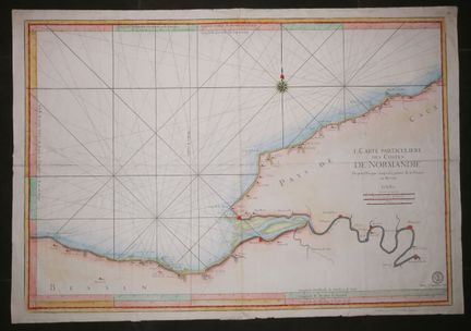
85 - NORMANDY - MARINE MAP - J.N. BELLIN "Carte particulière des Costes de NORMANDIE depuis DIEPPE jusqu'à la Pointe de la Percée en BESSIN". 18th century. Large engraved map, on laid paper. Colored. With the cachet of the Dépôt de la Marine. Margins. 63 x 91 cm. A/B condition (trace of vertical median oirgin fold, tear on the left consolidated on the reverse, rare short tears in the margins, otherwise good general condition).
Estimate €200 - €300 -
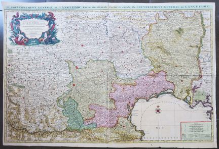
86 - LANGUEDOC - LARGE MAP of the "General Government of Languedoc divided into three general lieutenancies, namely Haut Languedoc, Bas Languedoc and Sevennes, subdivided into all its parts, surveyed on the spot", by Guillaume de LISLE. 18th century. Engraved map in two joined sheets. Layered paper. Colored. Nice title cartouche in the upper left corner. Printed and published in Amsterdam, by Jean Coevens & Corneille Mortier. Small margins. 63 x 91 cm. Condition B (good general condition).
Estimate €300 - €400 -
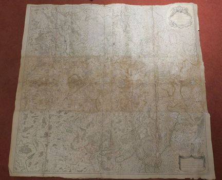
87 - LORRAINE - MAP of "Estats du Duc de Lorraine où sont les Duchez de Lorraine et de Bar. Le temporel des Eveschez de METZ, TOUL et VERDUN, dédié au Roy par [] Hubert JAILLOT, géographe ordinaire de Sa Majesté." 1734. Large engraved map in several sheets. laid paper. Colored borders. Title cartouche in the upper right corner. In Paris, at S. Jaillot. Margins. Rolled. 135 x 144 cm. Condition C (a few tears consolidated and/or restored, traces of sun exposure and handling, a few stains).
Estimate €200 - €300 -
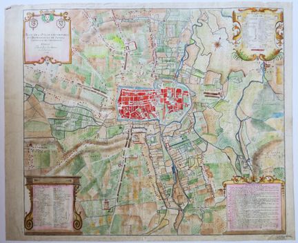
88 - AUBE (10) - TROYES - RARE "PLAN de la ville, Fauxbourgs et dépendances de TROYES, Capitale de CHAMPAGNE dressé par Ordre des Maire et Echevins", 1747. Large plan engraved in colors by Martial Desbois. laid paper. Names of the main buildings at the bottom left. Title cartouche at the top left. Margins. The plan shows the city and its ramparts, as well as the suburbs outside the city. 57 x 70 cm. Condition B (a few restored tears and losses consolidated in the margins, traces of handling and ver
Estimate €200 - €300 -
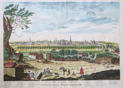
89 - CALVADOS (14) - LARGE "VIEW of CAEN, Capital City of Lower NORMANDY". 18th century. Colored engraving. Layered paper. Caption under the subject. Margins. RARE. 45 x 61 cm. A/B condition (three restored tears in the shelf, a fold in the sky, otherwise good general condition).
Estimate €400 - €600 -
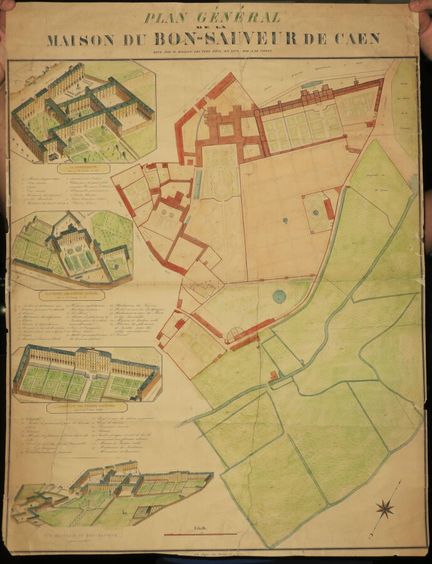
90 - CALVADOS (14) - CAEN - "GENERAL PLAN OF THE HOUSE OF THE GOOD SAVIOR OF CAEN, surveyed by Mr. HALLOT. The views dess. And lith. By A. LE COINTE". Lithograph. Colors. Printed on wove paper by Pagny, rue Froide, 23 in Caen. Small margins. Ground plan of the estate on the right; and on the left the views of the Habitation des femmes aliénées, General view of Bon-Sauveur taken from the East, Habitation des hommes aliénés & La Communauté seen as the crow flies. 77 x 58.5 cm. Condition C (traces
Estimate €200 - €300 -
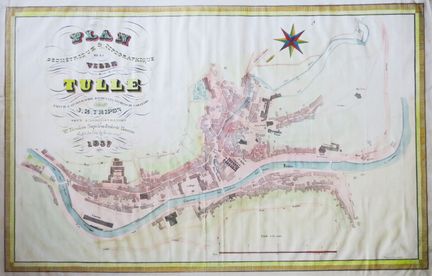
91 - CORREZE (19) - LARGE "Geometrical & topographical PLAN of the City of TULLE, executed & lithographed according to the elements of the cadastre by J.B. TRIPON under the administration of Mr. Théodore Napoléon Frdéric Thomas, Prefect of the Dept. of Corrèze", 1837. Lithograph, on laid paper. Colored. Printed by Dupont in Périgueux. Margins. 52,5 x 74 cm. Condition A (some marks or stains from handling and very slightly dusty).
Estimate €150 - €200 -
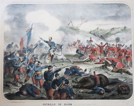
92 - CÔTE D'OR (21) - "BATAILLE de DIJON (21, 22 et 23 janvier 1871)". End of XIXth century. Large lithograph, on wove paper. Older colors. Printed by Mrs Widow GOSSELIN and published by the widow Gadola. Margins. 53,5 x 67,5 cm. Condition A (rare short tears consolidated in the margins, good general condition).
Estimate €200 - €300 -
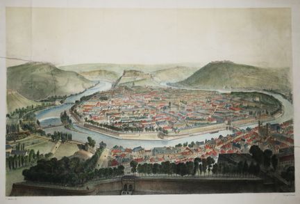
93 - DOUBS (25) - VIEW of "BESANCON, taken above the Porte Battant". c.1852. Lithograph by J. Arnout, after a drawing by Alfred Guesdon. Colored. Vellum paper. Printed by Lemercier, rue de Seine in Paris and published by Pellizaro in Besançon. Margins. 38 x 51 cm. Condition C (two consolidated tears reaching the subject, some traces of folds and slightly dusty, as is)
Estimate €150 - €200 -
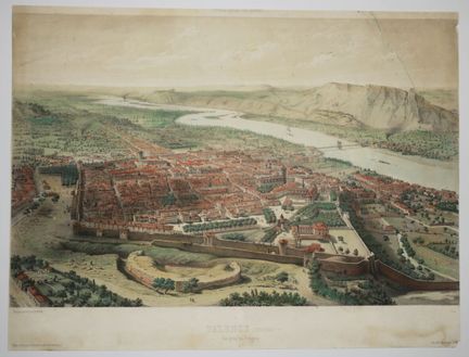
94 - DRÔME (26) - VIEW of "VALENCE, prise du Polygone". c.1850. Lithographed by Alfred Guesdon. Colored. Vellum paper. Printed by Lemercier and published by A. Hauser in Paris. 33,5 x 44 cm. Condition C (margins cut, consolidated tear at the top right in the subject, some stains and scratches, as is).
Estimate €150 - €200 -
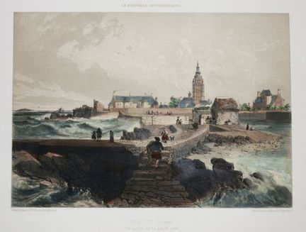
95 - FINISTERE (29) - "ROSCOFF, View from the small pier". 19th century. Lithographed by Félix Benoist and Sabatier. Colored. Vellum paper. Printed and edited by Charpentier in Nantes. Good margins. 33,5 x 48,5 cm. Condition A (rare short tears and handling marks in the good margins, subject in good condition).
Estimate €150 - €200 -
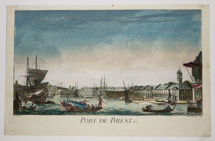
96 - FINISTERE (29) - RARE VIEW of the "PORT OF BREST". XVIIIth century. Engraved by Marie-Jeanne OZANNE (1736-1786), after Nicolas OZANNE (1728-1811). Proof on laid paper formerly laminated. Colored. Small margins. 23,5 x 36,5 cm. Condition B (trace of vertical fold otherwise good general condition).
Estimate €150 - €200 -
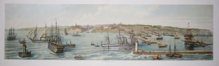
97 - FINISTERE (29) - BREST - 'PANORAMA du Port et de la ville de BREST'. 19th century. RARE and beautiful panoramic view lithographed by ASSELINEAU (1808-1889). Vellum paper. Old colors. Signed at the bottom right in the plate. Printed by Frick and published by F. Sinnett in Paris. Margins. 30 x 87 cm. Condition A (trace of original median vertical fold, good general condition).
Estimate €150 - €200 -
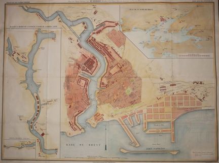
98 - FINISTERE (29) - BREST - "PLAN de la ville et du Port de BREST, avec une légende historique par Mr MAGADO, Chevalier de la Légion d'honneur, dessinateur des travaux hydrauliques". c.1860. Plan engraved by Erhard. Colored. Vellum paper. Printed by Lemercier. Published by Auguste Logerot, in Paris. In Brest, at the main booksellers and printers. On the left, a plan of the Penfeld River from the rear guard. Margins. 72,5 x 103 cm. Condition C (original marked folds, some tears at the level of the
Estimate €150 - €200 -
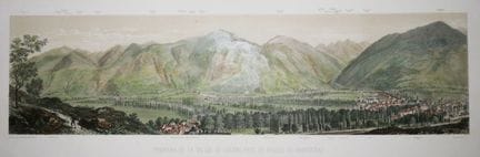
99 - HAUTE-GARONNE (31) - PYRENEES - "PANORAMA OF THE VALLEY OF LUCHON, taken above BARCUGNAS". c.1860. Large lithograph in colors, on wove paper. Drawn after nature and lithographed by Ch. Mercereau. Printed by Frick frères and published by F. Sinnett in Paris. Margins. 31 x 88 cm. Condition A (slight marks of handling in the margins, good condition).
Estimate €150 - €200 -
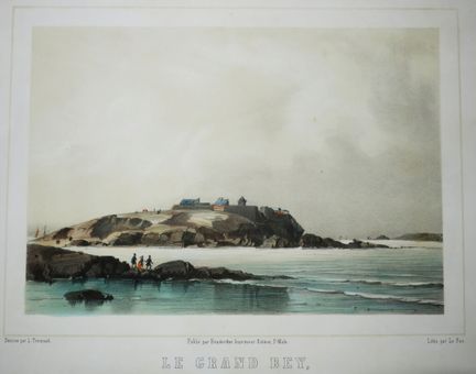
100 - ILLE-ET-VILAINE (35) - SAINT-MALO - "LE GRAND BEY, TOMBEAU DE CHATEAUBRIAND". 19th century. Lithograph by Le Pan, after the drawing of L. Trémisot. Colored. Proof on wove paper. Published by Benderitter, printer-publisher in St Malo. Margins. 25,5 x 33 cm. Condition A (good condition).
Estimate €150 - €200
About the sale
Selling expenses : 28 % TTC on a voluntary basis
Internet fees :
+1.5% ex VAT of the hammer price (i.e. +1.8% incl. VAT) for voluntary lots.
Terms of sale
Show the terms of sale
Frais de vente : 28 % TTC en volontaire
Frais internet :
+1.5% HT du prix d'adjudication (soit +1.8% TTC) pour les lots volontaires.