
Lot n° 15
Estimation :
100 - 150
EUR
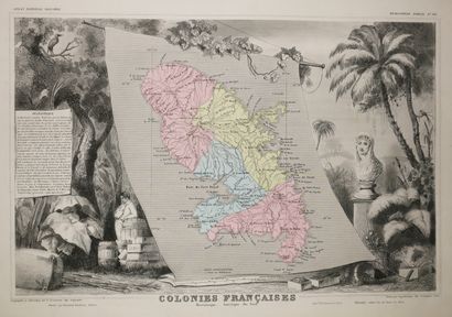
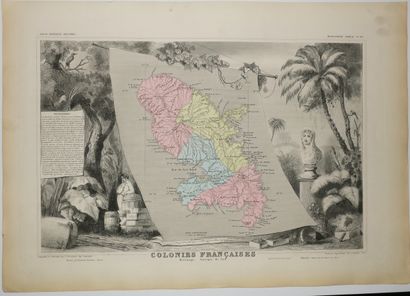
MARTINIQUE - MAP OF "French Colonies, Martinique,... - Lot 15 - Eric Caudron
MARTINIQUE - MAP OF "French Colonies, Martinique, South America", by Victor LEVASSEUR (Atlas National de la France illustrée), 1852. Map engraved by Laguillermie. Antique colours. Printed by Lemercier and published by Pelissier, in Paris. Margins. Beautiful map illustrated by Raimond Bonheur. 36,5 x 52 cm. Condition A (very rare light marginal foxing, good condition).
My orders
Sale information
Sales conditions
Return to catalogue